Hello Cornell…

Last week, the boychild and I visited Cornell University so he could make a decision about college for next year. He had said all along that he didn’t need to visit a college to decide, but hey, when reality is staring you in the face and it’s a few thousand miles away, then apparently you change your mind.

So I scheduled a last-minute trip during his (and my) Spring Break and their Cornell Days. I watched the weather and was a little freaked out about snow being forecast, especially since we were flying into Syracuse and driving to Ithaca (cheaper). We got into Syracuse (and Ithaca) pretty late. Luckily, I’ve realized that all college towns in the East have the same pizza place that delivers (yes, even to hotel rooms) late at night.

The next day, we ventured out into the rain to the registration area and a class and an info session and lunch and the bookstore, but it was nasty wet rain (I actually bought an umbrella, it was so bad…I know. I’m from Southern California and my old umbrella had BROKEN way back in January or February and I hadn’t replaced it because I DIDN’T NEED TO. I realize my entitlement). I took zero pictures during the rain, mostly because it was so wet and then it got cold, dropping about 40 degrees from the morning to the late afternoon. So ALL of these are from the next day. Well, except this lovely photo, taken from the (crappy) hotel room window when I realized it was SNOWING. Yes, I don’t get out much.

Apr 18 14 004 small


It’s not even sticking at that point. We actually went out in that to find a local brewpub for dinner.

The boychild doesn’t like to write his name…in fact, I have no problems posting this online, because you can’t even read it (OK, not really).

Apr 18 14 006 small


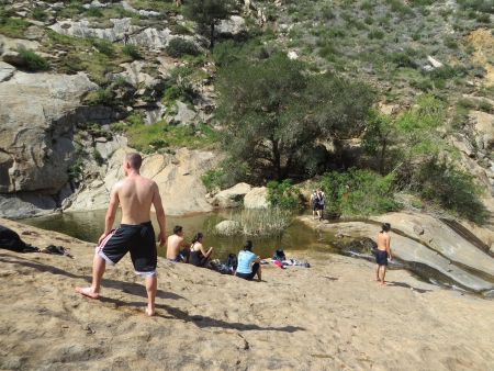
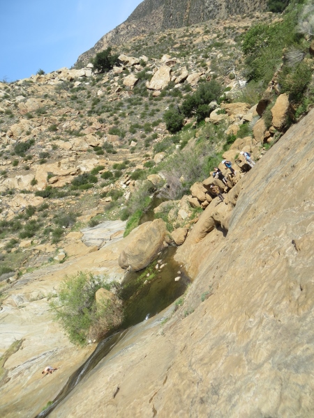
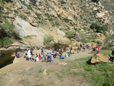
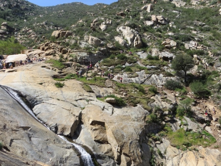
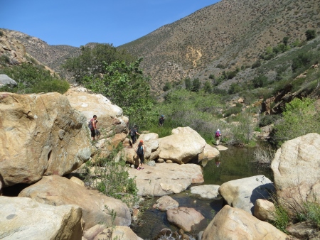
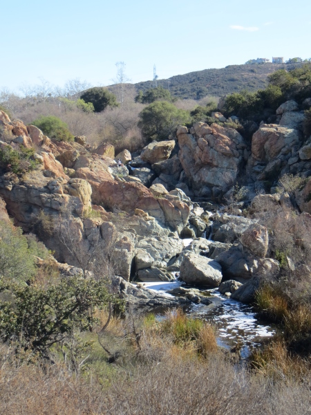
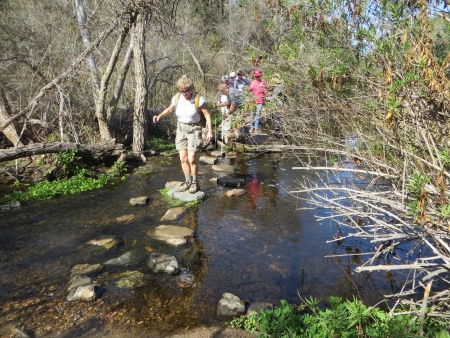
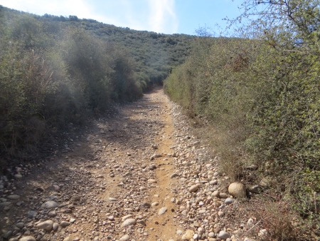
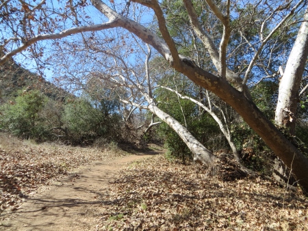
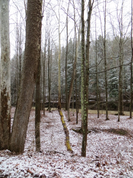
He did wear this, but under his jacket. OK, wait, I lied. I did take pictures at Buttermilk Falls State Park, where we went before dinner, just to get a walk in. It was bloody freezing and snowing and absolutely different from what he’s used to here at home, and gorgeous.

Apr 18 14 016 small


I’m not sure you can argue with any of that. Certainly, visits to see him at college will be fun. Although I might avoid some of the snowier months.

Apr 18 14 018 small


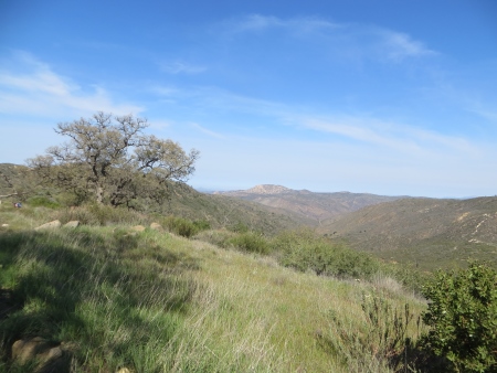
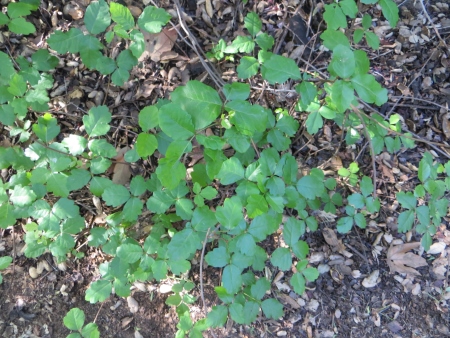
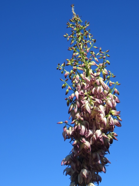
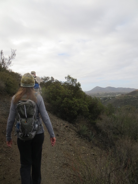
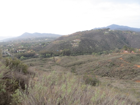
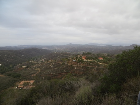
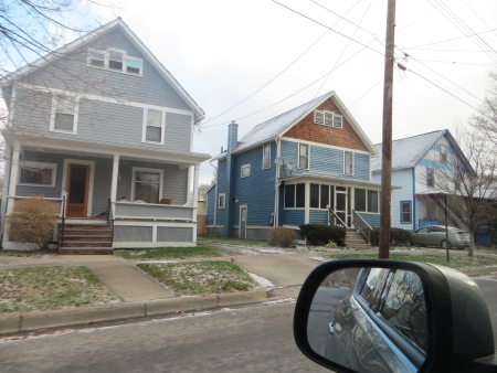
To many of my readers, this style of house and yard is probably very familiar, but San Diego doesn’t do it this way.

Apr 18 14 022 small


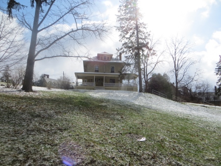
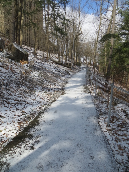
The next morning, we headed back out to campus to wander around in NON-rainy weather. This I believe is one of the cooperative houses on campus…there were a few of them. At this point, there were some brief snow flurries, but mostly it was just a pretty (and bloody freezing) day. I managed to keep my nose from freezing off my face, but only barely.

Apr 18 14 025 small


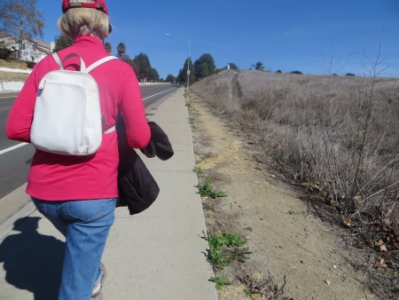
Boychild acknowledged that he might need gloves and better shoes for next year. He wore short sleeves the entire time we were there, but the jacket I bought him for Christmas was entirely the right move.

Apr 18 14 027 small


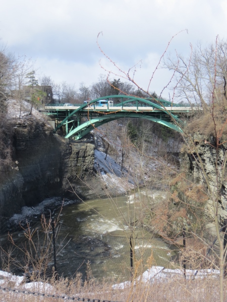
There’s a lake on campus (it’s not very big, but it’s cute) and a bridge going over the river that exits the lake…

Apr 18 14 028 small


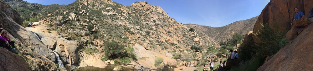
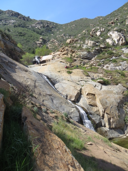
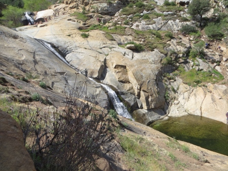
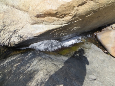
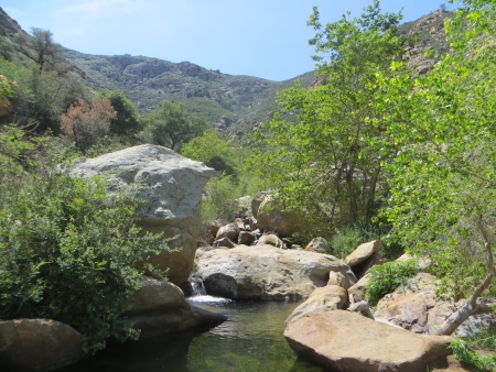
The falls were very impressive in the morning…

Apr 18 14 031 small


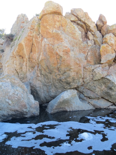
He was kind of amazed by the color of the water and the walls of the ravine on each side.

Apr 18 14 032 small


I was kind of amazed by the ice…

Apr 18 14 033 small


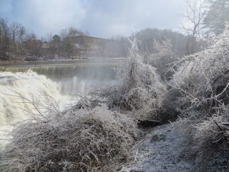
And the tree icicles.

Apr 18 14 034 small


Towards the bridge we walked over in the rain yesterday.

Apr 18 14 035 small


I know. Not much snow.

Apr 18 14 036 small


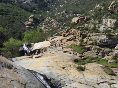
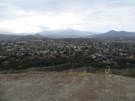
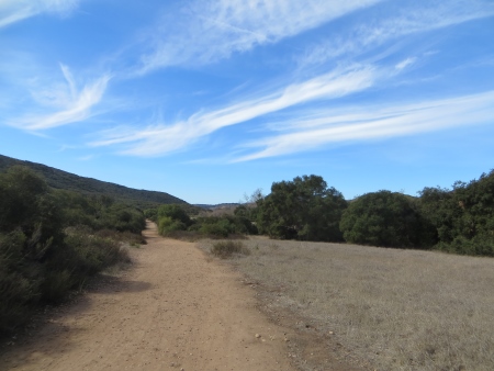
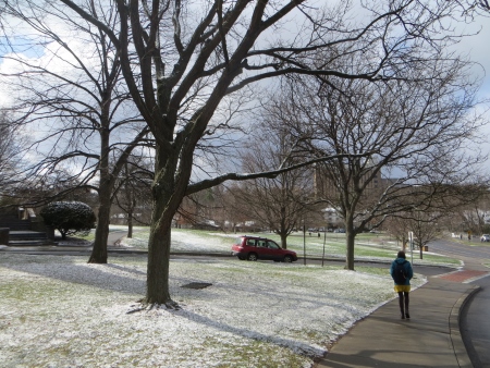
This time, we just wandered around to get a feel for the place when water wasn’t sluicing into your eyes.

Apr 18 14 037 small


He likes it. He says it’s pretty.

Apr 18 14 038 small


And it has its own art museum.

Apr 18 14 039 small


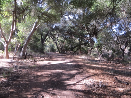
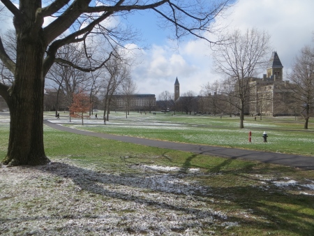
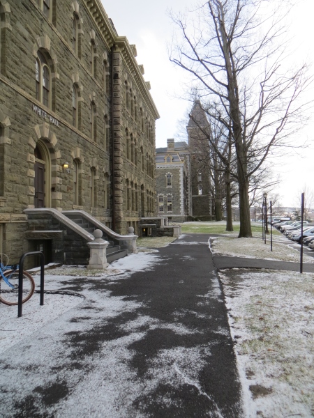
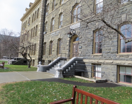
Lots of old buildings that remind me of going to school in Wales.

Apr 18 14 040 small


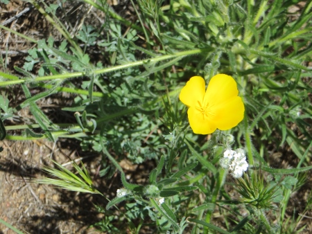
With Spring just around the corner.

Apr 18 14 041 small


We ate in there the day before…the bathrooms looked like something out of Hogwart’s, and there was a library with lots of soft chairs and tables, a really old library, that I was too lame to take pictures of…

Apr 18 14 043 small


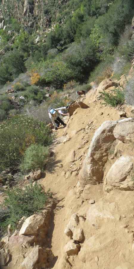
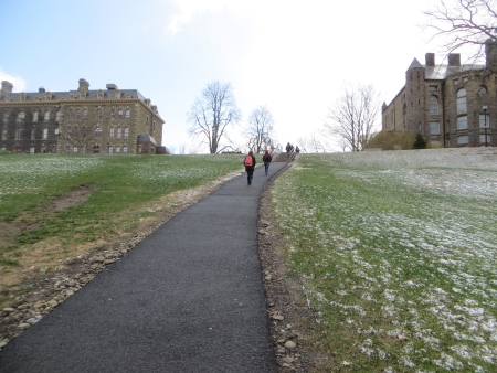
Part of the student housing is down this big hill…so I made him walk down it…

Apr 18 14 044 small


Looking back up at the main campus…

Apr 18 14 045 small


So he could then experience walking back UP that hill. Definitely a good exercise option if you have to do that a few times a day.

Apr 18 14 046 small


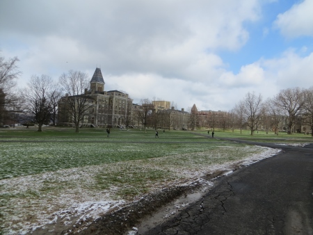
The weather stayed nice (but still freezing!) the whole time we walked around.

Apr 18 14 048 small

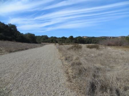
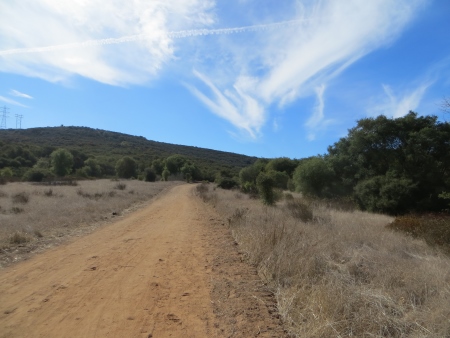
When we were done exploring (he had decided…he needed no more exploring), we headed off for Syracuse…driving the Bob Nida (my dad) way: If there is a two-line road running parallel to the main highway, then you should be on it, because it is more interesting than the main highway.

Apr 18 14 050 small


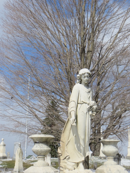
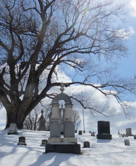
Plus, it has more cemeteries (I warned the boy that I like these…he has experienced my cemetery habit before)…

Apr 18 14 051 small


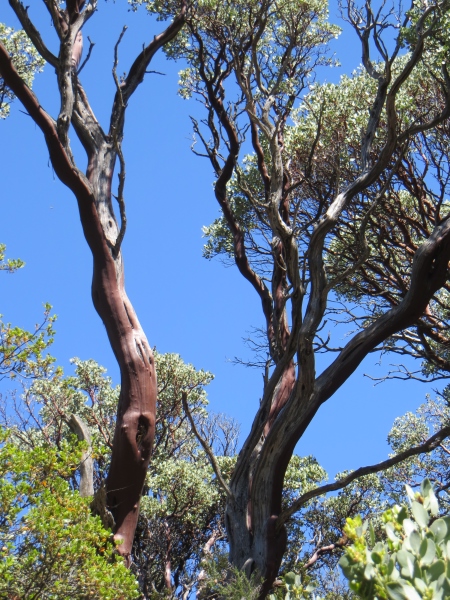
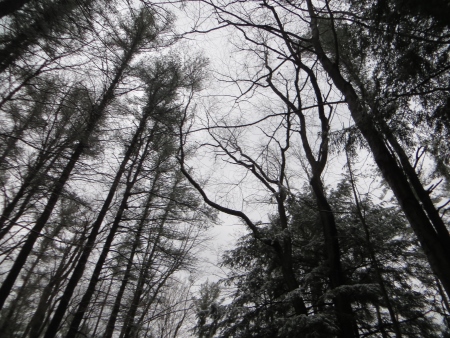
And the trees and blue skies with the snow made it quite lovely…

Apr 18 14 052 small


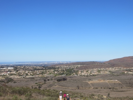
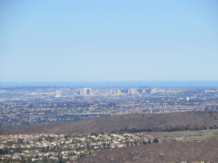
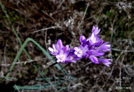
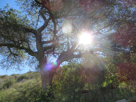
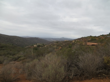
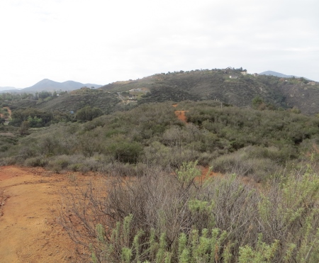
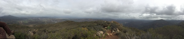
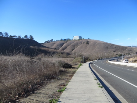
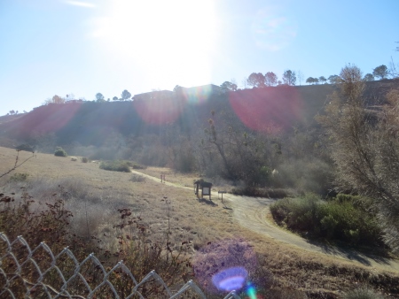
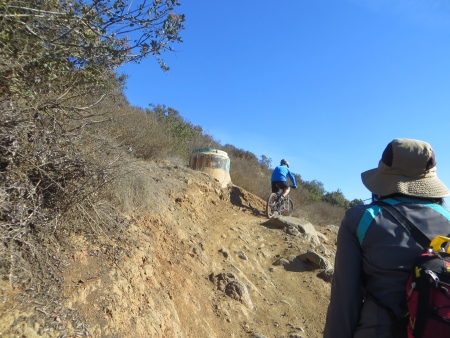
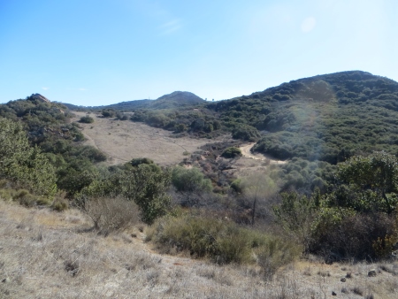
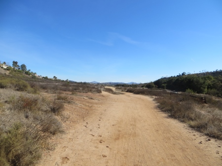
Meanwhile, back in San Diego, it was SO HOT (per the girlchild)…

Apr 18 14 053 small


It was in the 80s.

Apr 18 14 055 small


Certainly a temperature difference.

Apr 18 14 056 small


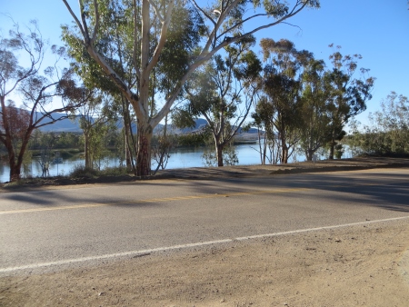
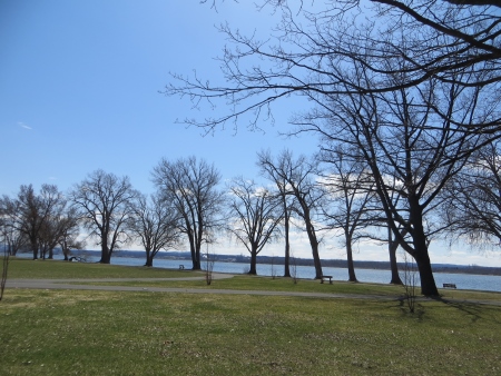
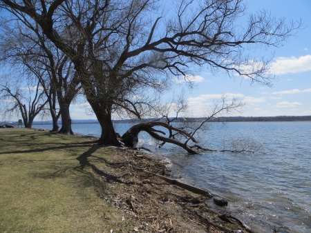
We had some time when we got to Syracuse, so we went to a local lake…

Apr 18 14 065 small

Where fish were dropping from the sky…

Apr 18 14 066 small


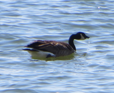
And geese were squawking…

Apr 18 14 071 small


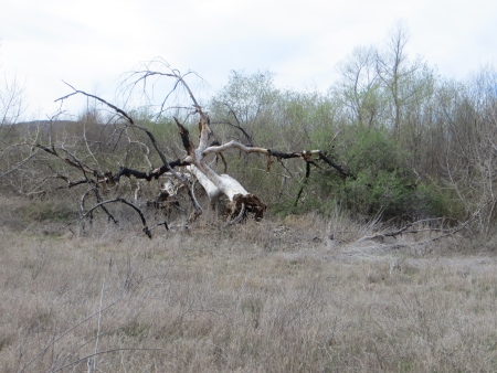
and trees were falling in the lake…

Apr 18 14 074 small


More icicles (things I NEVER see).

Apr 18 14 075 small


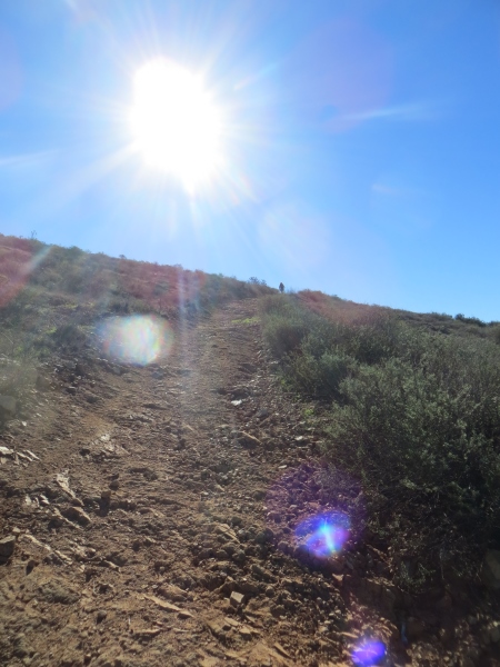
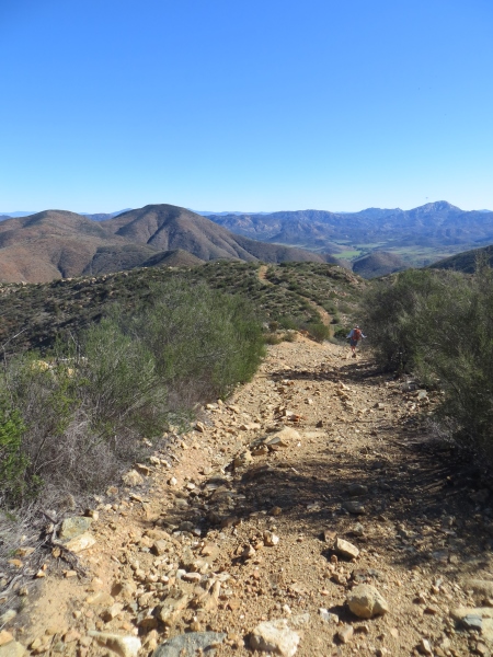
Anyway, the goal was to help him decide and it worked, and now I know where he’ll be for probably the next 4 years, so that helps me be less freaked out by it. Besides, I figure he’ll WANT to come back to Southern California after 4 years of freezing his butt off…and it gives me a good excuse to go out there and hike some new trails.


Agua Caliente and the PCT

Saturday found me on a portion of the Pacific Crest Trail with some of my regular hiking buddies…
AguaCalienteApr1214 small
The weather was pretty much perfect, in the low 70s with a cool breeze…we’ll be dreaming of that in a month or so.
AguaCalienteApr1214_1 small
The plan was to hike on the Pacific Crest Trail for about 4 or 5 miles, and then to follow the stream up as far as we could.
Apr 12 14 007 small
The hike starts out in a pretty valley with lots of oaks and wildflowers…we even briefly saw a deer hiding in the brush.
Apr 12 14 010 small
We crossed the stream multiple times…there was enough water for it to be pretty and make noise, but not so much that crossings were difficult.
Apr 12 14 013 small
I’m writing these words without being able to see the photos…probably not the best plan, but I’m sitting in the Minneapolis airport waiting for our flight…I preloaded the pictures into the post, but the preview function is being funky, so I have no idea which picture is which. Annoying.
Apr 12 14 015 small
This was a fast hike with not a lot of elevation gain.
Apr 12 14 016 small
We saw some PCT through-hikers, including two women in their 60s.
Apr 12 14 019 small
We also saw a bunch of Boy Scouts who were doing training hikes, with one group camping out.
Apr 12 14 020 small
After walking through the valley for a bit, we started to climb a bit.
Apr 12 14 027 small
You can see the valley for miles as you climb into the hills.
Apr 12 14 028 small
I finally gave up on writing this until WordPress updated the app last night, so now I’m writing in the Syracuse Airport. We were about 11 people, a good size for this type of hike.
Apr 12 14 029 small
There were lots of wildflowers among the chapparal.
Apr 12 14 035 small
Lots of Yucca about to get serious about blooming.
Apr 12 14 036 small
The mountains we were hiking towards…
Apr 12 14 038 small
More mountains…
Apr 12 14 039 small
And a look back at the valley…
Apr 12 14 041 small
Ah ha! There’s the stream…must be Spring in California…there’s water.
Apr 12 14 047 small
And more wildflowers…
Apr 12 14 048 small
This tree was persistently growing out of that rock.
Apr 12 14 052 small
There were plenty of oaks everywhere…
Apr 12 14 059 small
In oasis-like environments where you could imagine setting up a campsite for a while…
Apr 12 14 066 small
Or perhaps, like the Native Americans, grinding some acorns into flour in a mortero.
Apr 12 14 070 small
At about the 5-mile mark, we went off the PCT to follow the stream. This required some minor bushwhacking, which might have been an issue if what we had seen by the stream had been poison oak. We didn’t think it was, and it’s been a few days since I got slapped in the face by one of the questionable plants, and I am still rash-free, so I think we did OK.
Apr 12 14 071 small
We kept seeing more flowers…
Apr 12 14 072 small
And some significantly large manzanitas with their gorgeous red bark…
Apr 12 14 073 small
More flowers…
Apr 12 14 075 small
And more manzanita…
Apr 12 14 080 small
At this point, we divided into two groups, one that went further up the stream and one that went back to a beach area. Unfortunately, one of my group (the continuing bushwhackers) put her hand on a plant with tiny needles that got stuck and caused some swelling. Luckily, old people (like me) travel with a wide variety of drugs and equipment. Here she is being operated on with my tweezers, and later she got ibuprofen and Benadryl for the swelling. We recommended medicating with wine and a soak when she got home.
Apr 12 14 082 small
We stopped here for lunch, perched on rocks around the stream…
Apr 12 14 085 small
Enjoying it rushing around us…
Apr 12 14 086 small
Sitting in the sun or shade, it was restful to listen to the water rushing by…
Apr 12 14 087 small
I know the picture below is one of the frogs who joined us for lunch.
Apr 12 14 089 small
More beautiful stream…
Apr 12 14 095 small
There’s where the Boy Scouts camped out…
Apr 12 14 097 small
And here we are heading back…
Apr 12 14 100 small
There were many varieties of cactus…
Apr 12 14 103 small
And no, I don’t think it was cactus that injured her…there were nettles too, and these were super fine and caused swelling.
Apr 12 14 106 small
The wildflowers were plentiful down in the valley.
Apr 12 14 116 small
The meadow with the grasses rustling in the wind…it was amazing watching each plant shift position in unison with the others as the wind blew through.
Apr 12 14 120 small
Another flower-strewn meadow…
Apr 12 14 122 small
The official PCT trail sign…
Apr 12 14 124 small
And a big old dead tree.
Apr 12 14 136 small
We did probably 11 miles…this trail isn’t difficult. It is an out-and-back trail, so you will have to hike back however far out you go…I don’t find that to be a hardship because I think it looks different as the light changes during the day. This would be easy to do with kids, especially with the water crossings, although summer may reduce water flow and heat will make it more difficult.

3 Sisters Waterfall

Last Saturday’s hike was an interesting little trip down to 3 Sisters Waterfall(s), out near Descanso. We met at a couple different park and ride locations to carpool, because parking is difficult and it’s a long trip out there with some parts of it on a dirt road. Despite all that, there was a huge group signed up for this…seems it’s something to cross off some list. Thanks to a couple of people for group photos.

OLYMPUS DIGITAL CAMERA

The parking is all on a road that is barely wide enough for two cars and goes around a tight curve. We were amazed by how many cars were already there.

Mar 29 14 002 small

This is the entrance to the “unofficial” trail, with warnings about heat killing and no cell service once you’re out there (true that). It doesn’t look so bad from here.

Mar 29 14 003 small

Hiking with this many people on a flat trail is a little strange, but honestly, when we got to the hilly section, it wasn’t a big deal. And surprisingly, we all made it back out.

Mar 29 14 004 small

The weather was nice…started out not too cold, not too warm.

Mar 29 14 005 small

Lots of those big California oaks…

Mar 29 14 007 small

And hills and blue sky on either side.

Mar 29 14 010 small

Rolling hill vistas…

Mar 29 14 011 small

There were lots of people taking photos…

3Sis2 small

And then we started down into that space over there on the right, where the falls are located…

Mar 29 14 014 small

That part was pretty easy…until we had to come back up it at the end. But it was a relatively mellow downhill into this nice green area, obviously being fed by water.Mar 29 14 023 small

Hiking through the overhanging trees seems really nice…

Mar 29 14 026 small

Until you realize what’s surrounding you…like everywhere…reaching out to grab you…yes that’s poison oak.

Mar 29 14 027 small

We came by one young couple and their dog was standing right in the middle of it. Um. Excuse me. Your dog? Don’t touch it until you wash it well, and maybe not even then. I suspect a lot of the less-experienced hikers on the trail (not in our group) are currently nursing pretty bad-ass poison-oak rashes from that hike, based on the lack of protective clothing and protective behavior that we saw. It was nice and green, though…

Mar 29 14 030 small


And then we got our first view of the falls…

Mar 29 14 035 small

Realizing then that those little dots on the slope careening before us were the first part of our group (I was in the middle at that point). Oh. Hmm. OK. Downhill. When I hike, I am always aware of the fact that if it’s not a loop, I have to go up whatever I went down. Although sometimes down is harder.

Mar 29 14 038 small

Here’s the view on the way down. It didn’t seem too bad at this point, although this is my going AROUND the ropes section (I did go UP the ropes on the way back).

Mar 29 14 039 small

And in this one, you can see the line of people above. We were a really LONG line of people today.

Mar 29 14 040 small

This is the second rope section…again, I found an easier way down, but went up it on the way back.

Mar 29 14 041 small

After a brief rest (trying to get most of our group together) at the bottom of that slope, we started the next part of the hike, rock scrambling. There wasn’t always a clear path up the stream, so you’d often have to stop and go back the way you came, looking for something more doable, whether it was getting over the rocks or getting past the poison oak. Both were an issue.

Mar 29 14 046 small

I wore gloves for this part. Saved my hands. But path? For instance, see the arrow? Good…path. See all the greenery? All of that is poison oak.

Mar 29 14 048 small

Our whole group found about 5 trails going up this section. It was very pretty though.

Mar 29 14 051 small

The mountains were towering above us on both sides. Mountain goat territory.

Mar 29 14 052 small

This is looking up towards where the waterfalls are.

Mar 29 14 053 small

And then we were there. Along with 30 million other people. Seriously, I don’t know where half of them came from, but many of them were high-school or college-aged, and they were sliding (bump bump BUMP) down that rock on the right into the kinda shallow pool below. We were sure on a regular basis that people must have to be life-flighted out of there.

Mar 29 14 054 small

There’s no cell coverage though, so you’d have to hike back out first just to call life flight.

It was a Darwinism moment. There’s the lower pool. The rock just drops off and they fall a couple of feet into the pool. Mom brain is worried about these boys (and a few girls) hitting the back of their heads on the way down.

Mar 29 14 055 small

Despite all that, we enjoyed the day and the view. Sat in the shade for a bit to cool down…

iPhone Mar 29 14 031 small

Ate some food, and then sat out in the sun because it felt good.

3Sis1 small

This is looking up toward the upper portion of the falls. I did not climb up to the upper section because I could clearly see people having a hard time coming back and I didn’t feel like doing it.

Mar 29 14 057 small

See? Thirty million people. OK, not really, but here in San Diego, we joke about the number of people on Cowles and Iron mountains, weekend hikers who mess up the trails and won’t follow trail rules (damn, that sounds elitist, but seriously? Don’t hog the trail and get off the slope.)…this kinda was like that except mostly people were polite and helpful as they tromped around you with hardly any clothes on, right through the poison oak.

Mar 29 14 058 small

We’re all spread out on this boulder to rest. The key was to find a butt-shaped impression in the boulder. Notice my socks pulled up to protect me from the poison oak.

3Sis4 small

I rarely have the right clothes for these hikes. But I still don’t have a rash and it’s been almost a week! So I did it! (thanks to Maritie for that photo and some of the group photos)

Here’s the falls from another view. No, they weren’t sliding down THAT rock (although I kept waiting to see one of them try it).

Mar 29 14 059 small

And a view of the people up top.

Mar 29 14 060 small

This guy was doing yoga poses on a rock in the bigger pool.

Mar 29 14 062 small

No, I don’t know why, but it was amusing to watch. You can see the landscape next to the waterfall and see people going up and down the slope.

Mar 29 14 065 small

There was a lot of people-watching going on. We stayed at the falls for about 45 minutes and ate lunch and enjoyed the view. Then realized THAT below, that trail, was what we had come DOWN…

Mar 29 14 069 small

And if you zoom in, you can see the little people climbing back UP it.

Mar 29 14 070 small

And those little people would be us in a bit.

So we slowly gathered ourselves together and headed back out…past the rushing water…

Mar 29 14 071 small

Back through the pretty poison valley…

Mar 29 14 072 small

Looking back the way we came…

Mar 29 14 073 small

There were lots of wildflowers, but my camera still sucks at taking pictures of those, so this is all you get…

Mar 29 14 078 small

On the way back, I went up this lower rope portion (that’s actually me at the top, post-ropes; the guy behind me is coming up the rope section). You needed the gloves for pulling yourself up and along on a lot of this hike.

3Sis3 small

I used the ropes there because I remembered the dirt going down as being really loose and I didn’t want to try to go up that. But then I went up this…

Mar 29 14 082 small

Which mostly was easier because you were just pulling yourself up the rocks…until you get to the second ropes portion…

Mar 29 14 085 small

Which stretches from where I’m standing past the first woman to the second woman, who is still climbing at the very top. That was a bit of a challenge. No matter how much upper-body weightlifting I do, I’m not super strong in the arms, so there was a time when I thought…crap. Rest? Can’t. There’s someone coming up behind me. Interestingly, my arms and shoulders didn’t hurt the next day; my quads did, and my right way worse than the left. I didn’t stop hurting until Wednesday. So definitely somewhat strenuous. I think it was the rock scrambling that did that…being short and having to pull yourself up with your legs is hard on the quads, and apparently I often start with my right leg.

The way back was hot hot hot (a few had heat stroke, at least a mild version of it) and long and climbing, but we took it slowly and drank and ate as needed…

Mar 29 14 088 small

And eventually made it back to the cars. The trail was about 4.4 miles (although quite a bit of that was straight up or down, it seemed). It took us about an hour and half each way, maybe a little longer on the way back. I wouldn’t hike this alone…there was a lot of helping people up and down slopes and ropes and up and over rocks. The group was really amazingly good with that. I will say that if it had been any hotter, there would have been a lot more casualties…I think it was in the high 70s, low 80s that day, and it was definitely noticeable and made the trip back more difficult.

There were younger kids out there, and there’s a couple things to be said about that…sometimes kids are way better at scrambling up and down than us old people, but they also would be more prone to running right through the poison oak, so it’s kind of a crapshoot as to whether you would take them or not…I would think a healthy, fit 10-year-old would be OK (with plenty of water and food), but only if you go over the poison oak stuff before you go and make sure they’re covered as much as possible. The dogs were an issue…they mostly could handle the hike (but you better take lots of water for them, even with the falls at the end), but they don’t know to stay out of the poison oak, and the oil carries on their fur, even if they don’t get the rash…you will, as soon as they brush up against you. Plus we saw some dog owners taking their little dogs out there, up that crazy slope to the upper falls, and one of the dogs on the way down looks at the path down, stops, and then looks at her mom, like “WTF? I’m not going down that.” And then mom picked her up and carried her, which is really dangerous on a slope like that, not to have both hands ready to catch yourself.

So a lot of crazy people out there, unprepared and sometimes annoying, but it was a cool hike and destination, so now I can cross it off the list. I did actually enjoy it, even the crazy parts, so I guess technically I’m one of the crazies. And I took a nap when I got home, thus proving that I am officially an old person.

Corte Madera Mountain

Saturday I hiked Corte Madera Mountain, otherwise known as San Diego’s Half Dome…when we started in the morning, it was foggy, cold, and damp. Here we are at the trailhead (thanks to Keith and Maritie for their group photos)…

CM small

The trail starts out on a nice, oak-shaded, fairly wide road. You do need an Adventure Pass to park out on the road for this hike.

Mar 22 14 002 small

From there, the trail opens up into a bushy valley. To the west, we could have seen Los Pinos (if it wasn’t foggy)…we originally had a plan to climb that as well…

Mar 22 14 003 small

The wildflowers were blooming…

Mar 22 14 005 small

The deer (and some other pawed animal) had been on the trail before us…

Mar 22 14 007 small

The sky looked a bit gloomy, but it didn’t rain. This part of the trail, which really looks like a creek bed, was fairly easy to walk…a few small climbs, but not hard…until the last little bit up to the other road (I’m sure it has a name; haven’t got a clue what it is…wait, there’s this thing called the INTERNET…Ah…it’s Los Pinos Road, and yes, it’s actually a road.), which is on the saddle between Corte Madera and Los Pinos. This part was a bit steep at times.

Mar 22 14 009 small

Here we are on the saddle with Corte Madera hidden in the clouds.

Mar 22 14 011 small

There’s a sign there that marks out all the trails, some more officially than others.

Mar 22 14 012 small

This is about the only wildflower picture I took on purpose…

Mar 22 14 015 small

Here we are with Corte Madera in the distance…despite the fog, it’s starting to warm up (or we are starting to warm up because of the hiking)…

CM6 small

From the saddle, we took the road towards Corte Madera…apparently cars/off-road vehicles do drive this, but we didn’t see any of them.

Mar 22 14 017 small

From that road, here’s the path up to Los Pinos (which you can’t actually see, because it’s in a cloud). We did not do that hike, by the way…by the time we got back to the saddle, lots of time (and energy) had passed and there was a unanimous vote NOT to deal with this peak on this trip.Mar 22 14 018 small

There is then a small, unmarked trail that has this raptor sign at the head…this is the one that goes up to Corte Madera. This time of year, the birds are mating and laying eggs, so there are rules about where to hike and not hike, although it was fairly difficult once we were up there to figure out where that actually was…more about that later…

Mar 22 14 022 small

At this point, the trail got narrow and sometimes climby…

Mar 22 14 027 small

The views were gorgeous though…

Mar 22 14 030 small

Lots of boulders and pine trees and tromping through manzanita that was waist- to shoulder-high. It was still cloudy/foggy at this point.

Mar 22 14 031 small

These two rocks had space between them…I have a later view of them from below.

Mar 22 14 033 small

Many of the rocks were colorful.

Mar 22 14 034 small

As was the manzanita…

Mar 22 14 035 small

Beautiful vistas stretching for miles…

Mar 22 14 037 small

You can see a raptor flying in the blue sky that is now peeking through the clouds…

Mar 22 14 038 small

We stopped around here for a snack break…with a view of Corte Madera in the background.

Mar 22 14 040 small

More raptors…I think this was a turkey vulture, actually.

Mar 22 14 043 small

I took a panorama shot here of the group eating and resting…

iPhone Mar 22 14 011 small

This is one of the hills on top of the long stretch towards Corte Madera…

Mar 22 14 052 small

The top was fairly flat, a narrow trail, but you could see forever on both sides…

Mar 22 14 054 small

This is looking back at the group coming down the trail on the other side…this was the only bit where we had to climb on the top at all.

Mar 22 14 055 small

This is to the north…toward Cuyamaca…

Mar 22 14 056 small

I think this is where I took the next panorama shot…

iPhone Mar 22 14 012 small

There were lots of stacked-rock cairns marking the trail.

Mar 22 14 057 small

Can you see the face in this rock?

Mar 22 14 058 small

Nose, eye, big chin?

This is at the top of Corte Madera, where the can is. We weren’t sure, due to conflicting maps, whether this was where we shouldn’t be, in order to protect the birds nesting, but we did a silent hike for this whole section, no noise, no talking, just in case. This is the view to the northwest…you can see all the clouds are finally clearing out.

Mar 22 14 059 small

I think this is more to the west, but I’m not positive!

Mar 22 14 060 small

We all sat and admired the view, and took lots of photos. It was very peaceful being up there, even with so many people, because we were all still silent.

Mar 22 14 062 small

There’s something to be said for hiking like that sometimes. This was taken up at the top…

iPhone Mar 22 14 013 small

This is Cuyamaca Peak in the distance (hiked it in November)…

Mar 22 14 068 small

And the group shot at the top, looking north…

CM7 small

On the way back, we were waiting for the other group to catch up with us…this is the valley between the two sorta peaks up there. The bushes are about waist high.

CM1 small

These are the two trees we had used as markers to remind us to take another trail down, instead of returning the way we came. So here, instead of going back south, we headed off to the northeast, through bushes that were often head height and very close together…

Mar 22 14 070 small

There’s a view of the Corte Madera valley and pond to the east…

Mar 22 14 071 small

The bushes are closing in! One person found a tick on their body. Many people ended up scratched from this section. We put on long sleeves and long pants for a reason…

Mar 22 14 075 small

On the far end of the long ridge, there were some rocks with iron inclusions…very pretty…

Mar 22 14 077 small

It turned out it was one of the leader’s birthdays next week, so we all brought potluck snacks for lunch and surprised him. Someone brought party favors for a goofy picture at the top. There was even cake (sort of) and candles (that kept blowing out). It was a nice birthday surprise…CM3 small

Then we set off, way too full, down the back side of the mountain…there’s that pond again.

Mar 22 14 087 small

The path was difficult at times, but also there was a lot of wandering through areas like this, and one oak-covered area that was quite nice and shady.

Mar 22 14 094 small

Here’s those two rocks from below…

Mar 22 14 097 small

Lots of boulders and a wide trail at this point…

Mar 22 14 098 small

And a water barrel…that had holes in it and a bathtub at the front.

Mar 22 14 102 small

Yup. How often can you get in a bathtub with 11 other people? Not often enough apparently…

CM4 small

At this point, we were pretty tired…and then we realized something…we were on the wrong side of this fence…

Mar 22 14 106 small

Yeah. This one.

Mar 22 14 106 crop small

For the record, we never saw such a sign on the other side of our trail, and we didn’t see any patrols, but we did have to crawl through barbed wire to get out. So maybe that wasn’t the best choice for coming down the mountain.

So this is us curving back around the eastern side of the Corte Madera area, heading back to the saddle between Corte Madera and Los Pinos…because that’s  Los Pinos (not in the fog now) in the distance…

Mar 22 14 107 small

And back at the saddle, there’s Corte Madera in the bright sunshine…

Mar 22 14 108 small

And we looked back at everything we’d spent all morning climbing over…

Mar 22 14 109 small

Then went back down into the creek bed, with Los Pinos rising over us to the west…

Mar 22 14 111 small

Back through the shady oaks towards the cars…

Mar 22 14 113 small

This was a gorgeous hike, not super strenuous, didn’t need poles (though many had them). The various GPS devices said this was 8.6 miles (which includes our backwards descent into somewhere we shouldn’t have been) with about 4.5 hours of hiking time (that doesn’t count all our stops for photos and food). It took us longer than we thought it would, but I think that was the fault of the potluck more than anything else, plus a meandering trail at the end that we had never hiked before. What’s interesting is that I think I hiked this back in 2003 when I was hiking regularly…but it was about 90 degrees that day and I got mild heat stroke. Today was wonderful…started out chilly and got a little warm in the end, but the transition from foggy and cloudy to bright-blue sunny skies was definitely a plus.

You can drive up the road to where the raptor sign was and shorten your hike, which might make it very doable for families, although there’s still some scrambling and some issues with the raptor nesting dates, but otherwise, a drop-dead beautiful trail. You can access the trail off of Buckman Springs (off Interstate 8). This website gives fairly clear directions (I obviously don’t write posts to get people TO the hikes…that’s what the internet is for). He also has a bunch of other San Diego hikes at different levels of difficulty with lots of great photography.


Hiking the Jamul Mountain Range

Last Saturday, I hiked  with a group through the Jamul mountain range (a very small mountain range) on the hunt for wildflowers. It had only rained the week before, so we didn’t see many flowers, plus Southern California wildflowers are on the tiny side…but we did have a great excursion. We started on Otay Lakes Road…

Mar 9 14 001 small

One of the hikers had a GPS device that mapped the trip: 8.5 miles in about 5 hours with a ton of ups and downs and about a 1600′ elevation gain. The blue line is the elevations during the trip. The orange is his speed. The red is that actual trail we took. Cool technology…I’m totally jealous.

Map

This photo was taken about 10 minutes into the hike, so we’re all well-rested and possibly a little goofy (additional photos are courtesy of Ken T. and Maritie, the group leader).

JamulMar81 small

Where the hike begins is a graffiti-covered dam in the distance with the rocks by the side of the road.

Mar 9 14 002 small

Here’s the dam from a bit of a distance…

Mar 9 14 005 small

And right above it…

Mar 9 14 006 small

I thought the blocky quality of the graffiti painted over old graffiti was interesting…

Mar 9 14 008 small

And there’s Otay Lake (aka Lower Otay Reservoir) in the distance…

Mar 9 14 009 small

To the north was San Miguel…

Mar 9 14 013 small

Notice how everyone has poles? Yeah. I forgot mine.

Mar 9 14 014 small

The majority of the first part of the hike, I was OK without poles…the second half? Not so much.

The day was warm in the end…this is looking towards the first summit of the Jamul range.

Mar 9 14 016 small

This is looking towards downtown San Diego over Chula Vista in the front…you can see we’re starting to climb.Mar 9 14 025 small

A closeup of downtown…

Mar 9 14 031 small

We were pretty spread out for most of the trip…you can see someone way up at the top. The ups were challenging…the trail was fairly steep in places and had lots of rocks.

Mar 9 14 032 small

The Marines and a bunch of rock-pilers had been at the top of the first summit. I suspect this is where many people turn around and go back…

Mar 9 14 033 small

In fact, the only people we saw the entire time outside of our group passed us on the way up to here and went on to the second summit, and then came back past us. Here’s the trail up toward the second summit.

Mar 9 14 037 small

Yes, we live in a desert. In fact, there were very few trees on this trip, although some shrubs could pass for a tree if you were feeling really warm.

You can see for miles up there…this is facing east, trying to figure out what each of the peaks are…Mar 9 14 040 small

In fact, the little hill in the middle, between the two in the foreground, is probably McGinty Mountain from the previous weekend.Mar 9 14 041 small

A few of the yucca were blooming…I think that’s El Capitan in the background…

Mar 9 14 042 small

Beautiful flowers…

Mar 9 14 043 small

At this point, we started to work down a rocky trail on the eastern side of the range…

Mar 9 14 044 small

The back side had a lot more rocks, but there was greenery to be seen. In fact, this is where I saw most of the wildflowers.Mar 9 14 057 small

And sometimes my shitty old camera behaved enough to let me take pictures of them. This is the flower of buckwheat…Mar 9 14 058 small

I was lucky to have Ken T. also taking pictures (with obviously a MUCH better camera than I have), and he was nice enough to let me borrow some for the blog, so here was his buckwheat…

buckwheatflower small

His blue-eyed grass…

blueeyedgrass small

His black sage…

blacksage small

His deerweed…

deerweedflower small

(I told you his camera was better…I have all of these, but they’re blurry) His Dichelostemma capitatum (aka blue dicks)…Dichelostemmacapitatumbluedicks small

Way too pretty a flower for either of those names…there were apparently only two trees on the entire trail (not quite, but close enough)…and this was one of them. You’re almost required to stop under the tree on a hot sunny day on a hike with few trees, so we did.Mar 9 14 061 small

You can see green on the hills from the recent rains, off to the east…

Mar 9 14 062 small

And there are more trees down in that valley, but you’d have to bushwhack to get to them…

Mar 9 14 063 small

This was the view to the east off the back part of the range, quite beautiful…

Mar 9 14 064 small

Way down in the depth of that valley below, though, there was this structure…and we all had to try to guess what it was, why it was there…Mar 9 14 066 small

We had lunch at this high point overlooking the reservoir, with Otay Mountain to the left…it was hot, but not horribly so.Mar 9 14 069 small

Another group photo after lunch…we are looking a little less energetic…but still ready for whatever the trail might show us…JamulMar814 small

And the panoramas…this one from Ken’s camera…

Kenpanorama

And my phone, which is a little harder to control…

iPhone Mar 9 14 023 small

But still gives you an idea of what Southern California looked like before we built all those houses…iPhone Mar 9 14 025 small

I was reading about all the trails in this area, and it used to be open to these off-road vehicles until they decided there was some sensitive habitat there and closed it, so there are all these “roads” that aren’t super wide and are definitely not maintained well (which is fine)…so the plus is you’re not walking on a single-track trail, but there were lots of rocks and rough ground.

We saw lots of these caterpillars, apparently for the Salt Marsh Moth…

SaltMarshMothCaterpillarEstigmene_acrea small

They were often walking faster than we were, scurrying along the path. I’m not sure where they were going in such a hurry…

This is the red monkey flower…

redmonkeyflower small

We also saw people parachuting from airplanes and landing on an airstrip to the south…

Mar 9 14 071 small

At this point, the trail looked nice…flat but some green, looking south towards Mexico over that mountain…Mar 9 14 075 small

And then started the “sorta crazy” part of the trip (I think that’s how the leader described this section)…downhill at a significant angle. This is where poles were, quite honestly, as someone who didn’t have them, necessary…

Mar 9 14 077 small

I’m not really sure how I managed this downhill portion without faceplanting about 17 times, but I did. And I felt it for the next three days…you can see the airstrip where the parachuters were landing in the middle of the photo.

Mar 9 14 078 small

You can see everyone coming down the slope, which luckily had enough rocks that were planted in the ground to give me some traction going down.Mar 9 14 081 small

More parachuting…fascinating. It was on many people’s bucket lists to do this sometime in the future (including mine)…Mar 9 14 086 small

Some landed crazy, some landed calmly…I’m sure I would be doing the former…

Mar 9 14 090 small

I didn’t take a lot of pictures coming down that hill…I was trying too hard to keep from falling (went down on my butt once)…it was hard work.

After that, we had a choice of a very flat trail with part of it on the road or a trail with, as the leader described it, “ups and downs.” We chose the latter, thinking that after coming down that hill, how bad could it be? Well, it was a challenge, because it was about 5 significant climbs, plus more crazy downhills (not THAT crazy, but still…poles would have helped), and by this time, it was warm…low 80s. And we were tired. It doesn’t look too bad in this photo…

Mar 9 14 093 small

Now we are on the western end of the range, and the plants have changed again…

Mar 9 14 095 small

That’s more of what the up and down looked like…neverending…

Mar 9 14 097 small

You’d get to the top of one thinking you were in the clear, that you were almost there, and then you’d see the next one..Mar 9 14 098 small

It doesn’t look too bad until you see the people climbing and realize how steep it is. Again.

Mar 9 14 110 small

Luckily, everyone was a good sport and realized that a trail is a trail…it can be easy, medium, or difficult, but it’s still being outside in the fresh air, and a challenge is never a bad thing out here…we all had plenty of water and were able to keep moving…

Mar 9 14 112 small

Ken’s shot of where we had come (I’m hiding behind the woman in pink) just to give you a better idea of the slope…

highres_340202912 small

All in all, close to 9 miles, a hot day, lots of ups and downs, but there were flowers and wildlife…we saw mule deer and coyotes and California horned toads (I almost stepped on one…too fast for a photo), plus the caterpillars and the hawks and the parachuting folks…it was definitely worth the time and effort to hang out with a group with a remarkably good attitude about a difficult but not impossible trail. Will I do it again in two weeks to see more wildflowers (because it had just rained)? Um. Well. Probably not? But I’d consider it again next year around this time…we decided that some trails are like childbirth…you have to wait a while before it sounds like a sane thing to do again. It was good, though. Definitely worth the walk.

McGinty Mountain Hike

On Sunday, I hiked to the top of McGinty Mountain in the Jamul, California, area. It’s about 5 miles round trip and is fairly strenuously uphill. It was a day after a rather large rainstorm came through the area, so mud was sticking to our boots making me about an inch taller at times. Sticky mud helps on the uphills, but you slide on the downhills. The hike goes up about 1300 feet to an elevation of 2183′. Here’s a cool link to Derek Loranger’s 100 Peaks website, with video of rain and hail on the trail (hey, that rhymed). He also talks about the excessively sticky mud, but honestly, in San Diego, that probably only happens a few times a year.

Here’s the official government website. There is a regular Hike with a Ranger event on this trail, but amusingly, the government website doesn’t forward to the calendar properly, so I’m not sure how you’d find it.

There’s a nice little dirt parking lot at the trailhead with a view of this, which is NOT McGinty Mountain…

Mar 2 14 004 small

There’s another little hill and path to the left. Honestly, the hardest part about this trail besides the fairly strenuous uphill climb is trying to figure out which is the REAL trail and which are just dead-ends.

Mar 2 14 005 small

It is not marked particularly well…although you’re unlikely to get totally lost, you may wander around a bit if it didn’t just rain so you could totally track your own footprints back. There’s a chimney sticking up on this hill.

Mar 2 14 006 small

Here’s the trailhead itself, complete with warnings, doggie poop bags, and trail map.

Mar 2 14 007 small

Although again…it’s not always easy to tell where you should be going on the actual trail.

McGinty8 small

There are lots of sweeping views of the valleys on either side, with Rancho San Diego on one side, Jamul on the other.

Mar 2 14 008 small

The trail does track along next to houses on the lower slopes, and you can see more on the hills in the distance.

Mar 2 14 009 small

There is some steep climbing at the beginning and the end.

Mar 2 14 011 small

I think the parking lot is down in those trees in the middle of the picture.

Mar 2 14 012 small

We did see some weather, but it mostly left us alone…this is the view to the north, with Cowles Mountain in the distance (not the first peak in the middle, but the paler one to the right of it.

Mar 2 14 013 small

And a bird…which one of the hikers was able to identify…all I remember is that it’s a Spotted something (because of the wings, of course).

Mar 2 14 014 small

This is the view to the south of Jamul…the mountains on the right is where I’ll be next weekend.

Mar 2 14 015 small

Bailey was our faithful companion on the hike.

Mar 2 14 016 small

There was a mine off the trail on one side…

Mar 2 14 017 small

I’m not entirely sure what they mined (the Internet says gold), but these aren’t very big holes…we saw another one on the side of a rock on part of the hike.

McGinty2 small


I did not crawl inside. We took our first group picture up here…

McGinty1 small

It was a small group, due to the weather. And I am apparently short. You can decide which view is best…

McGinty5 small


Yes. I wore shorts. What can I say? It wasn’t actually super cold…cold enough that I had two shirts on for most of it, but went down to short sleeves for part of it…until the weather wandered back in…we could see rainstorms in the distance (or not-so-far distance). I have official zip-off hiking pants somewhere…I just don’t know where.

The trail consistently moved upwards…although most of the time, it wasn’t so bad that you couldn’t talk and hike (that’s my measure of how bad IS it…can I talk? Not so bad.).

Mar 2 14 019 small


Lots of valley views and vistas with big dark clouds…

Mar 2 14 020 small


It reminds me of what I love about San Diego County…all those mountains so close to home. I would die in Kansas…too flat.

This is looking north at where my house might be if you could see through hills.

Mar 2 14 021 small


On the right is San Miguel, which I’ve hiked previously. The trail was eroded by rain, definitely, but was also pretty rocky. Bailey was a trooper.

Mar 2 14 025 small


I think this is the portion the leader called “Heartbreak Hill”…here’s where talking and breathing had a bit of a conflict…

Mar 2 14 026 small

I was not the only one taking photos…you can see my naked legs up there in shorts…

McGinty6 small


Still easier than San Miguel though…more mountain vistas, off to the east, this time.

Mar 2 14 027 small


And northeast…

Mar 2 14 028 small


I think that’s looking at San Miguel again, but I’m not really sure!

Mar 2 14 029 small


That’s definitely north again.

Mar 2 14 030 small


North…

Mar 2 14 031 small

At the top, we climbed as high as we could (that rock) and took another group photo…


McGinty3 small


And here was the big money shot…

iPhone Mar 2 14 016 small

This was on the way back, I think…easier going down, but had some issues with picking the right trail.

McGinty7 small

We didn’t have much rain in the end. The hike was just short of 5 miles in about two and a half hours (with a few stops for people to rest and/or catch up, plus playing in mines and on rocks)…I would definitely do this again, although I suspect it’s particularly difficult in the heat of summer. Apparently snakes are a real issue up there too. This is closer to home than Cowles Mountain is and definitely less populated. Strenuous? Yeah…a bit…you need to be in some sort of shape, but if you’re persistent, you could go up it even if you are a slow but steady hiker…and you don’t have to go all the way up. It’s an up and back hike, so you could stop whenever you were tired and come back. The trail does continue past the mountain peak…I didn’t really explore beyond that…maybe on another day.

Searching for Better Than This…

When my head gets all tied in knots, I have this stash of partially written or barely started posts in draft form on here, and that’s what I put on the blog. It’s like fill-in-the-blank posts, posting-lite, don’t have to think too hard about posting…like the Road to California post…I had all the pictures resized and stuck in the post. I just had to go through and add all the names and links. I can do that without hardly thinking about it…and yet it takes up mental space and time. So I don’t have to deal too much with the goo in my head that wants me to feel bad. Avoidance. Book reviews? Same thing. I have about 8 other posts that are started in draft form, just sitting there, waiting. The Chihuly glass one? Started with photos, but then words took over.

This weekend? Not so much fun. Just keeping my head above water. Trying not to think too hard about feeling bad, about feeling sad. Trying not to remember how I used to feel, because that Kathy does not live here any more. She has moved out. She is never coming back. She can’t get in past the hoard (imagining when they try to get in the front door and all the crap that’s been hoarded is blocking it, and you can only squeeze in).

I went to a movie last night. I used to go to the movies almost every Saturday night. I loved going to the movies. I don’t love it so much by myself. I did it, though, because I felt like I was being punished for being alone, that I didn’t feel like I could do the things I love because of that. I’m becoming a hermit. OK, I was kind of hermit-like before, but I’m getting worse. It’s because it’s honestly too hard to be with people. I often feel more lonely in groups than I do at home alone with my sketchbook and my fabric and a cat or two. It’s sad. I wish it weren’t true. But it is. Right now. And realistically, the movies cost money and money is really tight at the moment.

So I picked a movie I had wanted to see when I first saw the trailers ages ago (there were others, but they weren’t at convenient times), and I drove out there to the theater and I cried through almost the whole movie and all the way home. I saw Her.

her_xlg

It was good…although it had some slow bits and the ending was…eh. Thing is, when I see people with technology now, out to dinner, hanging out in groups, everyone is doing that…talking to themselves, to their OS instead of a human…so it’s creepy, but not that far off of reality. Shades of that book…crap…Wake, by Robert Sawyer, where the WWW becomes conscious and starts talking to a teenage girl…because I know that’s who I would choose to talk to if I were the web (not). Anyway. Here’s why I’m on Goodreads…so I can look shit like that up, books I read before that I can’t remember the name of because my brain is like mush.

I suspect it’s really that so much of my brain is otherwise occupied that stuff like that just slips through.

So that was really successful, guys! I joined a couple of movie-going groups on MeetUp…maybe it will be a better experience. Of course, I can only go like one night a week, and most of their movies are not on that night. Sigh. But it’s better than this. It’s got to be. Something has to be. I keep searching for Better Than This…it’s an island in the Atlantic and there are no boats that go there. I might have to swim.

All the hikes I wanted to go on this weekend were too many hours for a two-day weekend…I had too much I needed to get done, so I got up this morning and hiked Cowles Mountain instead. It’s a quickie, but still is a good workout. San Diego has two mountains that get the shit hiked out of them by every weekend-walker and lame-ass wannabe hiker in the whole town: Cowles and Iron Mountains. The annoying part is the number of people…and the number of people who don’t know trail rules (yes, I’m a hiking elitist, sorry, get the fuck over if you are hiking that slow please)…and the number of dumb bimbos and assholes who are hiking up the side of the mountain, not following the trails, destroying it for future generations. Yes, I yelled at two girls. I apologize. Wait. No I don’t. They were being stupid. Ladies, if there’s a fence, it’s there for a reason. Where are the vicious rattlesnakes when you need them? Avoiding Cowles, for sure. I should carry one in my pack for times like this, just hurl it at the dumbshits who can’t walk on a trail without damaging sensitive habitat. Yes, they went over a fence right next to a sensitive habitat sign. I don’t feel bad about yelling at them.

That said, I did it fast (the hike) and proved I am much more fit than I was 7 months ago, when I would have to stop to rest. I didn’t rest at all, and I ran the downhill, passing two of my former students. HA! That was funny. And their mom. YOUR MOM. Sorry. Middle-school brain took over. I did pass your mom though. She’s looking good. You should be proud of her.

I didn’t do much in the way of art, because I was doing a lot of work-related shit. Which sucks. Always. I did a whole 16 minutes of cutting out Wonder Under…

Feb 23 14 014 small


The thing is, there isn’t much more to do on this one…then I’ll be on to the next step of picking out fabrics. But to what purpose? Hell. I still don’t know. Still don’t feel it. Maybe that’s why I didn’t push it. I knew I’d be done and have to go on to the next step and I wasn’t in the mood. It’s depressing to finish a step right now. I hate that. It used to be fun, sometimes even exhilarating. Now it’s just fucked up.

Then I cleaned photos off my phone. My computer is actually getting full. I have too much music and too many photos. I need to do something about that, like soon. I meant to do it over Xmas and freakin’ ignored it. It’s too much for my brain to handle, like the broken sprinkler lines. I just can’t take it on. I have to though.

The girlchild got reading glasses.

Feb 23 14 011 small


Which is funny, because it was the boychild we thought needed glasses and turns out his vision is almost perfect. She describes her vision as “buzzy.” We said, “vibrating? blurry? fuzzy?” She said, “No, buzzy.” The child has her mother’s way with words. Oh well.

There was this…

iPhone Feb 23 14 001 small


Now, it’s one thing to put all those words on the back of your car (to remind you? because it’s not reminding others…driving along, OH SHIT…I’ve blown number 8. Dammit.); it’s another to spell one of them wrong. Sigh.

Jake helping the girlchild make her bed…

iPhone Feb 23 14 010 small


I am still learning to take panorama photos on my phone…I inevitably do it wrong three times before I do it right.

iPhone Feb 23 14 068 small


That’s Penasquitos last weekend. NOT a panorama.

And here it is again…done almost right this time…

iPhone Feb 23 14 070 small


Pretty, huh?

And here was the top of Cowles’ Mountain this morning…

iPhone Feb 23 14 084 small

San Diego does have the weather, doesn’t it? OK, summer will suck. I’m a little worried about summer. I won’t be able to hike like this. I don’t do heat well. Maybe I will borrow my ex’s kayak a lot. Maybe I will swim more. I don’t like swimming though.

I finished this book…A Dirty Job by Christopher Moore…

adirtyjob

which is a good thing because book club is Wednesday. I liked it. I liked his turn of phrase. I like his weirdo stories. It’s the second of his books that I’ve read. It’s a little wacky, a little out there, but amusing and not dreary. Probably that was a good choice for the weekend, because it was a bit dreary…except for the hiking bit.

I watched this, a Tate Gallery video on nudity in art through the ages…

What’s funny is that to actually link to this video, I had to persuade YouTube that I didn’t need Safety Mode on my videos. They thought it was unsafe…I guess you shouldn’t watch it at work (I thought it was pretty benign myself). I like their shorts…educate the public about art. God knows we aren’t doing it in school any more.

This week? This week is the girlchild’s team finally making it to the CIF playoffs…two games this week guaranteed unless a volcano swallows us up (could happen), a book club meeting, and I think I signed up for two hikes next weekend, just because I think one will get canceled due to rain (she’s a real water wimp, the leader is). I set some goals on the art stuff for this week…I have two drawings I’d like to get done…one is in the sketchbook and one has been copied full size, but needs more. I want to finish the Wonder Under on the Mammogram quilt and start ironing it to fabric. I’d like to get all the wool cut out for Ivy’s quilt too, but I suspect I just shoved more into a busy week than can actually realistically get done. All that is better than thinking about the muck my brain wants to wallow in, though, so hopefully it will keep me distracted. If not, I may be back here again, clearing out photos and writing filler posts that don’t let my brain think too hard about reality. My other goal is to try to go to bed earlier…those super late nights aren’t helping. Maybe just 10 minutes earlier each night until I get back to something in the realm of sanity? Or not. It’s got to be better than this.

Mule Hill Trail to Raptor Ridge

I spent about 3 1/2 hours this morning hiking Mule Hill Historic Trail in the San Dieguito River Valley to the beginning of the San Pasqual Valley Trail, going through Raptor Ridge (over? through?) on the way. The trail map is here, if you’re interested. We started in Escondido off of Sunset (across from the mall), and there happened to be a very small farmers’ market taking place, so traffic was a mess. I’m fairly sure I did a hike out of here over 10 years ago, but going the other direction, under the freeway towards some hill on the other side.

Feb 16 14 001 small

This is part of the Coast to Crest trail, which will eventually be 55 miles from the coast near Del Mar to Volcan Mountain near Julian.

Feb 16 14 002 small

We didn’t do the whole thing…went 5.9 miles out and back. I guess the whole thing of that section is more like 24 miles…11.8 seemed plenty for one day.

Feb 16 14 006 small

It was a little on the warm side, certainly in the high 70s/low 80s for part of it, although there was a decent breeze, and the clouds kept it a little cooler. You could totally feel the potential for nasty summer heat baking up off the dirt when the sun was shining down on the eastern side of the ridge, though. I mean, this is February.

Feb 16 14 008 small

The skies were amazing today.

Feb 16 14 009 small

The trail is mostly flat and fast through the valley, although there is a lot of competition with mountain bikers. In general, the bikers are good people, respectful of trail rules (everyone yields to horses, bikes yield to people). We didn’t see any horses today, although they are allowed on the path.

There is a section of the trail that travels next to farmland, mostly strawberries it looked like.

Feb 16 14 010 small

You can see the plastic covering some sections. When you get further out into the valley, you can see the beginning on the left of the hills that lead into Raptor Ridge, which peaks out at 1000′ in elevation (not super high, eh?).

Feb 16 14 014 small

There were very few trees on this trail…so very little shade. Summer would be difficult.

Feb 16 14 018 small

Once you get out of the valley and start climbing into the ridge, there is some green and trees to shade you for the first part…

Feb 16 14 020 small

This is also generally where the mountain bikes disappear. It’s a one-track trail at this point, and it climbs fairly steadily from the valley up to about 600′ elevation, maybe a little higher. You can see the San Pasqual Valley from this section.

Feb 16 14 021 small

In the beginning of the hike, I was out in front with about three other hikers. It was a really big group, about 36 people, and it was just too many people and too loud for me. I guess when I’m out in nature, I want to actually BE out in nature. I don’t mind talking, but it was just too many live bodies in one space. At this point, though, when we started to climb, somehow I ended up being first, so once I got into my rhythm, I just kept going.

Feb 16 14 022 small

They’re all strung out on the trail behind me…not too far behind…

Feb 16 14 023 small

More of the San Pasqual Valley, sort of towards the Wild Animal Park.

Feb 16 14 024 small

I wasn’t trying to be antisocial. I just find it hard to hike slowly. Or behind people who are slower than I am. Or in huge groups of people. Sigh.

Feb 16 14 025 small

There are a few viewpoints on that side of the ridge…this is looking up to the peak, although apparently the trail doesn’t go up there…you have to bushwhack it.

Feb 16 14 027 small

We kept going around the ridge to the San Pasqual Valley side looking for some mythical bench that never appeared. Once we realized we had hit 5.9 miles…this is where you remember that however far you hiked out, you still have to hike back…the organizer decided to have us go back to the viewpoint.

Feb 16 14 028 small

So we did…took the obligatory group photo and snacked a bit. After about 10 minutes of drying the sweat off your back and eating something, a couple of people said they were taking off, so instead of being a social butterfly (I’m not), I took off after them.

MuleHillFeb1614 small

I was kinda tired of hearing boys tell girls to “work it.” Sigh. Sometimes. People.

There’s the rest of them at the viewpoint…they never did catch up with us…to our credit, we were moving pretty damn fast.

Feb 16 14 031 small

It only took about an hour and a half to get back to the parking lot…about 5.5 miles

Feb 16 14 032 small

I eventually caught up with the three ahead of me (garter snake on the path stopped them for a bit, just to move him out of the way) and hiked out with one of them, who is a high-school teacher…so we had lots in common. That was pretty much the only conversation I had.

Feb 16 14 034 small

I do better in smaller groups. This is a pretty easy section of the trail, even with the climb up to the ridge. Certainly, you could wander the river valley for a while with kids or dogs and have a good time, turning back when you’re ready, although I suspect it gets quite warm sometime in June or July through late October. Someday I will do the next section, across the San Pasqual Valley…maybe with someone to pick me up on the other end. I can do 12 miles…not sure I can double that though. The hips and knees eventually complain.

It was a good workout, a good day for it. Not sure where my next hike is…I don’t have one planned for another 3 weeks…will have to see if I can do something before that.

A Gesture of Release

Girlchild got me sick. I knew it yesterday, felt it lurking. This morning, I felt spacey…all day, spacey…but not really sick. Still a sore throat, headachey. I’ve had my flu shot. Think this is just a cold, but it’s holding off…maybe I’m actually fighting the damn thing. Maybe I’ll feel like shit tomorrow…maybe not? I don’t know. I debated going to the gym…for two reasons. (1) I didn’t feel great and (2) I didn’t want to infect people. In the end, I went. I needed it for my mental and physical state, and honestly, I felt better after I went. I disinfected every machine I was on (but I made sure I touched every kid who is annoying at school…OK, not really…but we did joke about it). I got to work out and read, and I came home and felt OK for about 2 hours before the spacey/sore throat stuff came back. We’ll see what tomorrow feels like. If it’s going to take me down, I want it to do it quickly, so I’m better before my weekend hike (priorities).

Girlchild had a soccer game, but she didn’t go to practice because she was sick yesterday, so she didn’t play…I did watch the sky…

Feb 11 14 003 small

It was beautiful…although apparently I should have been looking behind the bleachers…

Feb 11 14 005 small

I stitched during the game…

Feb 11 14 009 small

I think these two are almost done…I think all I have to do is stitch around the eyeballs and put the eye buttons on. Oh wait. They need feet. Damn. That’s a bunch of bullion knots. That’s time. Then there’s only one more of the Month 3 birds to finish. Then on to Month 4. Yes, I’m slow, but guaranteed I was the only person stitching palestrina knots in that stadium. It’s progress…on something. I measure my entire life a little tiny bit at a time, progress on this project and that project. I got one stitch done here. I got 30 minutes done there. It’s proof that I have things to do, to keep me going.

Some days are like that. What’s the one thing I can work on today that will let me feel like I’ve accomplished something decent? Not grades. Not dishes.

I came home to this…

Feb 11 14 008 small

There was a phone number too. It was shoved in the door handle. I too need joob and don’t know where to look. Lupe needs to be more specific.

After dinner (late), I organized all the financial aid paperwork; I’m missing three signatures from the boychild and then everything can go. Then I ironed his interviewing clothes…it’s Columbia tomorrow, he hopes the last interview. Probably true. Who knows. Then we wait. Apparently my brother and SIL are placing bets on what schools he will get into of those he’s applied to…better than the woman I hiked with who was the Queen of Negative Thinking about college apps. Whatever. He’ll get in somewhere, and that somewhere will have to be good enough at least for the first year. Am I worried? Of course. I’m mom. I worry. I’m Kathy. I worry. I will worry less in a couple of days when these damn envelopes are gone.

I meditated. That was not-so-good. I’ve spent the last 10 days trying to visualize a point of light in the center of my chest, warm and bright like the sun, which is supposed to expand and spread to fill my whole body. I suck at this. I start the spread and then black tarry stuff from my fingers and toes starts to encroach on sunny brightness and swallows it. Yesterday and today it was tears, oceans of tears, turning the sunlight into steam, covering it up, drowning it. I was trying so freakin’ hard to force the light to spread, and I finally stopped. I let it just sit at the size it could be in me right then, about the size of a cantaloupe. Interestingly, this is supposed to be an openness to creativity, which is not something with which I have a problem…so there’s just something about that meditative avenue that is causing me grief. Seriously weepy grief. Sometimes you just have to let the mind do its thing and you watch it and try to learn from it, but trying to force the change is not going to be a successful endeavor.

Then it was late and I had to choose…sleep? Or artmaking? I learned my lesson last night…I didn’t spend much time tracing, but I did spend some…

Feb 11 14 011 small

I got motivated after working on that drawing last night to finally restart the tracing on the mammogram quilt. I think I just need to have multiple projects in the works so I can pick and choose when I’m in a mood…something easy, something hard? Something that is totally engaging vs something that is more light and simple? Tracing isn’t usually easy, but it is engaging. And it helped. I was already a bit distant and numb from the gym experience (too many days of crying at the gym lately), so I guess I’m even more into that hole, but I’m not sure it’s a bad thing at the moment. It just is.

I committed to another challenging hike in March…looking forward to it, although I’m a little nervous about it…less so now that I know it is less elevation gain than San Miguel, but I don’t kid myself…it won’t be easy. It will be worth it, though. I made a comment on the last hike about dispelling demons from the tips of my fingers as I walked, and I think maybe I need to think of a way to do that for real, like a symbol of that maybe? I think this would be a good hike for that, although I don’t know if I feel comfortable with doing that with a bunch of mostly strangers (I know a few people who will be on the hike, but not well). We’ll see. Maybe. It’s on my mind…ritual to remove sad? Not a wake, not a memorial, but something more in the dirt. Thinking about it. How to persuade the brain to release things…a gesture of release?

Meanwhile, my gestures are in the art world…releasing grief and sad and even anger through the drawings. The guns, they’re about anger and pain…not hurting myself, but trying to mitigate hurt done on me. Trying to make it hurt less by drawing hurt? I can’t really explain how my brain is working…but it is trying to work through some of these things with symbols, images of things that hurt…thorns, cuts, tears, wounds…another gesture of release? Who knows.

Los Penasquitos Canyon Preserve Hike

On Saturday, a beautiful day in February in San Diego, I went on what ended up being over a 10-mile hike in Los Penasquitos Canyon Preserve. We started out at the western entrance near Sorrento Valley. There is a parking lot, but it had rained Thursday and a little bit on Friday, so the lot was closed (although it had opened by the time we returned). This meant having to park in a nearby residential area…by nearby, I mean almost half a mile away…this is coming down the hill to the entrance.

Feb 8 14 003 small

You can see the start of this end of the trail, plus the trail off to Lopez Canyon, down below from the road. San Diego is full of canyons and open-space areas like this…


Feb 8 14 004 small


I’ve lived here for 25 years and still haven’t been to even half of them. It was a bright and sunny day…

Feb 8 14 005 small


This is the view of the hillsides from the parking lot. The entire preserve is surrounded by office buildings and houses, although they are fairly unobtrusive for most of the hike.

Feb 8 14 007 small

Here is a link to the website for the preserve, which includes trail maps. We hiked from the western entrance to the waterfall and then out towards the eastern entrance, where one of our members continued to her house, and then we looped back on a different trail to the parking lot.

Someone had placed rocks on the fenceposts…

Feb 8 14 010 small


These are typical California rolling hills, very dry at the moment, as we’re in yet another drought…even with last week’s rain, there is not a lot of green popping up.

Feb 8 14 013 small


You can barely see the houses on the ridge to the right.

Feb 8 14 014 small


There was some mud on the trail, but mostly it was dry. We encountered lots and lots of bikers, some in huge groups of 30, and a few runners.

Feb 8 14 016 small


There was actually water in the preserve. Here’s the official group photo, minus the organizer, whom I’m hiked with before.

PenasquitosFeb814 small


It was a very fast hike…there weren’t many hills, but the organizer was also a superfast person…you can see the rest of the group way far behind us (yes, we did stop and let them catch up occasionally).

Feb 8 14 019 small


That’s why I’m sore today…speed exertion, not hilly stuff…although there was a little of it on the way to the waterfall.

Feb 8 14 027 small


This is one of the areas where we just had to stand aside to let all the bikes go past…the trail wasn’t wide enough for both of us.

Feb 8 14 029 small


When I lived in Britain for a year, this is the landscape I missed…that brown and olive green color, rolling grassy hillsides, California live oaks, the green showing where the stream lies.

Feb 8 14 030 small


The waterfall is in volcanic rock…

Feb 8 14 034 small


Not rare in San Diego…

Feb 8 14 036 small


The foam in the water was somewhat disturbing…especially when it looked like big blobs of detergent. Gotta love that after-storm effluvium.

Feb 8 14 037 small


Another group photo above the waterfall…most of us are sweaty at this point. It wasn’t hot, high 60s, low 70s, but we weren’t moving slowly. I think I said that already.

PenasquitosFeb814b small


The leader took one photo of me talking while walking. Yes. I do actually talk sometimes. I had discussions about blogging, bad job situations, negative people, colleges (I tried to avoid that one), kids, being outside in nature, SEO, website traffic, and books about the Pacific Crest Trail…this group was fairly diverse.

PenasquitosFeb814a small


There were shady areas on the hike…this will be a hot hike come summer, but the shady bits might make it doable.

Feb 8 14 040 small


That’s one problem with Southern California, is that there are about 4-5 months of the year when certain activities like hiking aren’t particularly easy or pleasant. I think this is when normal people go to the beach. I’m trying to get in as many hikes as possible before the heat comes…I don’t do heat well.

Feb 8 14 041 small


And there are lots of stretches of dry, hot, treelessness on this hike.

Feb 8 14 043 small


It was fine today though. We did a couple of stream crossings, some more wet than others…

Feb 8 14 044 smal


I told you it was a gorgeous day, didn’t I? I took lots of deep, cleansing breaths, banishing demons from the tips of my fingertips out into the brush.

Feb 8 14 046 small


The peacefulness of these groves of sycamores and oaks was wonderful.

Feb 8 14 048 small


And even the vast expanse of trail and sky was soothing…

Feb 8 14 050 small


It’s even better being out front with nothing human messing with the view…

Feb 8 14 051 small


I love the sky…

Feb 8 14 052 small


The trails were a variety of straight, wide, and flat, with some rocky bits, and some narrower rocky trails near the waterfall. Usually we could walk side-by-side, and didn’t have to go single file. You had to keep your ears open for bikes coming up behind, though.

Feb 8 14 055 small


This stretch had very few bikes…

Feb 8 14 059 small


When we finished, we still had to hike the 1/2 mile up the concrete hill to our cars, but it wasn’t too bad.

Feb 8 14 067 small

The actual hike that we did in the preserve was about 9.4 miles, and we added another 0.9 on the hike to and from cars. We did it in just over 3 hours, so pretty fast (and that included a couple of stops). It was a nice day for it. If you go look at the trail maps, you can get a better idea of all the different access points to the preserve and the mileages involved. There were lots of little kids and families out for walks or rides in the space, and many mountain bikes. There’s also a historic adobe on the preserve, although we didn’t see that on this trip. Those living in the Penasquitos area have a great resource nearby in this preserve.