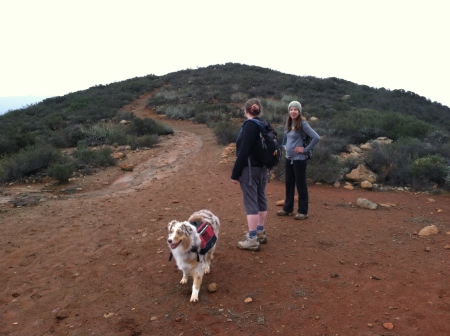
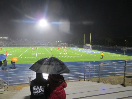
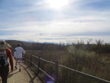
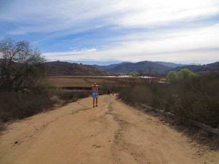
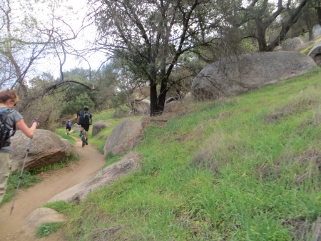
Managing my moods is becoming a full-time job. There’s food, there’s situations, there’s stress, there’s exercise. I’m now carrying my blood sugar tester thingie (it needs a name, like Ralph…or Daisy) with me everywhere I go. My meds get tested again in another three weeks…I’m suspecting my diabetes meds are off. I’ll email the doc before testing so she knows what to look for. I’m a little paranoid about hiking this weekend…in fact, I’m not sure I will do this hike, because it’s supposed to be really warm, but I really WANT to do it. So. I can pack carbs and sugar and…dammit…sigh. It’s not like I didn’t hike last weekend with no blood sugar problems. In fact, I’ve hiked ALL the weekends with no problems. I’m just paranoid now. The last thing I want is to be in the middle of nowhere with a bunch of people I barely know and have a major problem like last night. That would be bad. I remember one hike post-divorce with two guys I knew fairly well and my blood sugar dropped (it was also hot), and they dealt remarkably well, but I had all the right stuff in my pack and was coherent enough to tell them what was going on. And I’d warned them beforehand. It really has been a long time since I’ve had issues.
The moods are tied to blood sugar, but also to hormones and then the emotional sine wave that I seem to live on…I had the wave graphed earlier today (in my head, of course), with a listing of what made it zoom up and down and hold steady at numbness. Trying to control the seemingly uncontrollable (blood sugar and mood swings) tosses the curve downwards. Yet another art rejection (too many of those lately) sends it downwards even further. Analyzing my own life? Hell, should just stay away from that most days. It’s down down down, all the way down. Girlchild tells me I am in a bad/sad mood on the days I have detention. She’s right. I should just give up. Is detention creating world peace? No the fuck it’s not. Then why do it?
But I didn’t give up. I got my hairs cut. They needed it. They are getting fussy in their old age. And then I made it to the gym and that was good. I read. I cooked and ate dinner. I forgot to do a bunch of stuff (sigh. I always forget a bunch of stuff…I am the Queen of Winging It). But then I was ready.
So I drew.
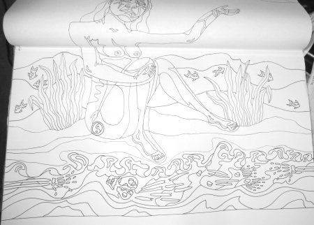
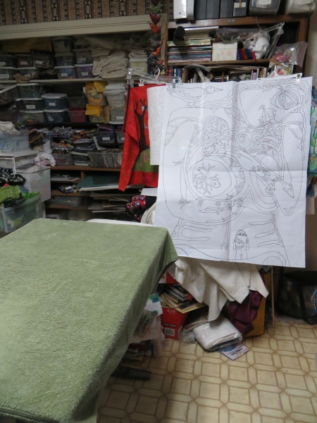
And I can’t even describe the peace in my head, my heart, that drawing gives me. It’s like a wave of calm washing over. It’s therapeutic. It’s stupid that I don’t do it more often (I run out of time, no more hours in the day). I haven’t meditated in a few days (more time/energy issues). I completely forgot tonight, but it’s OK, because I drew. And that is Kathy Meditation. It was so worth it. So the bottom is mostly done. I think. And the middle section is done. So now I need to go back to the top, to the first page, the one I started in December…and I need to finish it. I don’t know if this is next in line to get done. I haven’t decided. Maybe. It could be. It’s kind of a crazy beast. The ones I love don’t get into shows. At the moment, nothing gets into shows. Artistic angst. Why am I making all this art if it never gets out to be seen? You make the art because you have to. It keeps you sane. The getting out and being seen? That’s the least of your worries. Just keep making it.
You’re so lucky. You get to hear all the conversations I have in my head.
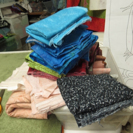
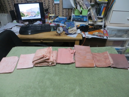
Meanwhile, I remembered that I hadn’t finished ironing the Mammogram fabrics, so I headed into the office/studio/national disaster area and pulled everything out, reminded myself of what I was doing whenever I last worked on it (March 7), and started picking blood vessels and heart parts…

so often a part of my quilts, the heart. My heart, the one that’s destroyed, eh? So yeah. This drawing was done before all that. Broken hearts. Shattered. Cracked. This one is still whole. I wonder what that feels like. Maybe some day I will know.
I keep thinking I will be better. I am better. But I’m not BETTER. If you know what I mean. I’m someone else. That someone may never be truly better. She may just be OK. My hair person asked (sort of) if I was done with love, like how some (old) people say they have experienced great love and they feel OK with that after their great love dies and they don’t need to go through it again. But I don’t want to be alone for another 30 years. I still don’t feel like I’ve done it right…that sounds awful. But it’s not right if they can’t stick around, if they can’t make it through the hard stuff, if they can’t be supportive, if they can’t stand next to you as an equal. So no. I’m not done. I haven’t given up, but I don’t have a lot of hope. I’m not OK with any of it. I think I need a dog. Dogs are nice. Except then they die of cancer at age 6, and it takes you two years to get over that too. Maybe I just need to sit alone in my house for a long while. Quietly. In a corner. A dust-free corner. Then everything will start to make sense again. Or not. Because maybe there is no sense to be made.
I still cry every day. In case you were wondering. I don’t know when that stops. Maybe never. I was never a crier like this. This is hard. I would cry when really bad shit happened. I cried at sad bits in movies. I cried when I saw babies born (usually in movies or on TV…when I teach human reproduction, I cry every time the baby is born on the movie I show my students). I cried during PMS if something was really funky in my head or in real life. It wasn’t a daily occurrence. It was rare.
Now? Not so much in the rareness. I’m always on the verge. So if you’re wondering when you’re talking to me if you hear tears in the background, you do.
I ironed a lot…
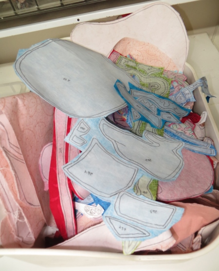
And I was pretty sure I was done…until I started to fold up all the fabric…
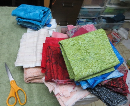
And realized I hadn’t ironed the bird. That damn fucking bird.

I didn’t have the energy to do the bird. I couldn’t even imagine the bird, let alone decide on her colors (orange. black. maybe some turquoise.), so she will have to be done tomorrow. Thirteen whole pieces. I know. I should have just done it. But sometimes the brain just rebels and yells NO NO NO over and over again and you don’t really want to push it too hard, because it is your brain and it kinda controls all the important stuff, and you kinda need it to keep doing that. So maybe tomorrow.
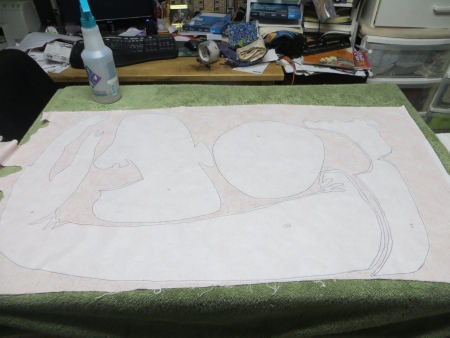
Now that’s two quilts I have that are ready to be cut out (or nearly there). Maybe my goal for Spring Break will be to trace this one I’ve been drawing and then draw the one I need to have done by November, with the assumption that I will work on it over the summer.
Or not. I do know that the mood is better. Drawing AND ironing: the cure for a fucked-up mind. I don’t know what the permanent cure is. Maybe there isn’t one.