42 Hours…

It was good to have a few days, wait, was it even days? It was not…it was good to have…um…42 hours off of work. Seriously. It was. I came home with a nail in my tire, a bunch of wet tent parts, and a tick embedded in my torso (it’s OK…that one is gone and now I’m on antibiotics, purely precautionary. No way was it on me long enough to do anything but an allergic reaction. But the doc thought it was worth treating). I’m tired…we didn’t sleep well either night, from idiotic camp neighbors one night (solved by Ranger Eric, who reminded them of their indoor voices and the camp quiet hours) and the wind the next night as a storm wandered, no blew in. Hence the wet tent parts. But we got the hell out of here, and yes, I’ll pay all week with grading and planning, but I was doing that already. There is no catching up this year. There’s no feeling like you’re on top of things, like you’ve got it all under control. There’s just getting through it.

Let’s see if I can keep that in my mind as I wing it today in one of my classes…the other 5 are planned, but one is a little um not nope planned. Ah well. I have a short prep period before it happens.

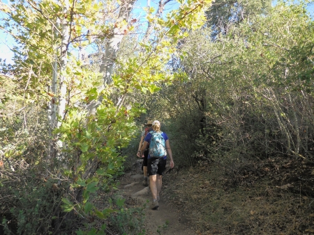
We made it out of the house Friday at 4, but had to deliver stuff and pick up dinner and then the tire pressure light went on, but that’s not when we found the nail. We finally made it to Cuyamaca and Paso Picacho Campground at around 5:30, I think. Not dark yet, but wondering about it. Tent was up in the light still, although it was a bit dodgy. It’s been a while since we put it up.

It was a great campsite, no one on either side, down slope a bit. It would have been more awesome if the people inhabiting three campsites across from us hadn’t been throwing a rave that night, or if the camp host had taken that down. They were pumping music and yelling at sports-attendance levels until after 12:30 in the morning. I was too tired and cold to get out of the sleeping bag to go yell at them, but the man talked to the rangers the next day, and it was handled. They were great the next night, proving that even Trump lovers (ah the T-shirts) understand a man in a uniform telling them to shut the fuck up.

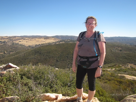
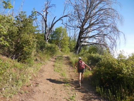
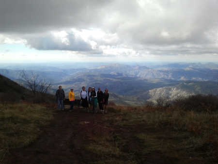
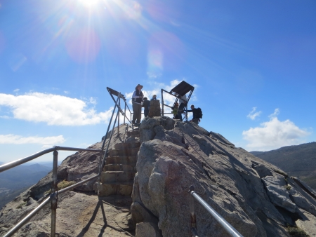
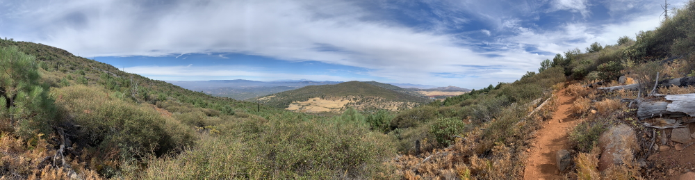
We got up Saturday and headed up to Cuyamaca Peak, at elevation 6512′, the 2nd highest peak in San Diego County. I’ve been up there at least twice before, maybe three times. It’s not an easy hike, but it’s not impossible…

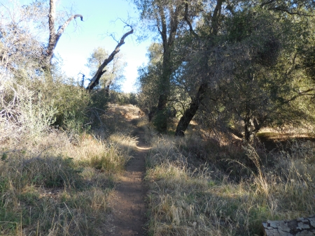
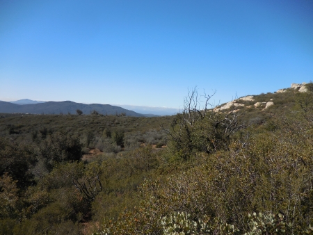
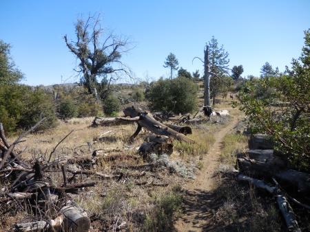
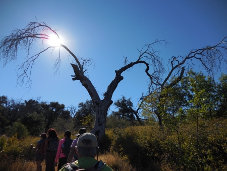
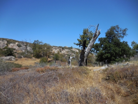
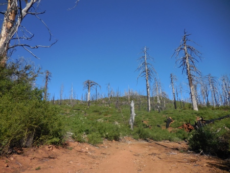
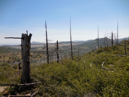
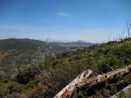
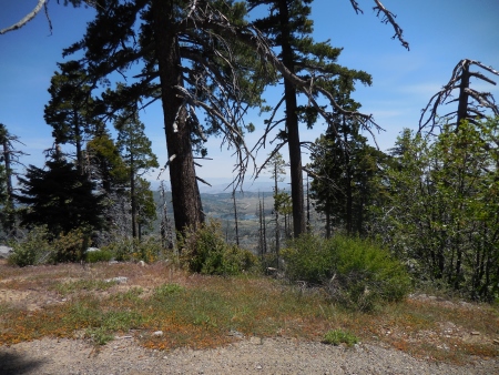
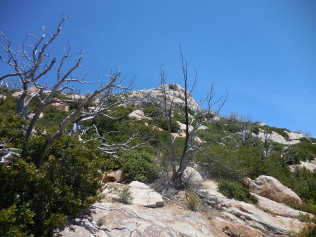
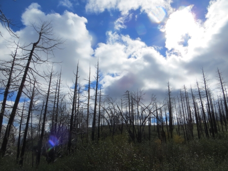
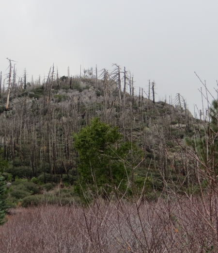
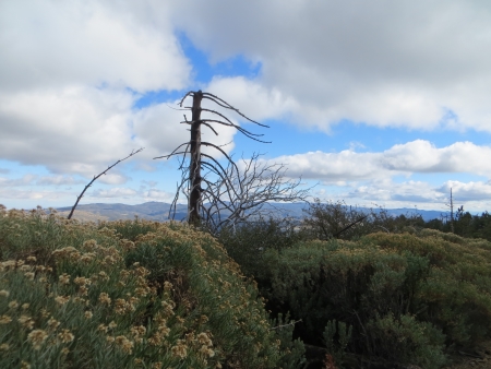
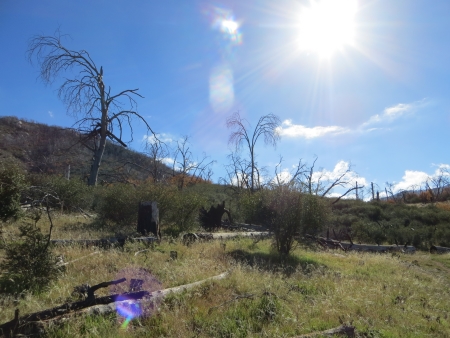
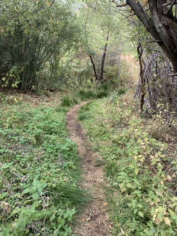
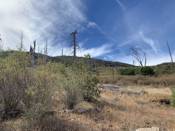
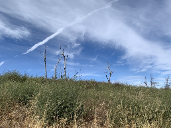
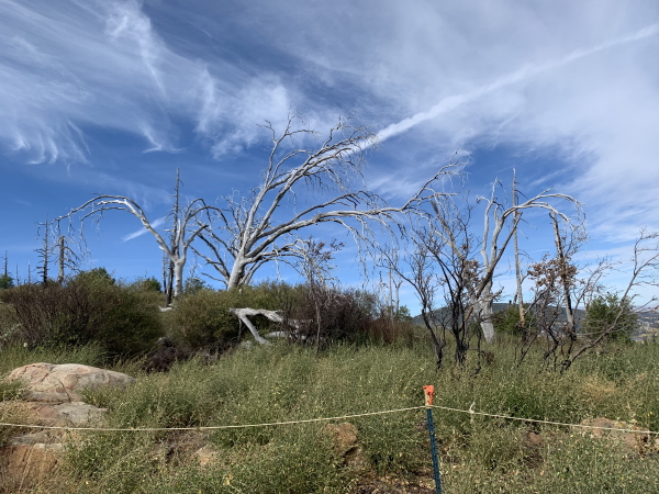
This area was burned some years back. The trees are definitely coming back, in full force, which is nice to see.

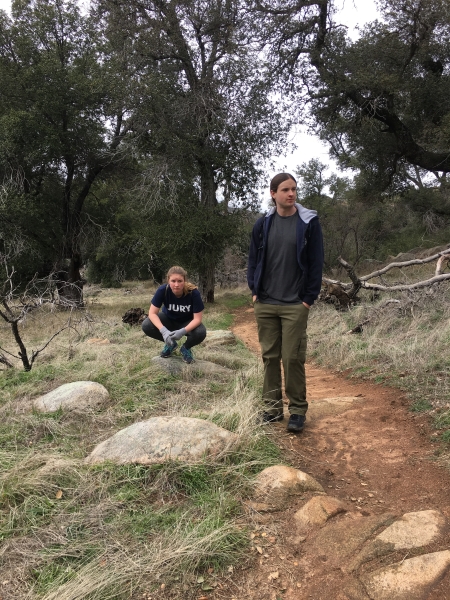
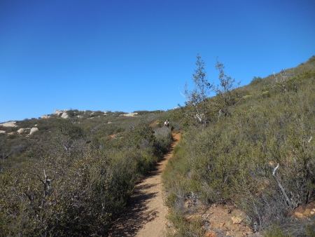
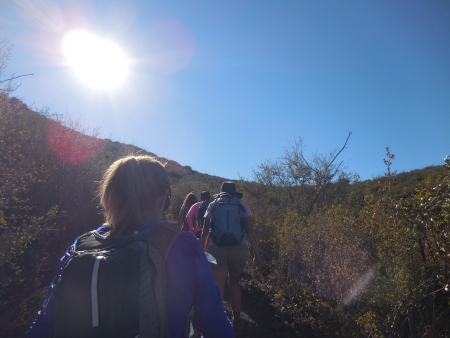
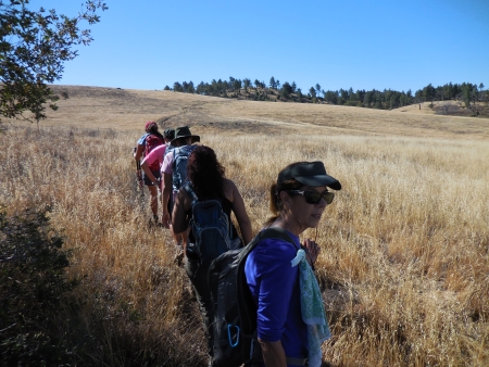
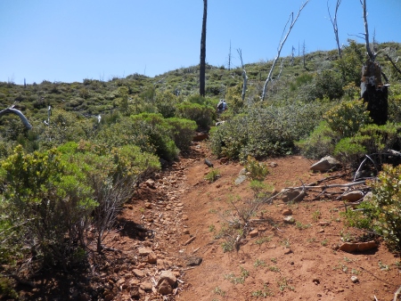
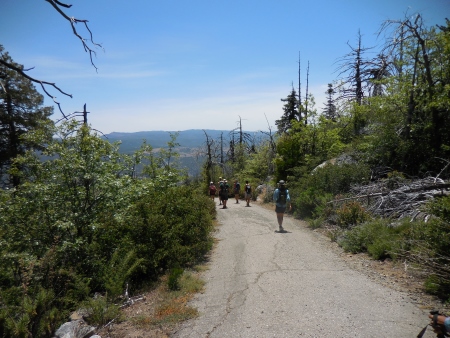
We started from the campground and took the Azalea Glen trail up to Conejos, and then across to the peak. Sounds easy, but it’s a good 5+ miles of climbing to get there.

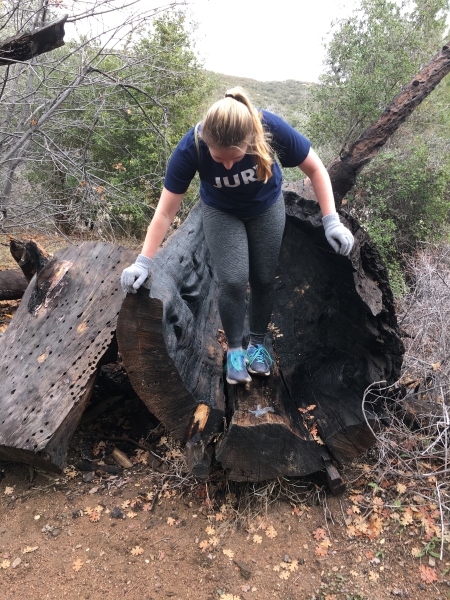
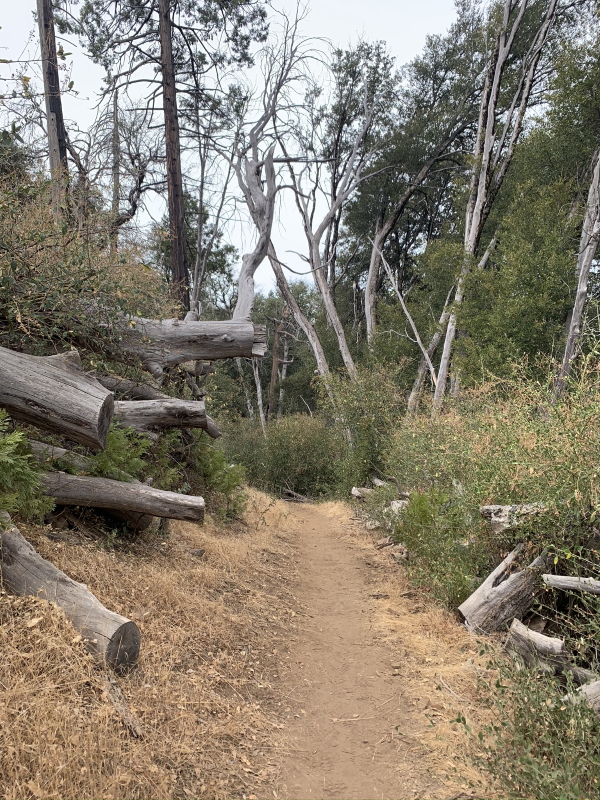
Trees are still dying and falling from the fires, and there are huge sections where the tree parts are just piled by the side of the trail.

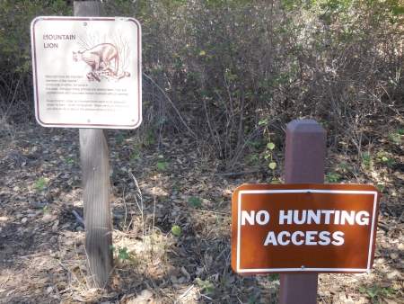
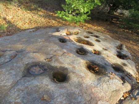
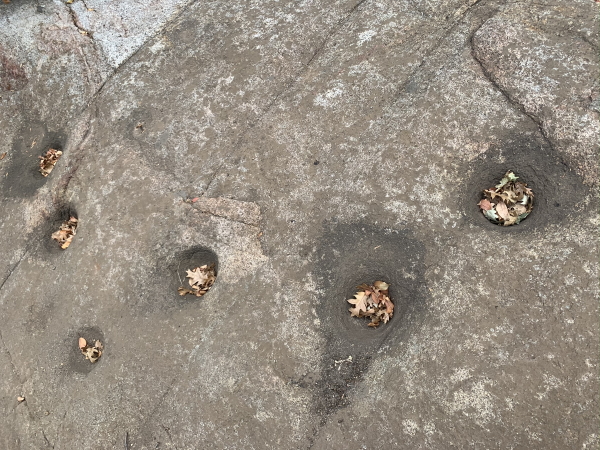
Also, morteros…signs of Native inhabitation in the past…

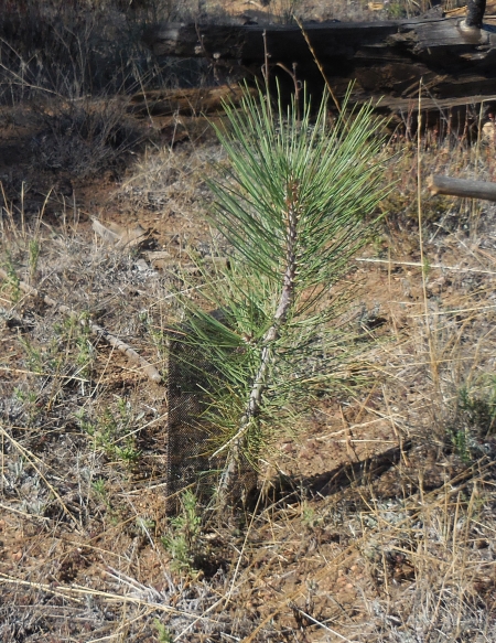
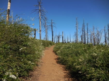
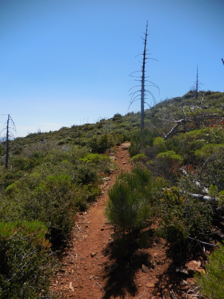
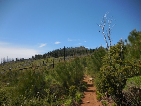
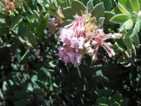
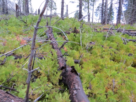
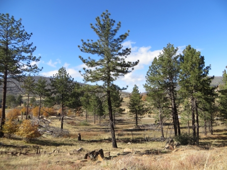
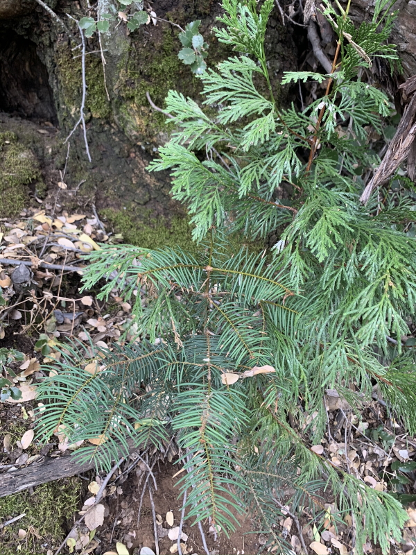
Lots of new trees coming up, of all different types. Not sure what the conifer with the long needles is…

It’s heartening to see the new trees popping up all over…imagining what it will look like in 10, 20, 30 years. A forest again.

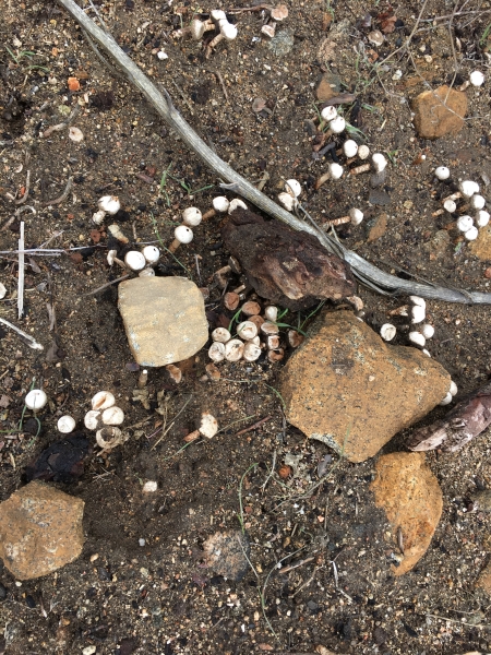
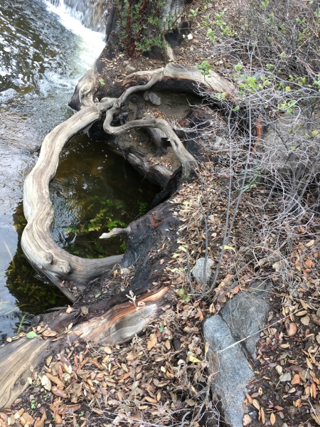
Even the dead trees grow stuff…burnt wood feeding fungus…

It took us a long time to hike it…

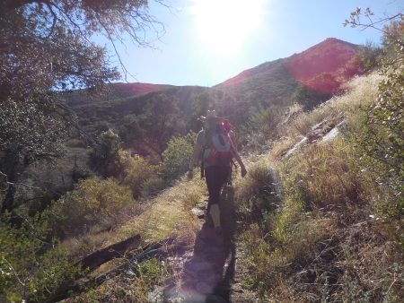
The weather was reasonably cool, a plus, because there wasn’t much shade on the first part.

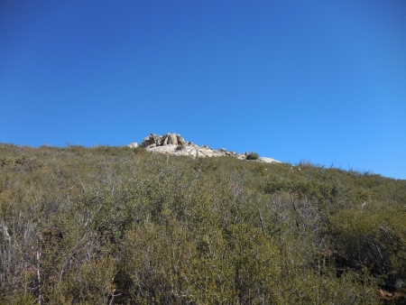
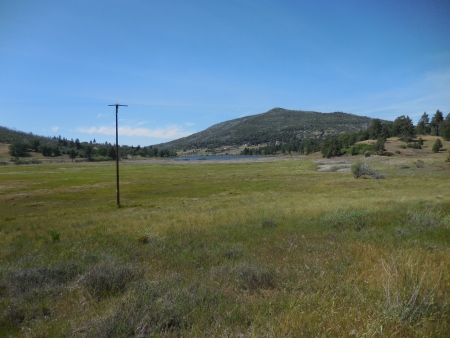
It’s a pretty steady climb. There’s Middle Peak…another way up.

I’ve done that too.

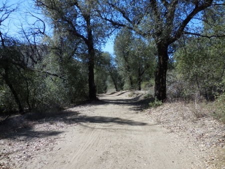
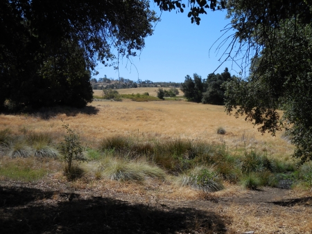
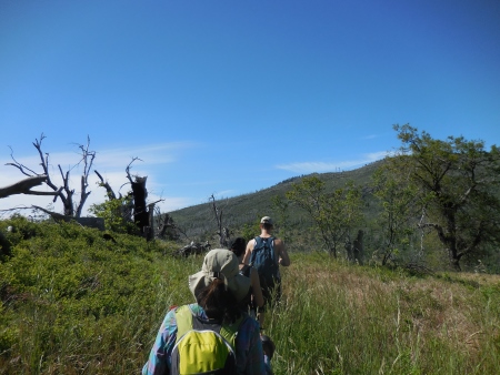
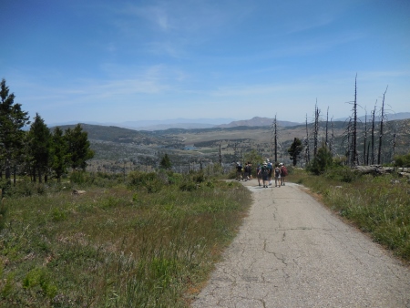
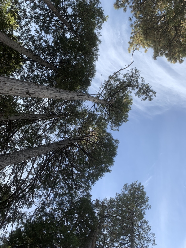
Eventually we got out of the fire-devastated area into some with more trees…
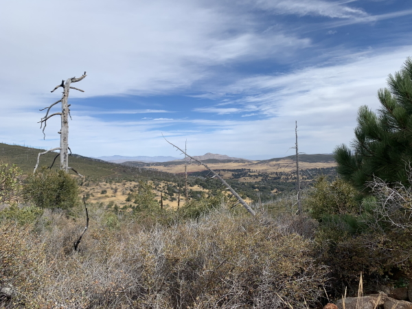
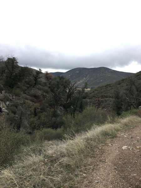
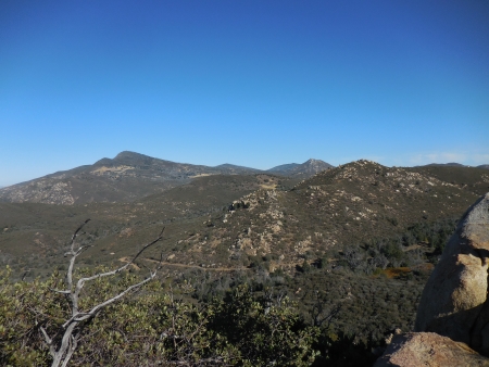
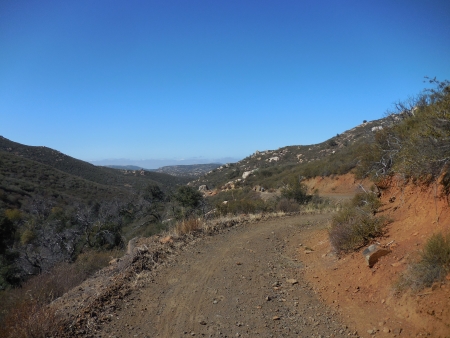
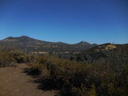
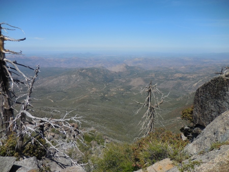
Great views though.

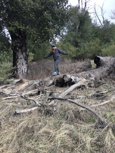
One part of the trail is pretty rocky…slowed us down.

OK, to be honest, we didn’t hike fast. It’s at elevation, we were both tired, and it was long. But we did it. We always do.

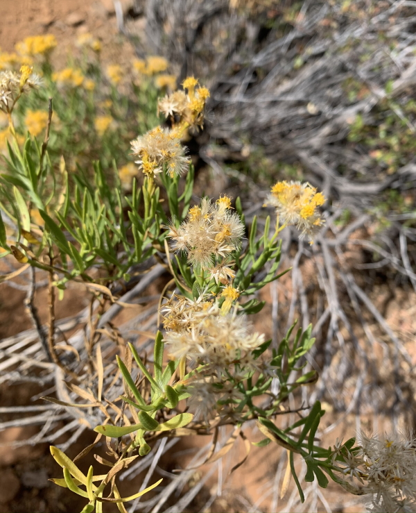
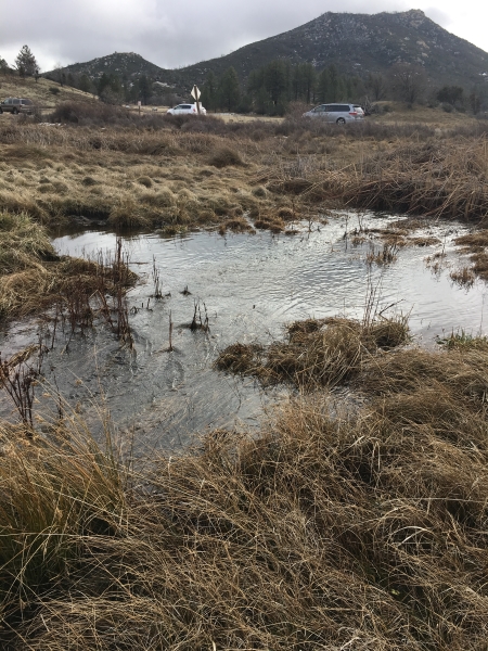
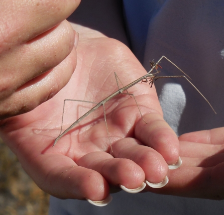
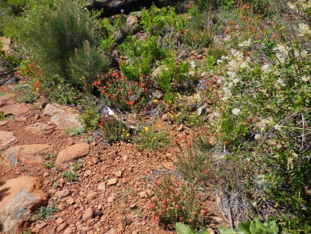
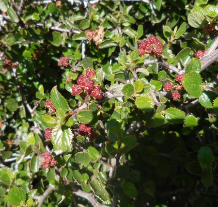
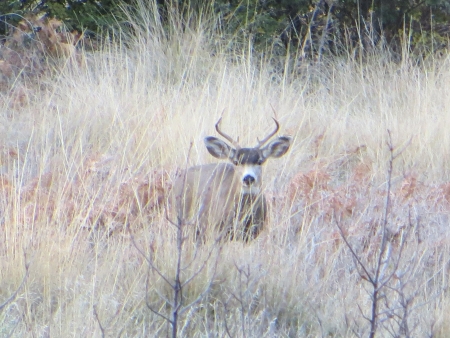
And there are great sights along the way.

Earlier in the week, the man had said we would get up, do this hike, take a break, a nap, whatever, and then do the other peak, Stonewall, across the way.

At some point, I said, nah. I’m gonna do this one and that’s it.

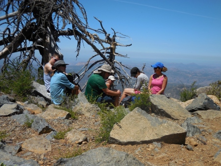
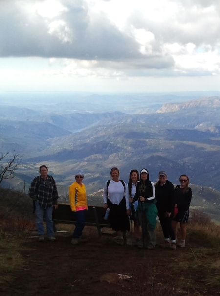
I do love it. I just need a break. At the top…

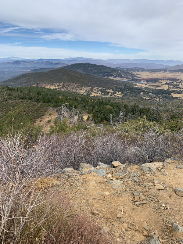
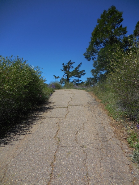
It’s a pretty spectacular view, even when you can’t see to the ocean. The fire road you use to get to the top is steep and evil, but that is often the case.

We get there eventually.

I think our slowest mile was 53 minutes…ouch. Funny, that wasn’t even the last bit up the fire road…it was mile 4. Our fastest was 20 minutes, more our style.

I think I had to put blister bandaids on in mile 4…definitely slowed us down having me redo both shoes. Anyway…we’re not in it for the speed.

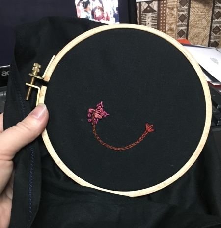
We came back and relaxed. I drew.

We ate, we stared at a campfire on a much quieter night than the one before, went to bed, and the storm started up. I’m not sure if the wind was louder than the neighbors the night before? Certainly it brought rain and then next morning, we packed up pretty quickly and came home. Tent still needs a bath, but we’re waiting for better weather…it’s all laid out in the garage for now.

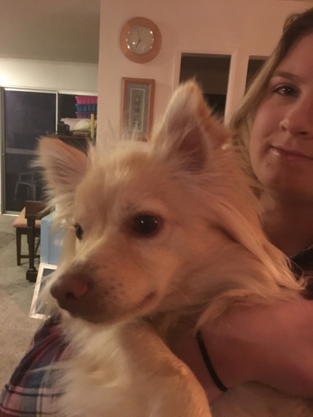
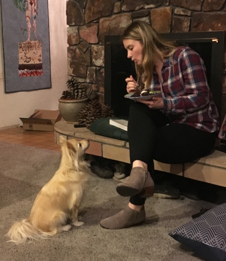
All good things. Cats were glad to see us.
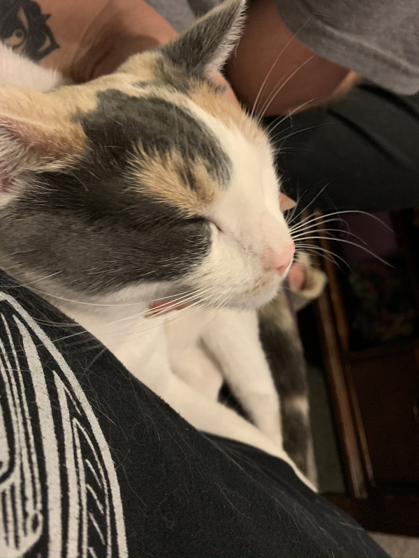
Luna love.

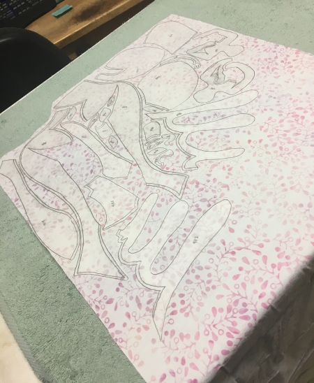
Today I am back to work, school all day, barely planned some of it, made some progress in some places, I need to go do some stuff now. Oh yeah, the tick got pulled, probably attached less than 24 hours, but the doc wanted to be safe…plus I obviously had an allergic reaction to it…nice red ring (no bullseye until day 3, so we’ll be good). So I’m on antibiotics for 10 days just to be sure. Fun stuff. The quilt goes to the photographer today and then I’ll start on the next one. Once I figure out what that is.

Is This a Matter of Worse or of Better*

So on 4 hours of sleep, maybe, I power through today. Seriously. Ugh. Girlchild and friends had an early flight up north (road trip…remember how we used to drive for those?) and I volunteered to be the one up bloody early to drive. Came back and tried to sleep. Yeah. Not so successful. Part of the not sleeping was a panic attack about all the deadlines and school have-tos in the next 3 or 4 months. The other part was a throbbing ankle, which I twisted apparently worse than I thought yesterday. It’s OK…at this point in the day, I’m on the third cup of tea, I have food in me, I’ve showered, the ankle is feeling much better than it was at 4 AM, and I’ve calendared some shit. Written some shit off, because you have to do that. Started meditating regularly again yesterday (well, it’s not regular until I can keep it going)…it’s funny, because I feel like I don’t have the 20 minutes a day to do it, but I think it’s better for me long term if I do it, despite the time crunch. So we’ll see if I can keep that going.

Back to the hike…

So first of all, we were planning on a waterfall hike, Sill Hill, off Middle Peak in Cuyamaca. We got up there and the road was closed to all but residents from mid-December for an unknown time for replanting. OK. Well. So then we looked at our handy-dandy map and picked a trail across the road, one I’d been on part of way back when on a hike of all three peaks (Middle, Cuyamaca, and Stonewall, which you can see in the picture below)…but when we started on the trail, this is what we found. I’m not sure if that’s an over-enthusiastic stream or the trail. But it was wet. And bloody freezing. So we regrouped…

img_1384-small

Maps help for that. We picked something a little further south, not really a trail, but a loop anyway, out Cold Springs or Stream (there are both) Trail and then picking up a few fire roads until we met up with another trail that dropped us back on Cold S-word Trail.

img_1388-small

Cuyamaca will have burn evidence for years to come.

img_1390-small

It was not warm…42 degrees at the start. It threatened rain, but never did. All those layers that we needed at the outset came off and were shoved in packs.

img_1399-small

It was pretty out…

img_1406-small

Even picking up some manzanita and cactus on parts of the trail…

img_1408-small

As well as interesting rock outcroppings…

img_1410-small

There was fungus everywhere, which is wild, because it probably snowed here over Christmas weekend.

img_1413-small

We started analyzing tracks at some point…after we saw the first deer (well, girlchild saw it…most of us just saw deerbutt).

img_1414-small

Crossed one stream…

img_1415-small

Down the fire road next to the stream.

img_1418-small

More deer! Yeah, we didn’t get too close. They moved away.

img_1420-small

And then we started out that fire road across Green Valley towards the road.

img_1424-small

Trees that escaped the burn.

img_1428-small

Trees that didn’t…actually, this one might just be old instead of burned.

img_1430-small

Then somewhere between that last photo and the next one, we heard a noise. A loud noise. And we know now that it was mountain lion. Like close. So the girlchild and I were like, um, let’s get in a group and hike away from it…loudly…and the guys are like, um, no, let’s investigate, so even though it was pretty damn close, they both sort of wandered up to the bushes where the loud roaring growl came from. So now I know they’re insane. We eventually got them to come with us, thus avoiding the 14th California injury due to a mountain lion, or worse, the 7th fatality.

The kids had to wait for us old people quite a few times…I don’t apologize for that…I have old body parts.

img_1433-small

More fungus…

img_1435-small

Beautiful stuff. That’s the first time I’ve heard a mountain lion in the wild. I came home and Googled mountain lion sounds, because they were like, no, that wasn’t a lion, and I was like, um, yeah it was, and I was right. So that was scary.

img_1436-small

Girlchild likes to explore, even when it means walking on a tree branch…over water…

img_1440-small

There was a nice pool in there…

img_1445-small

Burnt-out trees have a similar fascination…

img_1448-small

Way up in the distance is the boychild…I guess he’d decided the mountain lion was no longer tracking us at this point. We were within range of the road by then, so he was probably right.

img_1452-small

It was about 5 1/2 miles, mostly level, about 550 feet of gain. I’m feeling it today, though the ankle is feeling better finally, so that’s good.

I ironed in the afternoon, still trying to get all the flesh ironed down…

img_1455-small

Then we had birthday dinner etc…here’s Simba and his mohawk…

img_1459-small

It’s not very obvious in this photo, but he’s growing additional fluffy bits that make a nice dinohawk.

There was cake, although we decided against 21 candles, for fear of burning the cake down…

img_1464-small

Puppies like cake apparently.

img_1477-small

Here’s my 2nd day of stitching on A Year in Stitches. I just cut a length of some leftover thread from a Sue Spargo bag of bits and pieces (from the last quilt I think?)…and I stitch randomly until it’s done.

img_1481-small

I picked a smaller hoop because the big one was hurting my hands to hold. I have spring hoops somewhere. At some point, I’ll find them…they’re easier to use, I think.

So after last night’s panic attack, I’m trying to get everything done today! No really. I can’t possibly do that. But certainly having a plan helps me. I know Thursday and Friday are pretty trashed this week due to school and some other stuff, so that leaves today and tomorrow! Yeah! OK, so that’s how I start panicking. But getting the ironing done today would be a plus. So that’s the only plan I’ve really made. It helped that I went through some of the deadlines and figured shit out earlier today. There’s only so much I can do…

I should keep that in mind.

*Amanda Palmer, The Bed Song

Hiking Oakzanita Peak

I’m not in the mood to write about anything in my head right now. It’s not a pretty place to be. To banish that shit, I often hike, so here’s the hike from Saturday, which ironically I think put my head where it is now. Well, that and hormones and life and my plumbing. And my house. And money. And school. So yeah. Hiking is really better, even when the after effects are bad.

Oakzanita is in the Cuyamacas, just south of the Stonewall/Cuyamaca Peak area. We were a small group.

highres_422608502 small

The hike is mostly through (shockingly) oaks and manzanita…oaks in the lower section, very wooded, almost chilly at times (I left long sleeves on for a while).

Oct 19 14 005 small

The fires have been through here, although some of the dead trees are just dead for other reasons…

Oct 19 14 009 small

There’s lots of brush, and because it’s fall in Southern California, mostly everything is brown and dead-looking…

Oct 19 14 012 small

Fire…

Oct 19 14 016 small

But this is the California I know and love…the California I missed when I lived in Britain, where everything is so green it’s fluorescent. The drab olive greens of a California fall.

Oct 19 14 019 small

The peak on the right is Oakzanita…funny, it didn’t seem like climbing to get there. It was a pretty easy hike, although my legs were dead from not hiking for a few weeks.

Oct 19 14 020 small

I was sick all week, so that’s what made it a challenge. The weather was gorgeous, high 60s, low 70s.

Oct 19 14 028 small

This is Cuyamaca Peak on the left, Middle Peak just to the right of it, and then Stonewall in the middle back.

Oct 19 14 030 small

Here’s most of us with Stonewall and Middle in the background…

highres_422620302 small

The view to the south, where I’ll be hiking in December…there might be snow by then.

Oct 19 14 033 small

The view to the west, with the marine layer still covering most of San Diego proper.

Oct 19 14 035 small

At this point, we’re up in the manzanita and brush that covers the top of the peak.

Oct 19 14 036 small

That’s what we’re aiming for.

Oct 19 14 037 small

And from the top, sweeping views in all directions. I could live up there.

Oct 19 14 040 small

Lots of boulders line the trail to the top.

Oct 19 14 041 small

The last stand of a dying yucca, still looking at major marine layer to the west.

Oct 19 14 042 small

And the south again…

Oct 19 14 045 small

At the top, we perched on the rocks and ate lunch.

Oct 19 14 046 small

It was perfect weather…not really hot, but just warm enough that you dried off (sweat!).

Oct 19 14 047 small

I don’t get many pictures of myself…but Maritie helped out…this is to the east. Yes, I’m sweaty. I worked to get up there.

highres_423695012 small

The trail back was slightly different…

Oct 19 14 049 small

We headed back on the fire road…

Oct 19 14 064 small

Where there was lots of evidence of actual fire…

Oct 19 14 066 small

The Oakzanita sign…

Oct 19 14 068 small

They planted new trees to replace those that were burned…

Oct 19 14 070 small

The fire road back…

Oct 19 14 078 small

Nicely shaded for part of it…

Oct 19 14 079 small

Hmm. Probably should have checked those warning signs out before we went.

Oct 19 14 082 small

Although I haven’t seen a lion up here for over 10 years (I know…it doesn’t mean they aren’t there). Thanks to Maritie and Watson for the people pictures.

Anyway, it was 7.6 miles, a gorgeous day. It’s my fault I hiked it mostly by myself, which is not really a good thing. It gives my brain too much room to think. But it was beautiful and I enjoyed it despite that silly brain…and hopefully I’ll get past this bump and on to the next hike.

Dyar Springs Hike

I picked last Saturday’s hike because of my knee…it was supposed to be about 5 1/2 miles with very little elevation gain/loss. The knee doesn’t like going downhill at the moment. So we went out to Dyar Springs in the Cuyamacas. I’m always amazed by how many hikes there are out there. I’ve been on so many hikes out there and there are always new ones.

It’s a typical California landscape…

Aug 9 14 002 small

I always imagine native people hundreds of years ago tramping across the landscape and what they would see.

Aug 9 14 003 small

It’s August, so it’s warm even in the mountains…it hit the 80s really quickly.

Aug 9 14 007 small

Some of this area had been hit by the fires over the last 10 or so years…but also bugs have killed some of the trees…

Aug 9 14 010 small

But those rolling, brown, grassy hills are what I see in my mind’s eye when I think of MY California…

Aug 9 14 014 small

With pines in the distance or oaks…

Aug 9 14 015 small

There was wildlife…a California horned toad (aka a horned lizard)…cute little creatures, aren’t they?

Aug 9 14 017 small

And a stick insect…

Aug 9 14 020 small

He had some plant life tangled around his head? Is it a HEAD? We tried to pull it off, but he wasn’t having it. Fought it the whole way. Don’t know that I’ve ever seen one of these in the wild. Belongs on WTF Evolution.

We hiked off trail a bit for some reason. I don’t remember what.

Aug 9 14 021 small

And then back towards the springs.

Aug 9 14 022 small

There wasn’t much in the way of springs…mostly mud. We stopped for lunch here, near these oak trees and rocks.

Aug 9 14 025 small

Those old California oaks are part of my sense of home too…

Aug 9 14 026 small

There weren’t a lot of flowers around this late in the season…

Aug 9 14 027 small

And some of the trees looked a little worse for wear…

Aug 9 14 028 small

Hard to know if they’re still alive sometimes, especially at this time of year…

Aug 9 14 029 small

This was the view back the way we’d come…

Aug 9 14 031 small

And here’s where we set up our potluck picnic…

Aug 9 14 032 small

Lots of good food and debating how many calories we’d burned so far and how many more we’d have to burn after eating everything that was laid out for us.

dyar small

The path back was that typical mix of grass and trees…

Aug 9 14 033 small

Mountains in the distance…I think that’s Stonewall Peak to the left.

Aug 9 14 034 small

More dead trees from the fires…

Aug 9 14 036 small

Some monuments to the destruction that keeps this area alive.

Aug 9 14 037 small

And then? Strangely? A patch of watermelons. No water to be seen around. No reason for them to be there…WAIT! My loyal reader Julie (who is a bit of a native plant expert, certainly more than I am) tells me this is calabazilla (which is the funnest name around), aka buffalo gourd or more interestingly stinking gourd (glad we didn’t figure out why). It has a great Latin name, for sure: Cucurbita foetidissima. I’m always looking for the word foetid involved with food.

Aug 9 14 038 small

We kept hiking…

Aug 9 14 040 small

It was good. It was peaceful. It was 7 3/4 miles instead of 5 1/2. Oh well. And there was dirt and mud and I sunburnt the BACKS of my knees (nope, didn’t even think to sunscreen those). And my knee hurt briefly…but that’s it. Good.

Three Peaks in Cuyamaca

Two weeks ago, I signed up for a hike I didn’t think I could finish. I had done 12.5 miles the week before, and it felt like my limit. I was significantly tired the next day, and sore too…so when I signed up for the three peaks hike (Middle, Cuyamaca, and Stonewall), I figured I would just skip the last one…the leader had set the hike up so we didn’t have to do all three.

I mapped the hike out using Map My Hike, but it did add some mileage to it…so it’s probably not exact. The leader had it at 14.4 miles, and this one is over 15…

3 peaks hike

We started at the parking spot near Milk Ranch Road, heading up the switchbacks on the fire road to Middle Peak. From the parking area, here’s Stonewall Peak…

May 18 14 001 small

And Cuyamaca in the distance…

May 18 14 002 small

Here’s the fire road…it was a warm day…

May 18 14 003 small

There were some flowers I hadn’t seen on previous hikes…

May 18 14 004 small

Middle Peak used to be covered with big trees, but the Cedar Fire in 2003 swept through this area in a pretty devastating way. Lots of undergrowth is coming back, but most of the trees are dead…

May 18 14 005 small

It wasn’t an easy climb, and this group hiked really fast…

May 18 14 006 small

Here’s Stonewall again from higher up the peak…you can just see our cars parked in the turn in the road.

May 18 14 007 small

And Stonewall again, through the burned trees. There was a good breeze all day, which was good…

May 18 14 009 small

More flowers…there were LOTS of these.

May 18 14 010 small

And dead trees…

May 18 14 011 small

A big fire road…

May 18 14 012 small

You can imagine what this might have looked like when the trees were alive. I actually hiked this area the weekend before the Cedar Fire, and then went back about two weeks after the fires…it was hard to see.

May 18 14 013 small

And yet, the dead trees have a fascinating presence…stark though it might be.

May 18 14 014 small

This is looking off towards Stonewall again, but closer to the top of Middle Peak.

May 18 14 015 small

There is no actual trail to this peak…you can bushwhack it if you like…

May 18 14 017 small

More flowers…they flourish in the full sun without trees shading them.

May 18 14 018 small

We reached the highest point of the trail, and then headed around the western side of Middle Peak…

May 18 14 019 small

This is the view to the west, which wouldn’t have been visible prior to October 2003…

May 18 14 022 small

Another view…

May 18 14 024 small

We headed south towards Cuyamaca Peak, following the Conejo Trail for most of it…

May 18 14 026 small

This is looking toward the east…

May 18 14 034 small

The trail was rocky now, and sometimes there were trees (some significantly large ones) over the trail…

May 18 14 035 small

But new trees were growing by the trail…

May 18 14 037 small

Not sure what direction this is…maybe north?

May 18 14 038 small

The wildflowers were everywhere on this section of trail, truly beautiful riotous color…

May 18 14 039 small

And long vistas of blue sky…

May 18 14 041 small

Even more pine trees lining the trail, close enough that you had to edge through them at times…makes you wonder what will happen to the trail as they get bigger…

May 18 14 042 small

It’s nice to see them growing…

May 18 14 043 small

This is the view of the slope looking north…once covered with trees…

May 18 14 045 small

Some berries?

May 18 14 047 small

This is one of the smaller trees I climbed over…some required assistance, but this one was on my own…it attacked my pants…had to sew that hole up…

May 18 14 049 small

Pretty flowers…

May 18 14 051 small

This was where the Conejo Trail meets the Cuyamaca Peak fire road to the peak itself.

May 18 14 054 small

Looking up the fire road…

May 18 14 055 small

There are still some trees alive on Cuyamaca…

May 18 14 056 small

Here we are at the top of Cuyamaca Peak, at 6512′, the second tallest peak in San Diego County.

May 18 14 057 small

I was last here in November, with snow…

May 18 14 058 small

We sat and ate lunch and communed with the iridescent green beatles…

May 18 14 060 small

This was over where the antennas are…looks like they’re building new ones.

iPhone May 26 14 022 small

Flowers and butterflies live at the top…

May 18 14 062 small

We then took the fire road down…

May 18 14 063 small

Down, down, down…

May 18 14 064 small

There’s Stonewall in the distance…the third peak on our challenge…

May 18 14 065 small

Still lots of dead trees…

May 18 14 068 small

So we got to the Paso Picacho Campground at the base of Cuyamaca and Stonewall peaks, and we rested a bit (bathrooms! with black widows!)…and it was then I had to make a decision about the last peak. Hell. I was still moving. It was hot…but it seemed lame to stop there. Some people wanted a longer rest, but I just wanted to get UP the last peak…so a few of us headed out…below you can see Cuyamaca Peak from the trail going up Stonewall, with Paso Picacho down across the road.

May 18 14 071 small

There’s Stonewall from below…

May 18 14 072 small

The hardest parts were tired legs and the heat…it was about 85 degrees at this point. I needed almost all of my 3 liters on this hike.

May 18 14 074 small

This is the view to the south…you can see the highway on the right side…

May 18 14 075 small

More dead trees…these creaked in the wind.

May 18 14 076 small

This trail is really hot and dry.

May 18 14 077 small

But beautiful flowers lined the trail…I last hiked this one in November as well…

May 18 14 078 small

Here’s Cuyamaca from the west trail on Stonewall…

May 18 14 079 small

And here’s Middle from Stonewall…

May 18 14 080 small

And there’s the peak I’m heading for…

May 18 14 081 small

These trees creaked in a very scary way…

May 18 14 083 small

Trees hung over the trail even up here…

May 18 14 087 small

Here’s the view from the top…there are steps going up to the peak and info maps up there to show you what you’re looking at…

iPhone May 26 14 023 small

I didn’t take a lot of pictures on the way down…we went down the back way and across some meadows with trails that were barely clear…pulling foxtails out of our shoes and socks became a regular stopping point…

May 18 14 092 small

At some point on a hike this long you are just trying to get done…although the meadows were very pretty…

May 18 14 094 small

That’s the Trout Pond in the distance (notice the electrical poles…must be approaching “civilization”…

May 18 14 096 small


It was a long tiring hike. It was a challenge, though, and it felt good finishing the whole thing. I think it took about 7 hours total…we stopped for maybe 40 minutes total…once at the top of Cuyamaca, once in the campground, and once at the top of Stonewall. No ticks, no blisters…just sore muscles and tired body. Definitely worth the trip.

Cuyamaca Peak

Sunday was supposed to be a 6 1/2-mile hike…until it mutated into a 10-mile experience…it was totally worth the muscles that are still sore two days later. We started across the street from last week’s hike. The easy way up to Cuyamaca Peak is up the fire road…but that’s always the boring way…so we started out through Azalea Glen on a trail that was apparently probably closed (whoops). Signage was confusing.

Nov 24 13 013 small

For some reason, I don’t have many pictures from the first part of the hike…probably had something to do with the 1700-foot-plus elevation gain. Here’s near the peak…small people, awesome view…

SAMSUNG

And a closeup on the people…yes some were in shorts.

SAMSUNG

They didn’t stick around for the extended dance mix at the end (goosebumps).

You can just see the radio towers at the very top.

Nov 24 13 026 small

This is at the very top…

Nov 24 13 043 small

We took a few detours on the way down for the sake of “pretty” (the extended dance mix) and saw these large pine cones…there were at least 3 varieties of pine cone…

Nov 24 13 056 small

This is still fire territory, but it’s great to see the dead burned trees with all new growth surrounding them…

Nov 24 13 063 small

In fact, a lot of this trail, ironically called Burnt Pine, was seriously overgrown. We had to climb over some trees that had fallen while fighting thorny bushes.

All that green is new trees.

Nov 24 13 100 small

This is the view towards Cuyamaca Lake, coming down the fire road.

Nov 24 13 108 small

Then we detoured on another road past the creek, where we saw multiple deer…this guy kept an eye on us as his peeps ran through the meadow.

Nov 24 13 116 small

This is Stonewall Peak from the valley below, last week’s hike.

Nov 24 13 128 small

Poop. What else can I say?

Nov 24 13 129 small

These are morteros near Paso Picacho.

Nov 24 13 131 small

The sun is going down as we get near the end, illegal paths, all blocked. We end up just picking what we think is a trail that will get us back, ignoring the signs. Bad hiking etiquette, but we couldn’t find a pattern to the signs or a reason for their existence.

Nov 24 13 143 small

10 miles, 5 hours. The peak was at 6512′. Tired? Yeah. Good hike? Yeah. It’ll be a while until the next one unfortunately. Life conspires against me.

Hiking and the Brain

I went to sleep early last night because I knew I was going on a hike today. I shouldn’t have wasted my energy. My overactive depressoid brain woke me up two hours early and then fussed over stupid shit and wouldn’t allow me to go back to sleep. And just so you know, putting your pillow over your head works for blocking light and the noise of cats licking their nether regions, but it doesn’t do shit for shutting up an overly active brain. It’s like having a 2-year-old in the house. They don’t know it’s the one morning in the week when you can sleep in. They just know it’s morning and they’re bored.

Stupid brain. Maybe I should just take sleep off my wish list. I hope for 6+ hours a night. I rarely get it. Not by choice.

Anyway, I got all my hiking stuff ready and headed out for the meeting spot…we drove out to Cuyamaca Rancho State Park to climb Stonewall Peak…

Nov 17 13 002 small

I’ve climbed this one before, at least once, maybe twice…right after the divorce, I hiked a lot with the Sierra Club local singles group. I was young then…no really, I was. This hike today was with a local women’s hiking group.

The weather was cool, but not freezing, and the day was beautiful, blue skies and bright autumnal weather.

Nov 17 13 011 small

Great views…sometimes the weather conspires against, especially this time of year, but today was perfect.

There is an 850-foot elevation gain from the parking lot to the top…

Nov 17 13 014 small

It took us an hour to do the first 2 miles…we weren’t walking super fast, but not slow either…

SAMSUNG

We weren’t even halfway through the hike at this point, but we stopped and ate, and then headed down for the back half of the trail…

Nov 17 13 013 small

Instead of going back the way we came, we went down the northern end of the peak…

Nov 17 13 015 small

Which was gorgeous, despite being full of trees that had burned in the Cedar Fire of 2003, which raged through this area…in fact, I hiked another peak in this area the week before, and then three weeks after, went through (illegally…because fires were still burning inside the trunks of some of the oak trees) and was devastated by the loss of the big oaks. I have pictures somewhere of before and after. So walking through a valley like this is a little like walking through a graveyard…

Nov 17 13 031 small

A beautiful graveyard…and then you notice these little guys…

Nov 17 13 026 small

Tiny little trees shaded and protected, growing…and you see some that were burned halfway up the trunk, but survived and seem to be thriving.

Nov 17 13 028 small

And at some point, the brain stops remembering all the stupid shit that woke you up before 6 AM and it’s just staring at the trees and the path and the oak leaves that had fallen on the ground and the patterns in the rings of the trees that had been cut to clear the trail post-fire. And the clouds in the sky and the smell of the skunkweed and the burnt log that looked like a bear and the taste of the sandwich and the sight of an expansive view. And the brain stops being such a fucking 2-year-old and starts to resemble Kathy again.

Some of the trees look dead but have new branches coming up from the trunks, surrounding the old, dead wood.

Nov 17 13 035 small

And some parts just seem completely untouched by disaster.

Nov 17 13 044 small

It’s a beautiful area, no matter what. Charcoal and all. Five miles, a little less than three hours. My brain left all the stupid behind and I communed with nature and a few humans. If I could do that and draw every day, I’d probably be almost human pretty damn quickly.

Not really a plan I can stick to at the moment…but I can certainly try to add a few hikes a month to my therapeutic plan.

I came home and rushed through school stuff and grocery shopping and we went out to dinner with mom, because dad was still in an airport in Texas…managed meditation and cutting out of Wonder Under. Midnight approves of the newly cleaned-off table (OK, I did not get everything cleared off, but quite a bit of it, plus I washed the table runner that she loves to deposit her hair on, so that’s a plus).

Nov 17 13 058 small

Meditation talked about communing with our own minds as being helpful with knowing what’s in the minds of others. I’m usually pretty good at that, although the few times I’ve been slammed by NOT knowing were particularly devastating. Mr. Meditation talked about Being There for the experience…I did that successfully this weekend, I think…mostly. I just need to translate it into my whole life, and maybe kick my brain back into a mode where sadness doesn’t overwhelm me. I had my moments today, trust me. I felt it in the post-hike exhaustion in the car…my brain crept back in and was trying to drag me down. In the grocery store. On the phone with a friend. It’s a relentless beast. But he says that I can better understand where people are coming from, empathize with them…he talked about most people conceptualizing, thinking about how they THOUGHT someone would feel, instead of KNOWING how they feel, and how this practice helps with that. I got caught in that this year…someone assuming they knew what I was thinking and feeling, and actually ignoring what I was saying and all the evidence that was there to make assumptions about what I thought and what I would do. I hate that. I do have a pretty good sense of what I think and feel, and I’m pretty good at saying it. I appreciate those who respect me enough to actually have the conversation with me before assuming they know what I would do. I had a couple really respectful, human, responsible, and mature conversations today…and it reminded me that is how they should all go…not behind my back, talking to other people, guessing at what I think. Fucking ask me, man. I’ll tell you. And you don’t have to agree with me, but if we’re talking about MY mind and how it works, I hate to tell you, I know better than any other person on the planet.

I did an hour of cutting…

Nov 17 13 059 small

Look any different? Fuck no. It will. Maybe.

I’m exhausted…physically, emotionally, whatever. I’m going to bed early again. If my brain really loves me, it will let me sleep.