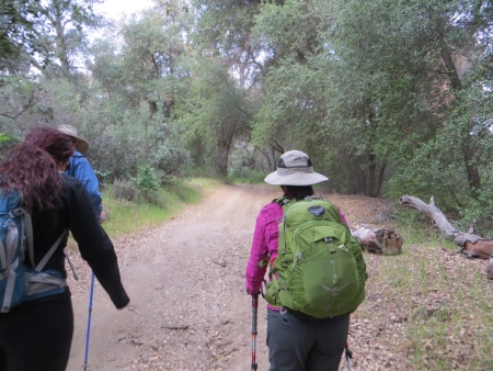
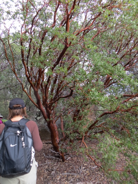
Saturday I hiked Corte Madera Mountain, otherwise known as San Diego’s Half Dome…when we started in the morning, it was foggy, cold, and damp. Here we are at the trailhead (thanks to Keith and Maritie for their group photos)…

The trail starts out on a nice, oak-shaded, fairly wide road. You do need an Adventure Pass to park out on the road for this hike.
From there, the trail opens up into a bushy valley. To the west, we could have seen Los Pinos (if it wasn’t foggy)…we originally had a plan to climb that as well…

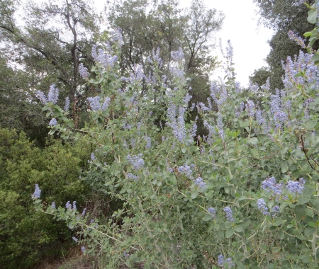
The wildflowers were blooming…
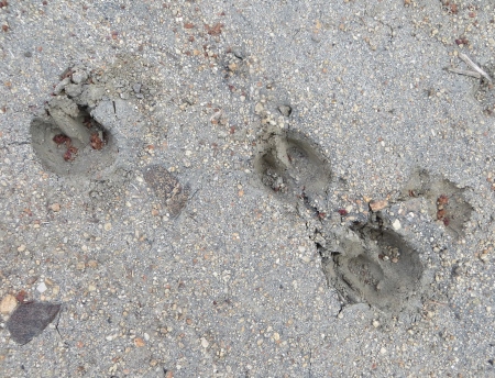
The deer (and some other pawed animal) had been on the trail before us…
The sky looked a bit gloomy, but it didn’t rain. This part of the trail, which really looks like a creek bed, was fairly easy to walk…a few small climbs, but not hard…until the last little bit up to the other road (I’m sure it has a name; haven’t got a clue what it is…wait, there’s this thing called the INTERNET…Ah…it’s Los Pinos Road, and yes, it’s actually a road.), which is on the saddle between Corte Madera and Los Pinos. This part was a bit steep at times.
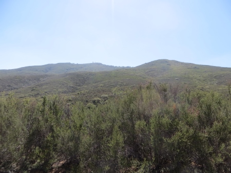
Here we are on the saddle with Corte Madera hidden in the clouds.

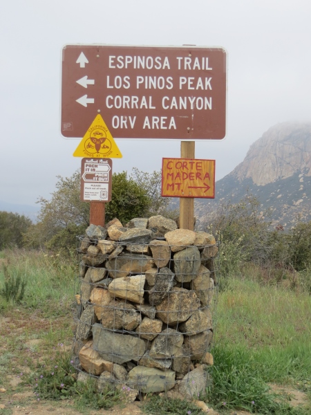
There’s a sign there that marks out all the trails, some more officially than others.
This is about the only wildflower picture I took on purpose…

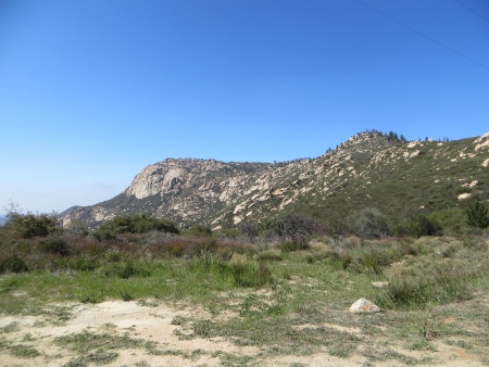
Here we are with Corte Madera in the distance…despite the fog, it’s starting to warm up (or we are starting to warm up because of the hiking)…

From the saddle, we took the road towards Corte Madera…apparently cars/off-road vehicles do drive this, but we didn’t see any of them.

From that road, here’s the path up to Los Pinos (which you can’t actually see, because it’s in a cloud). We did not do that hike, by the way…by the time we got back to the saddle, lots of time (and energy) had passed and there was a unanimous vote NOT to deal with this peak on this trip.
There is then a small, unmarked trail that has this raptor sign at the head…this is the one that goes up to Corte Madera. This time of year, the birds are mating and laying eggs, so there are rules about where to hike and not hike, although it was fairly difficult once we were up there to figure out where that actually was…more about that later…

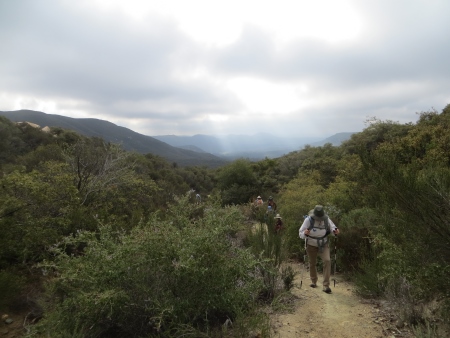
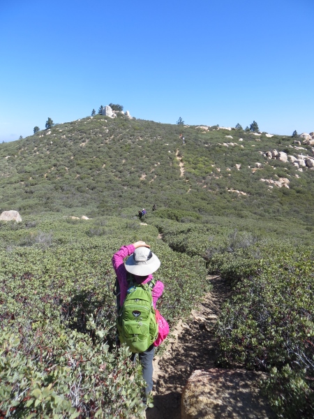
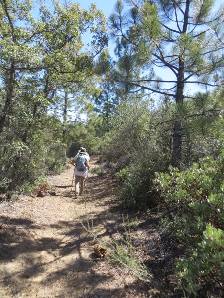
At this point, the trail got narrow and sometimes climby…

The views were gorgeous though…
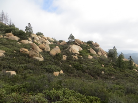
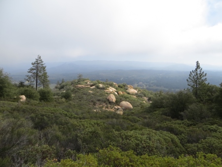
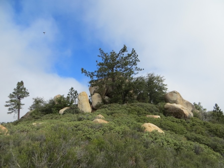
Lots of boulders and pine trees and tromping through manzanita that was waist- to shoulder-high. It was still cloudy/foggy at this point.
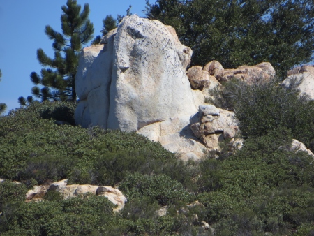
These two rocks had space between them…I have a later view of them from below.
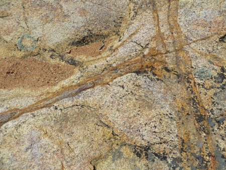
Many of the rocks were colorful.

As was the manzanita…
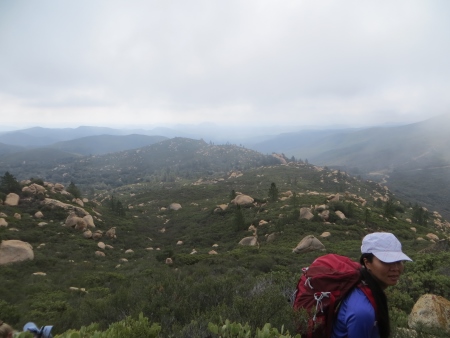
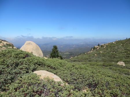
Beautiful vistas stretching for miles…
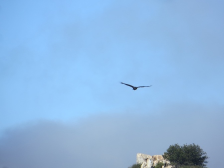
You can see a raptor flying in the blue sky that is now peeking through the clouds…
We stopped around here for a snack break…with a view of Corte Madera in the background.

More raptors…I think this was a turkey vulture, actually.
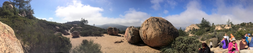
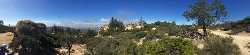
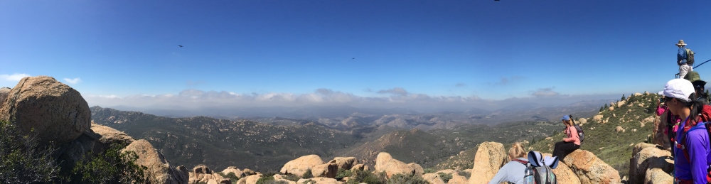
I took a panorama shot here of the group eating and resting…
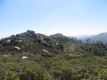
This is one of the hills on top of the long stretch towards Corte Madera…
The top was fairly flat, a narrow trail, but you could see forever on both sides…

This is looking back at the group coming down the trail on the other side…this was the only bit where we had to climb on the top at all.
This is to the north…toward Cuyamaca…
I think this is where I took the next panorama shot…
There were lots of stacked-rock cairns marking the trail.

Can you see the face in this rock?
Nose, eye, big chin?
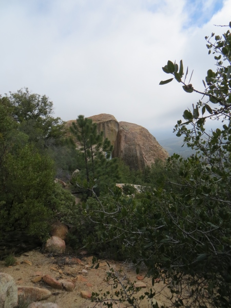
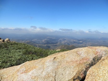
This is at the top of Corte Madera, where the can is. We weren’t sure, due to conflicting maps, whether this was where we shouldn’t be, in order to protect the birds nesting, but we did a silent hike for this whole section, no noise, no talking, just in case. This is the view to the northwest…you can see all the clouds are finally clearing out.
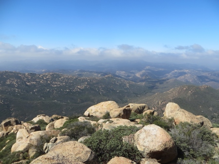
I think this is more to the west, but I’m not positive!
We all sat and admired the view, and took lots of photos. It was very peaceful being up there, even with so many people, because we were all still silent.

There’s something to be said for hiking like that sometimes. This was taken up at the top…
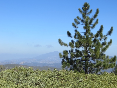
This is Cuyamaca Peak in the distance (hiked it in November)…
And the group shot at the top, looking north…

On the way back, we were waiting for the other group to catch up with us…this is the valley between the two sorta peaks up there. The bushes are about waist high.

These are the two trees we had used as markers to remind us to take another trail down, instead of returning the way we came. So here, instead of going back south, we headed off to the northeast, through bushes that were often head height and very close together…

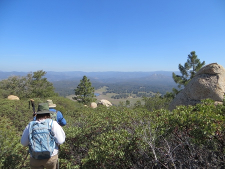
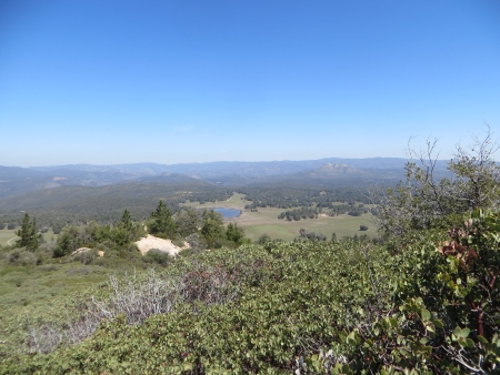
There’s a view of the Corte Madera valley and pond to the east…
The bushes are closing in! One person found a tick on their body. Many people ended up scratched from this section. We put on long sleeves and long pants for a reason…

On the far end of the long ridge, there were some rocks with iron inclusions…very pretty…
It turned out it was one of the leader’s birthdays next week, so we all brought potluck snacks for lunch and surprised him. Someone brought party favors for a goofy picture at the top. There was even cake (sort of) and candles (that kept blowing out). It was a nice birthday surprise…
Then we set off, way too full, down the back side of the mountain…there’s that pond again.
The path was difficult at times, but also there was a lot of wandering through areas like this, and one oak-covered area that was quite nice and shady.
Here’s those two rocks from below…

Lots of boulders and a wide trail at this point…

And a water barrel…that had holes in it and a bathtub at the front.
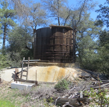
Yup. How often can you get in a bathtub with 11 other people? Not often enough apparently…

At this point, we were pretty tired…and then we realized something…we were on the wrong side of this fence…
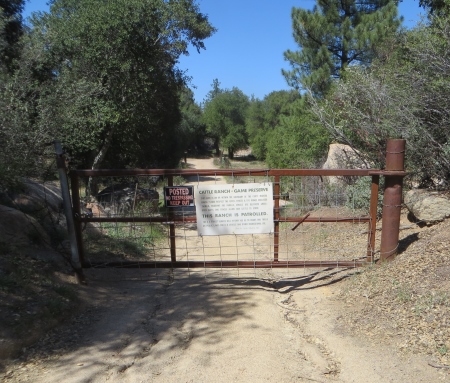
Yeah. This one.
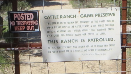
For the record, we never saw such a sign on the other side of our trail, and we didn’t see any patrols, but we did have to crawl through barbed wire to get out. So maybe that wasn’t the best choice for coming down the mountain.
So this is us curving back around the eastern side of the Corte Madera area, heading back to the saddle between Corte Madera and Los Pinos…because that’s Los Pinos (not in the fog now) in the distance…

And back at the saddle, there’s Corte Madera in the bright sunshine…

And we looked back at everything we’d spent all morning climbing over…
Then went back down into the creek bed, with Los Pinos rising over us to the west…
Back through the shady oaks towards the cars…

This was a gorgeous hike, not super strenuous, didn’t need poles (though many had them). The various GPS devices said this was 8.6 miles (which includes our backwards descent into somewhere we shouldn’t have been) with about 4.5 hours of hiking time (that doesn’t count all our stops for photos and food). It took us longer than we thought it would, but I think that was the fault of the potluck more than anything else, plus a meandering trail at the end that we had never hiked before. What’s interesting is that I think I hiked this back in 2003 when I was hiking regularly…but it was about 90 degrees that day and I got mild heat stroke. Today was wonderful…started out chilly and got a little warm in the end, but the transition from foggy and cloudy to bright-blue sunny skies was definitely a plus.
You can drive up the road to where the raptor sign was and shorten your hike, which might make it very doable for families, although there’s still some scrambling and some issues with the raptor nesting dates, but otherwise, a drop-dead beautiful trail. You can access the trail off of Buckman Springs (off Interstate 8). This website gives fairly clear directions (I obviously don’t write posts to get people TO the hikes…that’s what the internet is for). He also has a bunch of other San Diego hikes at different levels of difficulty with lots of great photography.

Thanks for the shout out to my web site Ihikesandiego.com. I’ve only done this hike once with a group but we all remember it fondly and also want to go back and give Los Pinos a try as well. Good luck with all your future hiking endeavors.
See you on the trail
Brad
LikeLike