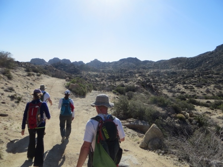
Last weekend, I went on a hike in the The Valley of the Moon, which is about an hour east of Lakeside off of Interstate 8. The parking lot is a lonely beast right off the freeway.

There’s a “road,” if you can call it that, going up and down into the valley. It’s dirt, then gravel, then some weird concrete texturized stuff. The road is fairly awful.

We hiked up it anyway; it wasn’t particularly easy or pretty.
In the distance is an ex-volcano that blew its top a good long time ago.
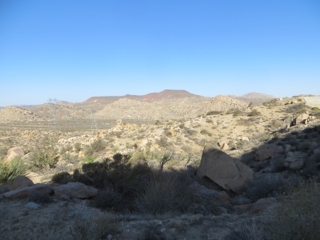
The geology of the area is awesomely cool…lots of weird veins of stuff and sparkly mica with rock that cooled awfully quickly and still looks liquid.

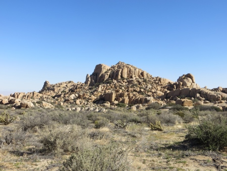
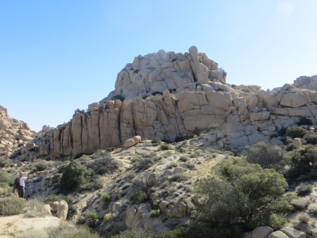
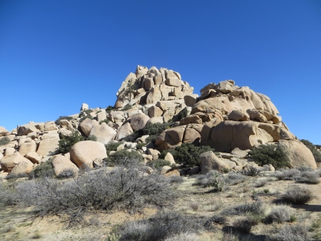
Once you get yourself up and over the first hills, you come down into the Valley of the Moon, which is all remnants of volcanic activity mixed with wind erosion.
The valley is surrounded by rock formations…those big granite rocks were originally formed underground, pushed upwards, fractured under the pressure, and the covering sediment eroded away.
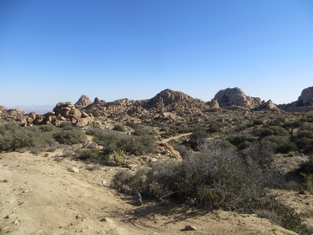
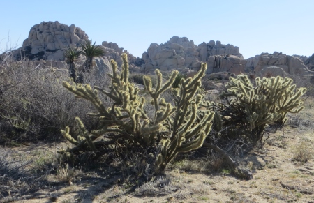
There’s plenty of desert plant life, from chollas to yucca.
This valley is nicknamed San Diego’s little Joshua Tree, as the rock formations are similar. It’s very close to the Mexican border, and is cooler than the desert below. El Cajon was in the 90s on Sunday, and I was worried about the hike at that temperature, but it was in the high 70s with a breeze, which was fairly perfect…
Enough to make you sweat but not be miserable. In about 6 weeks, it will be too warm to hike there comfortably.
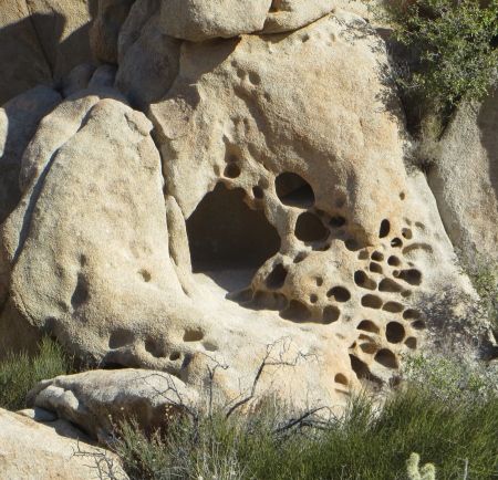
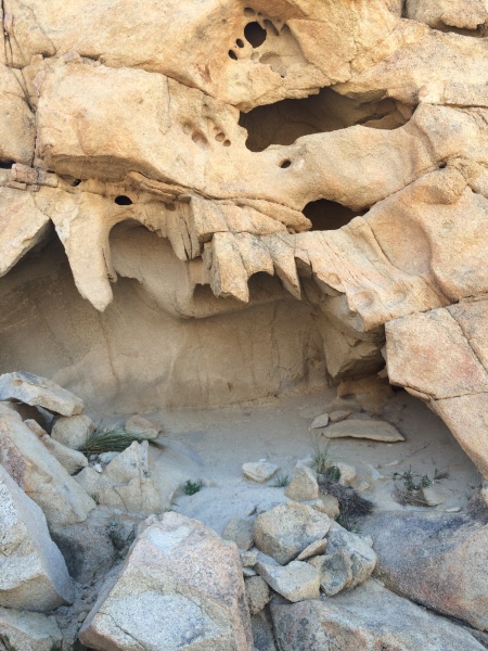
These strange holes look like animal caves, but are probably formed by wind erosion.
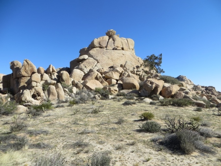
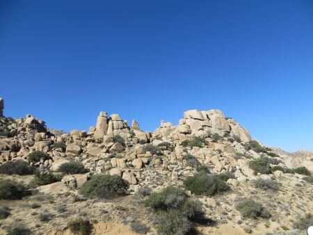
The rock formations want me to draw them…the way the rocks slot together is really fascinating.
Everywhere you turn, there are more piles…apparently the photographers prefer those last hours of the afternoon, when the light is warm and gives the rocks their best color.
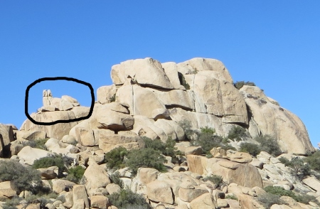
One of the guys on the hike was knowledgeable about geology and gave us info about types of rocks and formations, which was great.
I suggest everyone bring a geologist on this hike with them. We spent some time seeing things in the formations, like this cat…someone thought it looked more like a sphinx.
If you have 4-wheel drive and can drive further in (there was a Rubicon wandering all over the valley while we were there), you could bring kids on this hike. The hardest climb is coming in.
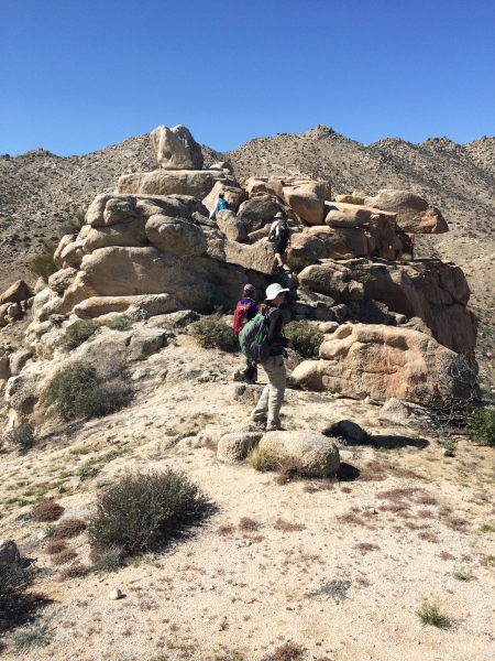
We did a little rock scrambling at this point to get a good view of the surrounding valley and to eat lunch.

This is where my camera randomly died…I don’t really know why. I charged it the night before. So all the pictures from here on out are taken with the iPhone…not the best camera in the world.
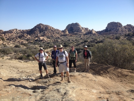
Except this token group photo, which someone else took…we look like we’re about to draw our guns against a rival gang.
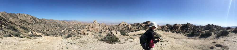
This panorama shot was taken from our lunch stop…the rock scrambling is apparently not my strong point…some people climbed higher.
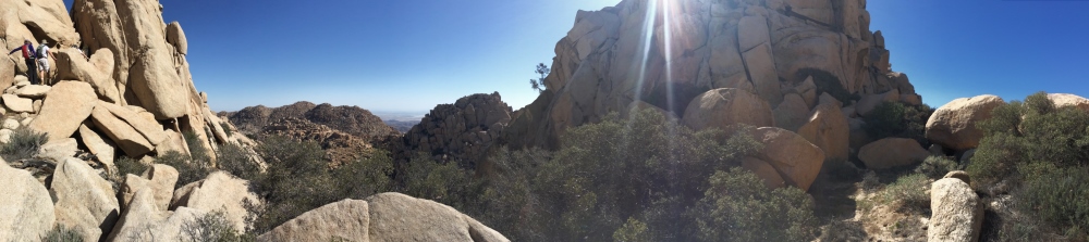
The reason we did the scrambling is so we could see the valley below…
Once we’d eaten, we wandered around the valley a bit, trying to find the path to the mines. We walked through some campsites (aka, places people had obviously camped…nothing fancy).
This shot is from the path that circles the peak where the mines are located.
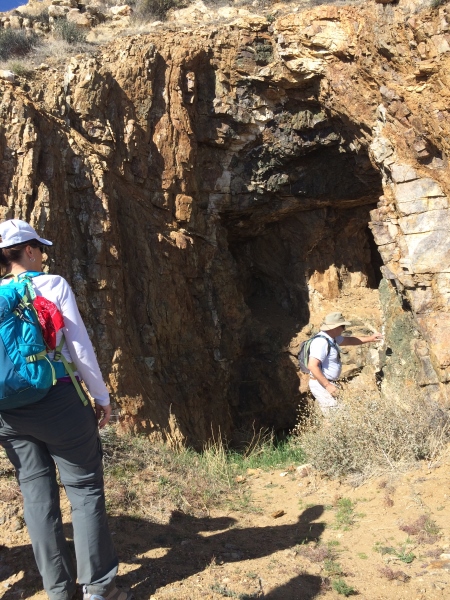
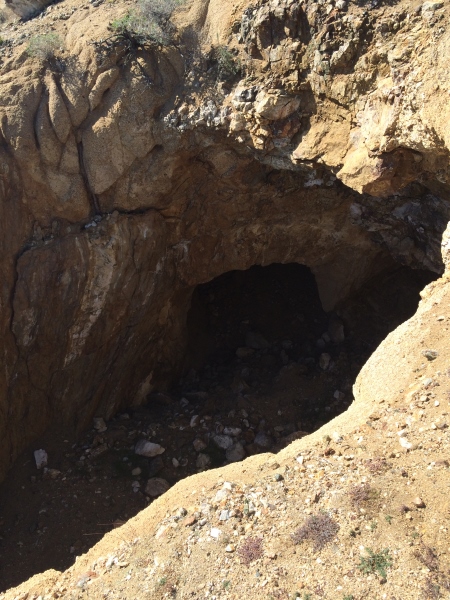
This was the first mine opening we came to, the evidence of copper being the green tinge to the rocks lining the opening, according to our geologist. Reading online, though, tells me this area is the now-abandoned Elliot amethyst mine.
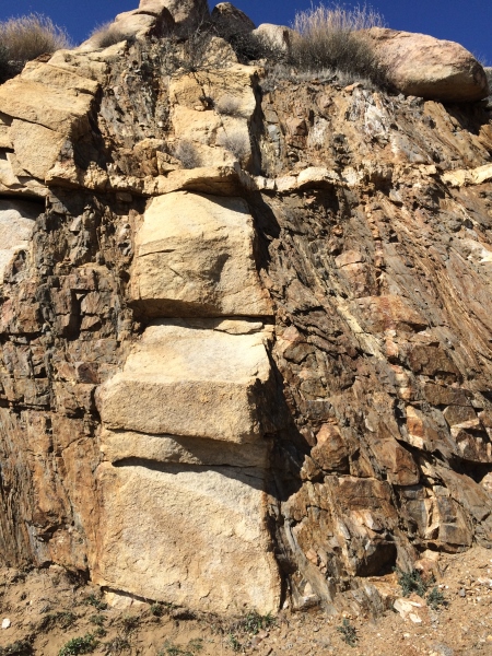
We hiked further up to another opening, where I took this shot of three different rock layers (I tell you, this area is a geologist’s wet dream)…
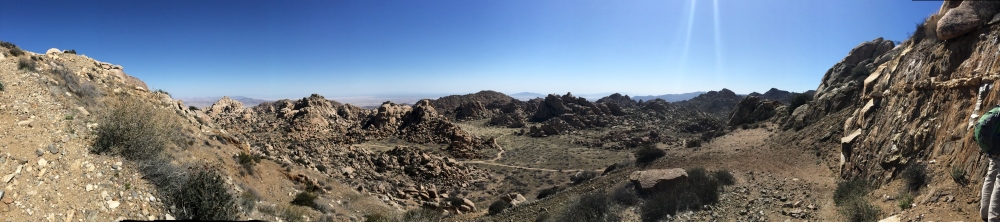
And another panorama facing east and south into Mexico.
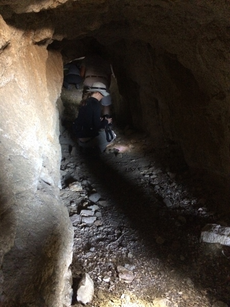
Some of our group went into this mine for a ways….
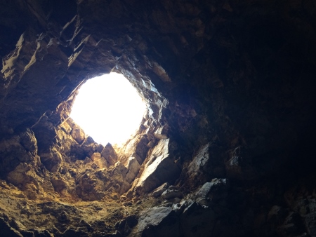
I went into this one, which required a little squat-crawling (technical term) until it opened up into this cavern with a chimney opening in the top…
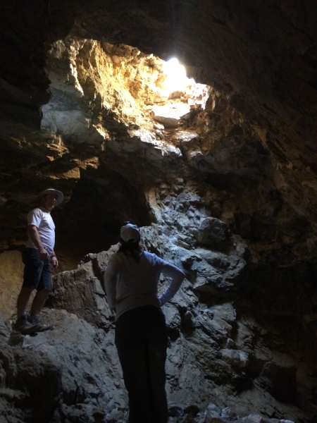
Giving enough light to actually see where humans had dug out more tunnels. I’m not a fan of being in small tunnels, personally.
From there, we climbed up on this rock pile for a view to the south of Mexico.
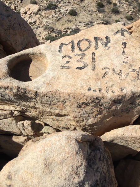
There was a painted marker for something on the top…
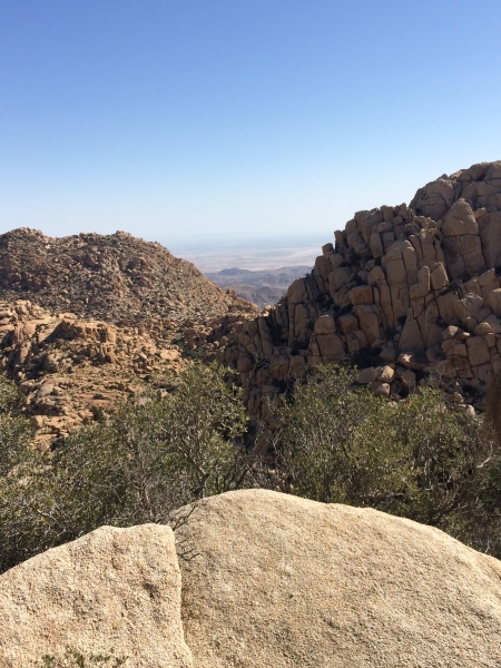
Looking south…
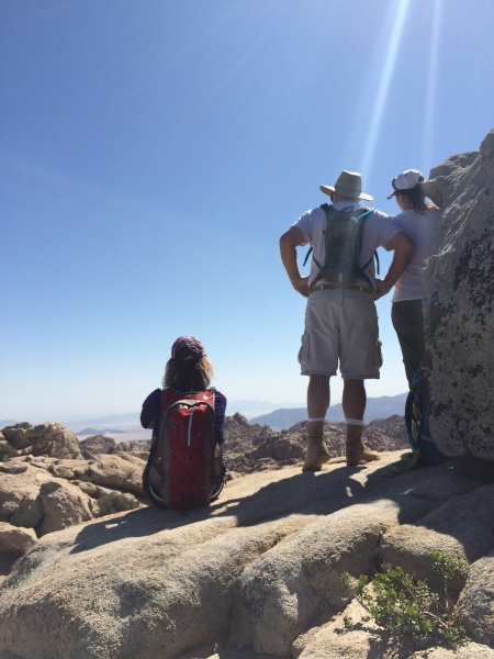
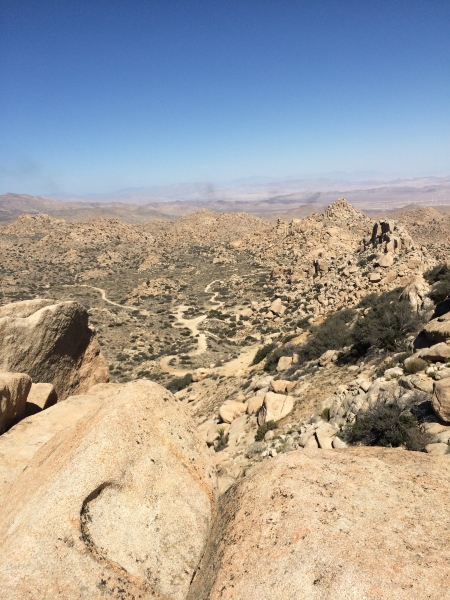
And looking north, where we saw some black smoke from a fire. We never figured out what was burning…you can see the paths through part of the valley below.
Here’s the whole group…

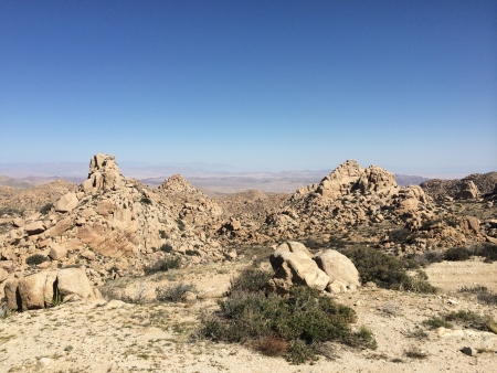
And another view of the rocks to the east…

Rocks eroded to look like teeth…
And a very skinny mine opening…
The hike was about 8.4 miles and we spent about 4 hours on the trail, stopping once for food and a few times to explore rocks or mines. There were a few other people out there hiking around. You can make it as short or long as you like, due to the many trails criss-crossing the area, as long as you realize it’s a bit more than a mile of serious uphill to get in, unless you have 4-wheel drive. Rock-climbers also love this area for all the climbing opportunities.
On the way out and back, you get a good view of one of the back-country wind farms.

Oh yeah…evidence that I’m not a rock scrambler…this was from a kind of flying-squirrel maneuver I had to make to get from one rock to the next because I’m not as tall as the rest of the other hikers…
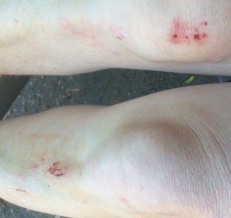
Oh well. It’s not the first time I’ve had scabby knees and it probably won’t be the last.

The rocks are great — could look at those all day.
Surgery today? Hope everything went well. Hugs…
LikeLike
Beautiful photos Kathy! 🙂
LikeLike