On Sunday, I hiked to the top of McGinty Mountain in the Jamul, California, area. It’s about 5 miles round trip and is fairly strenuously uphill. It was a day after a rather large rainstorm came through the area, so mud was sticking to our boots making me about an inch taller at times. Sticky mud helps on the uphills, but you slide on the downhills. The hike goes up about 1300 feet to an elevation of 2183′. Here’s a cool link to Derek Loranger’s 100 Peaks website, with video of rain and hail on the trail (hey, that rhymed). He also talks about the excessively sticky mud, but honestly, in San Diego, that probably only happens a few times a year.
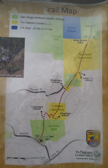
Here’s the official government website. There is a regular Hike with a Ranger event on this trail, but amusingly, the government website doesn’t forward to the calendar properly, so I’m not sure how you’d find it.
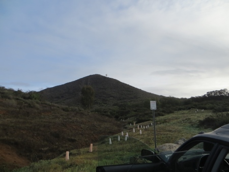
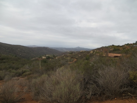
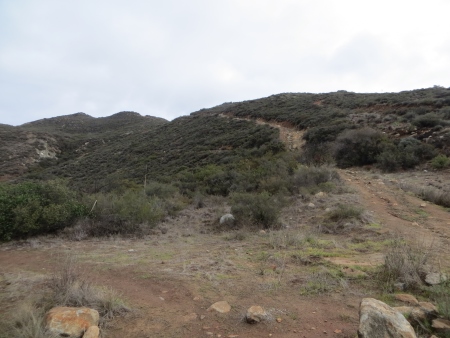
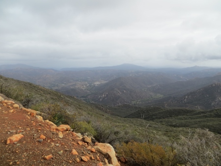
There’s a nice little dirt parking lot at the trailhead with a view of this, which is NOT McGinty Mountain…
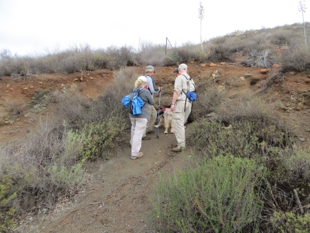
There’s another little hill and path to the left. Honestly, the hardest part about this trail besides the fairly strenuous uphill climb is trying to figure out which is the REAL trail and which are just dead-ends.
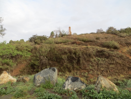
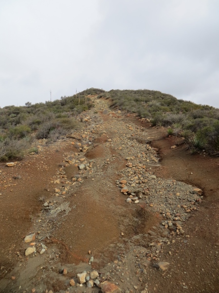
It is not marked particularly well…although you’re unlikely to get totally lost, you may wander around a bit if it didn’t just rain so you could totally track your own footprints back. There’s a chimney sticking up on this hill.
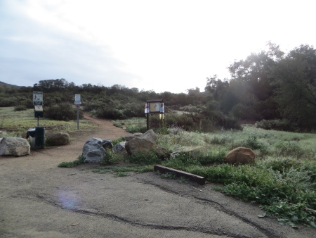
Here’s the trailhead itself, complete with warnings, doggie poop bags, and trail map.
Although again…it’s not always easy to tell where you should be going on the actual trail.
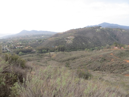
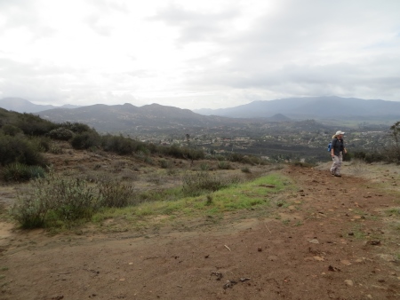
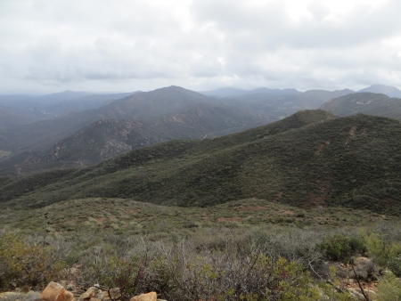
There are lots of sweeping views of the valleys on either side, with Rancho San Diego on one side, Jamul on the other.
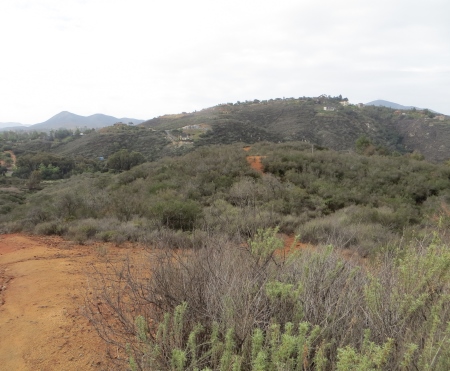
The trail does track along next to houses on the lower slopes, and you can see more on the hills in the distance.
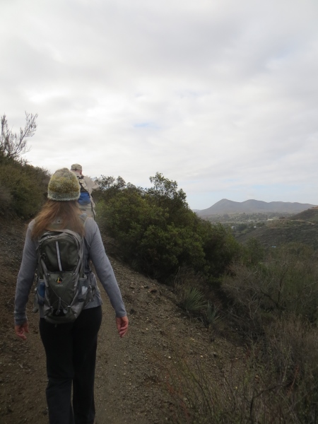
There is some steep climbing at the beginning and the end.
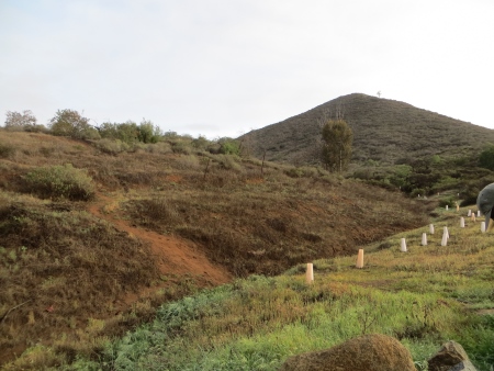
I think the parking lot is down in those trees in the middle of the picture.
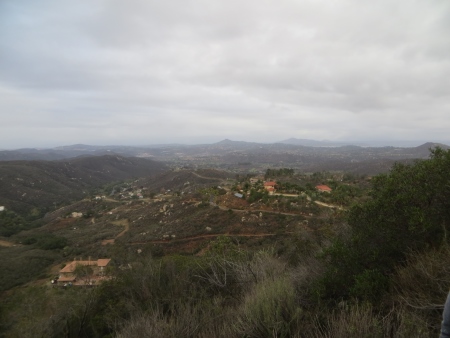
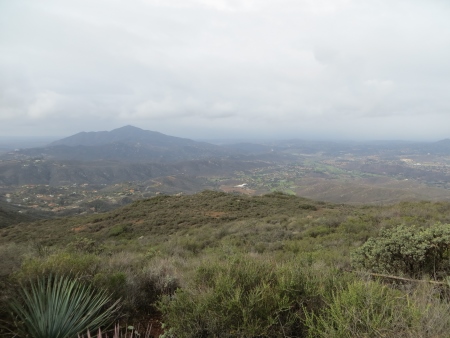
We did see some weather, but it mostly left us alone…this is the view to the north, with Cowles Mountain in the distance (not the first peak in the middle, but the paler one to the right of it.
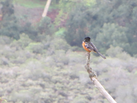
And a bird…which one of the hikers was able to identify…all I remember is that it’s a Spotted something (because of the wings, of course).
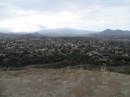
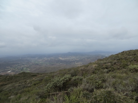
This is the view to the south of Jamul…the mountains on the right is where I’ll be next weekend.
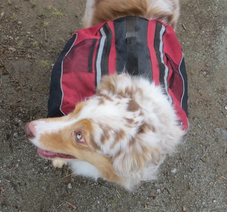
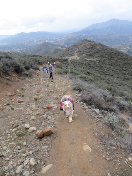
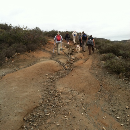
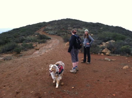
Bailey was our faithful companion on the hike.
There was a mine off the trail on one side…
I’m not entirely sure what they mined (the Internet says gold), but these aren’t very big holes…we saw another one on the side of a rock on part of the hike.
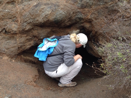
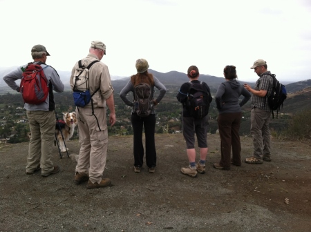
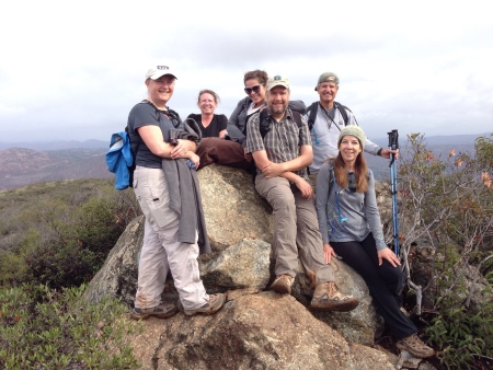
I did not crawl inside. We took our first group picture up here…
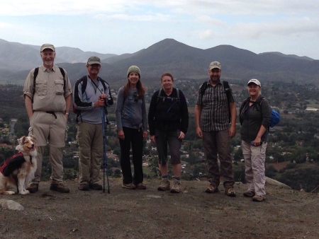
It was a small group, due to the weather. And I am apparently short. You can decide which view is best…
Yes. I wore shorts. What can I say? It wasn’t actually super cold…cold enough that I had two shirts on for most of it, but went down to short sleeves for part of it…until the weather wandered back in…we could see rainstorms in the distance (or not-so-far distance). I have official zip-off hiking pants somewhere…I just don’t know where.
The trail consistently moved upwards…although most of the time, it wasn’t so bad that you couldn’t talk and hike (that’s my measure of how bad IS it…can I talk? Not so bad.).
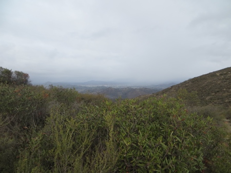
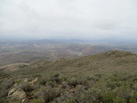
Lots of valley views and vistas with big dark clouds…
It reminds me of what I love about San Diego County…all those mountains so close to home. I would die in Kansas…too flat.
This is looking north at where my house might be if you could see through hills.
On the right is San Miguel, which I’ve hiked previously. The trail was eroded by rain, definitely, but was also pretty rocky. Bailey was a trooper.
I think this is the portion the leader called “Heartbreak Hill”…here’s where talking and breathing had a bit of a conflict…
I was not the only one taking photos…you can see my naked legs up there in shorts…
Still easier than San Miguel though…more mountain vistas, off to the east, this time.
And northeast…
I think that’s looking at San Miguel again, but I’m not really sure!
That’s definitely north again.
North…
At the top, we climbed as high as we could (that rock) and took another group photo…
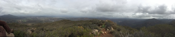
And here was the big money shot…
This was on the way back, I think…easier going down, but had some issues with picking the right trail.
We didn’t have much rain in the end. The hike was just short of 5 miles in about two and a half hours (with a few stops for people to rest and/or catch up, plus playing in mines and on rocks)…I would definitely do this again, although I suspect it’s particularly difficult in the heat of summer. Apparently snakes are a real issue up there too. This is closer to home than Cowles Mountain is and definitely less populated. Strenuous? Yeah…a bit…you need to be in some sort of shape, but if you’re persistent, you could go up it even if you are a slow but steady hiker…and you don’t have to go all the way up. It’s an up and back hike, so you could stop whenever you were tired and come back. The trail does continue past the mountain peak…I didn’t really explore beyond that…maybe on another day.

I’m seriously jealous of these amazing hikes… I wish we lived closer to each other. 🙂
LikeLike
Thanks for the shout out! That was a pretty memorable hike.
LikeLike