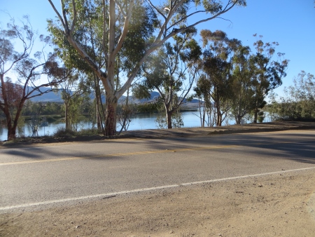
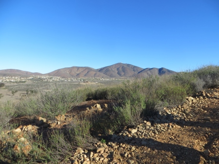
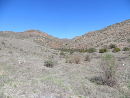
Last Saturday, I hiked with a group through the Jamul mountain range (a very small mountain range) on the hunt for wildflowers. It had only rained the week before, so we didn’t see many flowers, plus Southern California wildflowers are on the tiny side…but we did have a great excursion. We started on Otay Lakes Road…
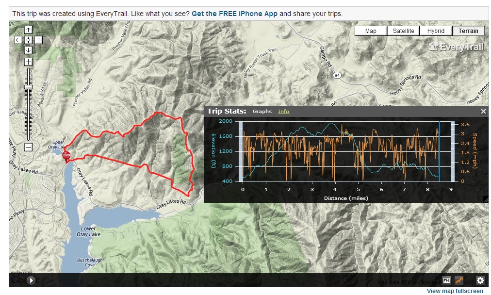
One of the hikers had a GPS device that mapped the trip: 8.5 miles in about 5 hours with a ton of ups and downs and about a 1600′ elevation gain. The blue line is the elevations during the trip. The orange is his speed. The red is that actual trail we took. Cool technology…I’m totally jealous.
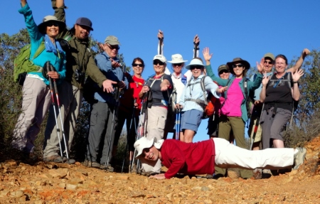
This photo was taken about 10 minutes into the hike, so we’re all well-rested and possibly a little goofy (additional photos are courtesy of Ken T. and Maritie, the group leader).
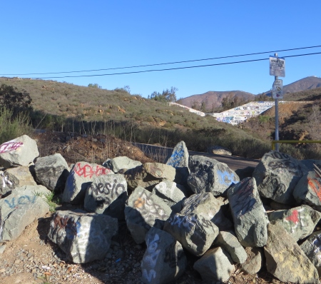
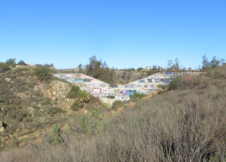
Where the hike begins is a graffiti-covered dam in the distance with the rocks by the side of the road.
Here’s the dam from a bit of a distance…
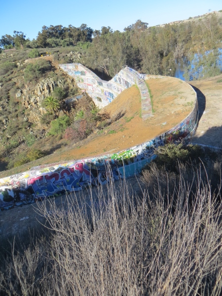
And right above it…
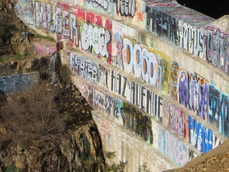
I thought the blocky quality of the graffiti painted over old graffiti was interesting…
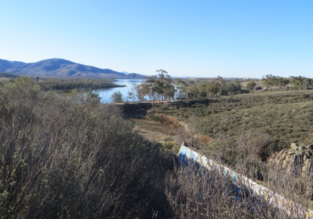
And there’s Otay Lake (aka Lower Otay Reservoir) in the distance…
To the north was San Miguel…
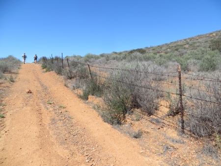
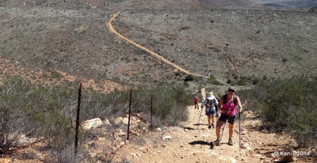
Notice how everyone has poles? Yeah. I forgot mine.
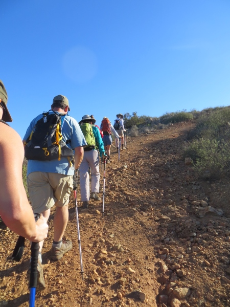
The majority of the first part of the hike, I was OK without poles…the second half? Not so much.
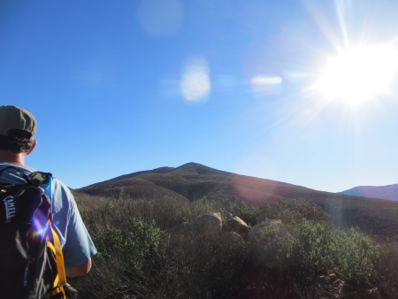
The day was warm in the end…this is looking towards the first summit of the Jamul range.
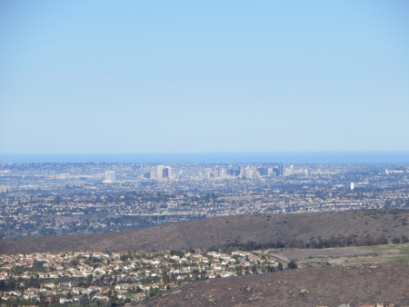
This is looking towards downtown San Diego over Chula Vista in the front…you can see we’re starting to climb.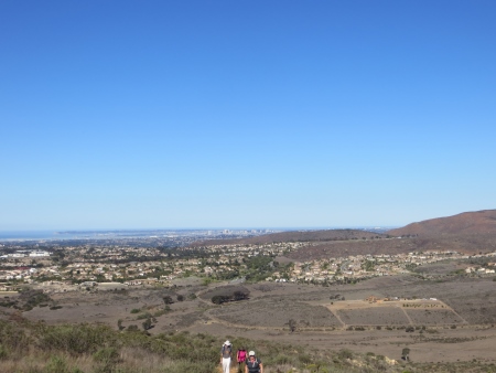
A closeup of downtown…
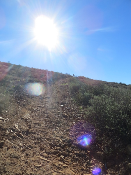
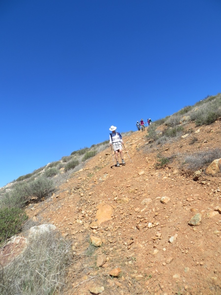
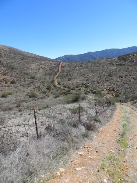
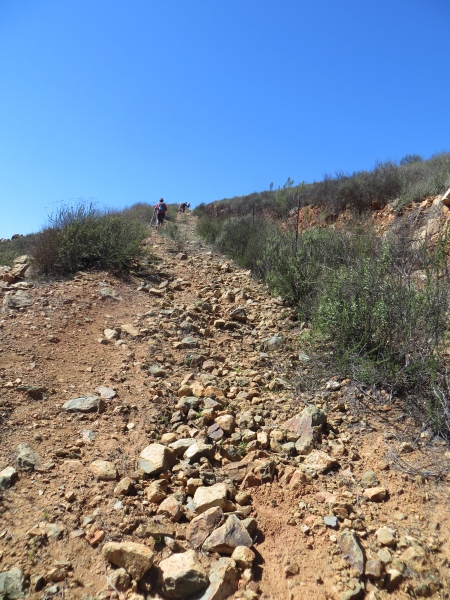
We were pretty spread out for most of the trip…you can see someone way up at the top. The ups were challenging…the trail was fairly steep in places and had lots of rocks.
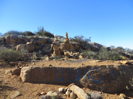
The Marines and a bunch of rock-pilers had been at the top of the first summit. I suspect this is where many people turn around and go back…
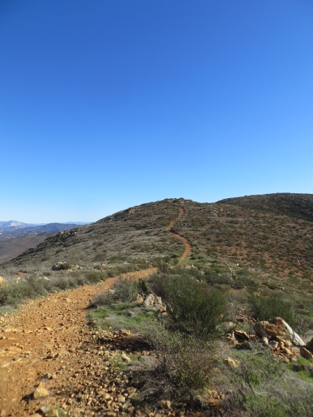
In fact, the only people we saw the entire time outside of our group passed us on the way up to here and went on to the second summit, and then came back past us. Here’s the trail up toward the second summit.
Yes, we live in a desert. In fact, there were very few trees on this trip, although some shrubs could pass for a tree if you were feeling really warm.
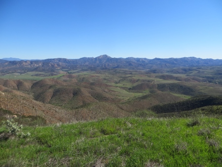
You can see for miles up there…this is facing east, trying to figure out what each of the peaks are…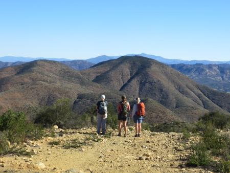
In fact, the little hill in the middle, between the two in the foreground, is probably McGinty Mountain from the previous weekend.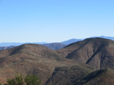
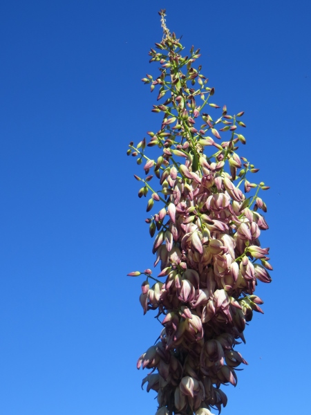
A few of the yucca were blooming…I think that’s El Capitan in the background…
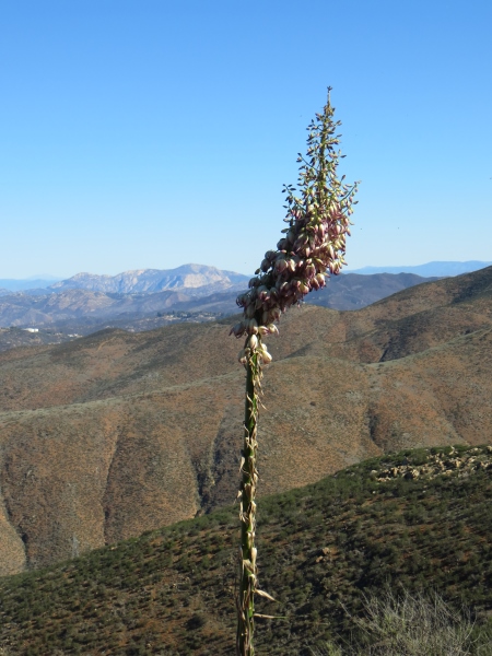
Beautiful flowers…
At this point, we started to work down a rocky trail on the eastern side of the range…
The back side had a lot more rocks, but there was greenery to be seen. In fact, this is where I saw most of the wildflowers.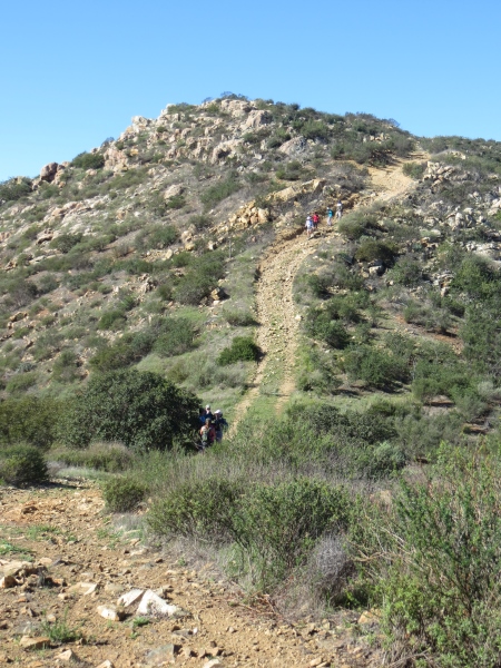
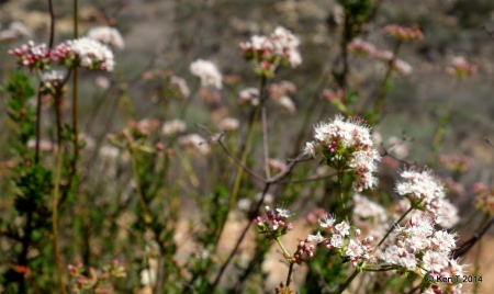
And sometimes my shitty old camera behaved enough to let me take pictures of them. This is the flower of buckwheat…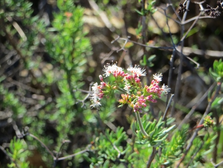
I was lucky to have Ken T. also taking pictures (with obviously a MUCH better camera than I have), and he was nice enough to let me borrow some for the blog, so here was his buckwheat…
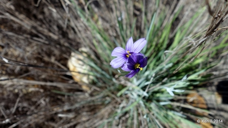
His blue-eyed grass…
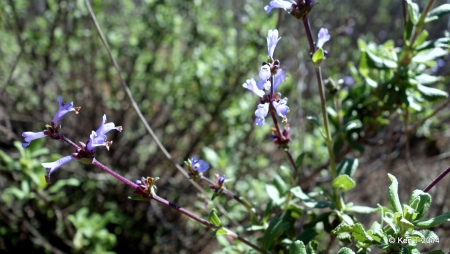
His black sage…
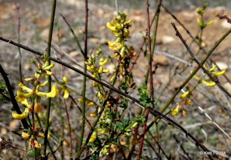
His deerweed…
(I told you his camera was better…I have all of these, but they’re blurry) His Dichelostemma capitatum (aka blue dicks)…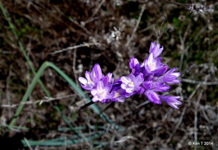
Way too pretty a flower for either of those names…there were apparently only two trees on the entire trail (not quite, but close enough)…and this was one of them. You’re almost required to stop under the tree on a hot sunny day on a hike with few trees, so we did.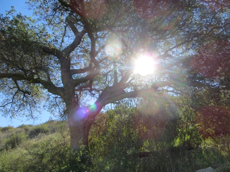
You can see green on the hills from the recent rains, off to the east…
And there are more trees down in that valley, but you’d have to bushwhack to get to them…
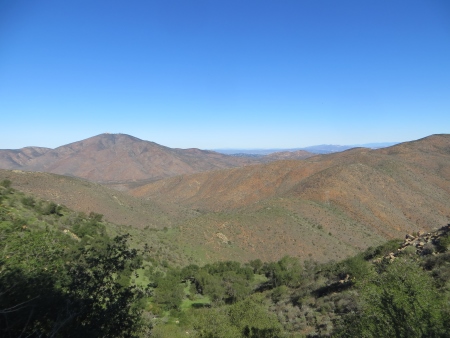
This was the view to the east off the back part of the range, quite beautiful…
Way down in the depth of that valley below, though, there was this structure…and we all had to try to guess what it was, why it was there…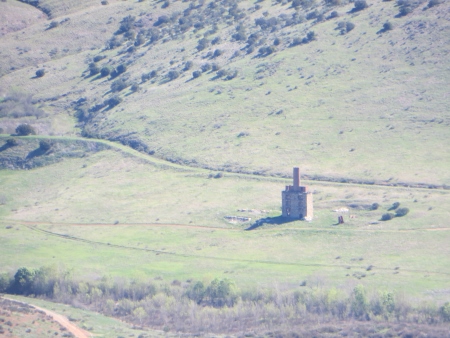
We had lunch at this high point overlooking the reservoir, with Otay Mountain to the left…it was hot, but not horribly so.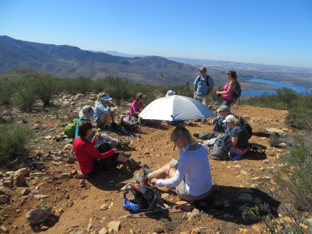
Another group photo after lunch…we are looking a little less energetic…but still ready for whatever the trail might show us…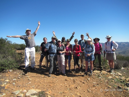
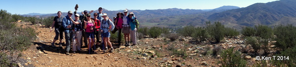
And the panoramas…this one from Ken’s camera…
And my phone, which is a little harder to control…
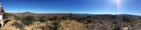
But still gives you an idea of what Southern California looked like before we built all those houses…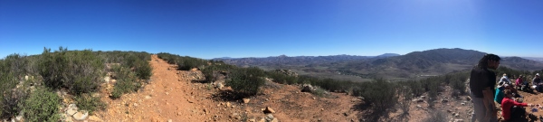
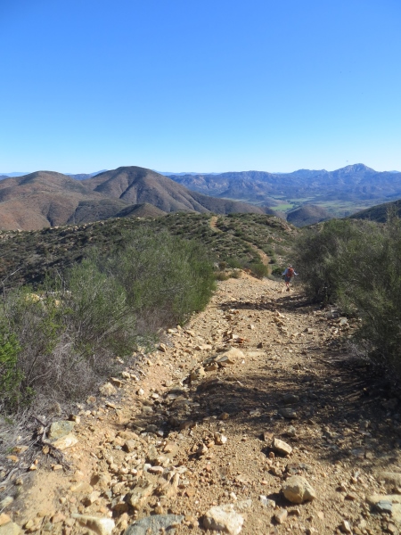
I was reading about all the trails in this area, and it used to be open to these off-road vehicles until they decided there was some sensitive habitat there and closed it, so there are all these “roads” that aren’t super wide and are definitely not maintained well (which is fine)…so the plus is you’re not walking on a single-track trail, but there were lots of rocks and rough ground.
We saw lots of these caterpillars, apparently for the Salt Marsh Moth…
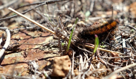
They were often walking faster than we were, scurrying along the path. I’m not sure where they were going in such a hurry…
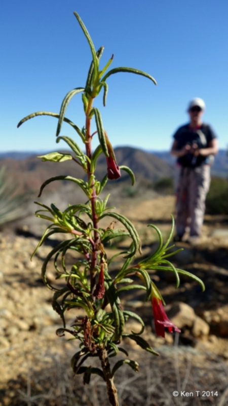
This is the red monkey flower…
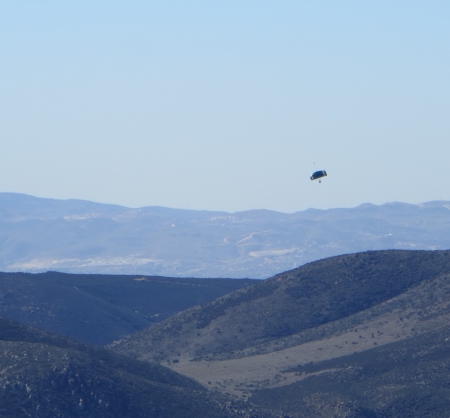
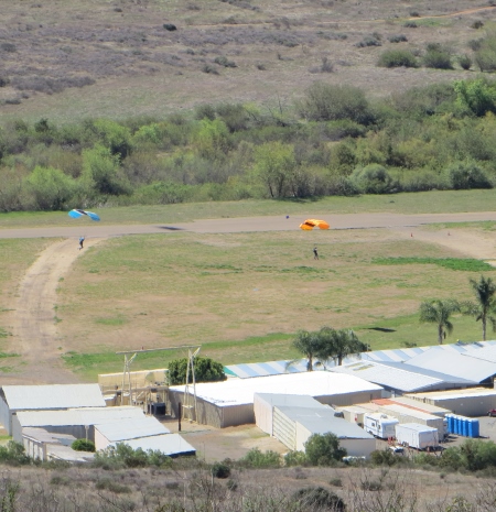
We also saw people parachuting from airplanes and landing on an airstrip to the south…
At this point, the trail looked nice…flat but some green, looking south towards Mexico over that mountain…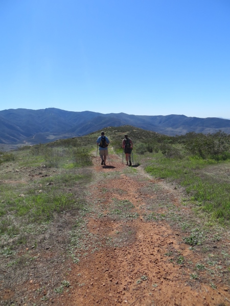
And then started the “sorta crazy” part of the trip (I think that’s how the leader described this section)…downhill at a significant angle. This is where poles were, quite honestly, as someone who didn’t have them, necessary…
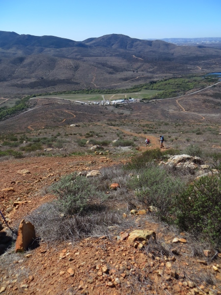
I’m not really sure how I managed this downhill portion without faceplanting about 17 times, but I did. And I felt it for the next three days…you can see the airstrip where the parachuters were landing in the middle of the photo.
You can see everyone coming down the slope, which luckily had enough rocks that were planted in the ground to give me some traction going down.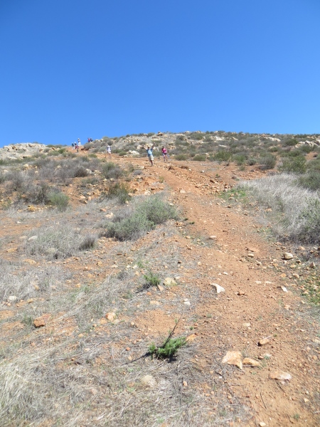
More parachuting…fascinating. It was on many people’s bucket lists to do this sometime in the future (including mine)…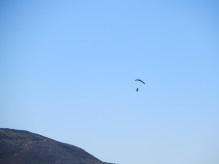
Some landed crazy, some landed calmly…I’m sure I would be doing the former…
I didn’t take a lot of pictures coming down that hill…I was trying too hard to keep from falling (went down on my butt once)…it was hard work.
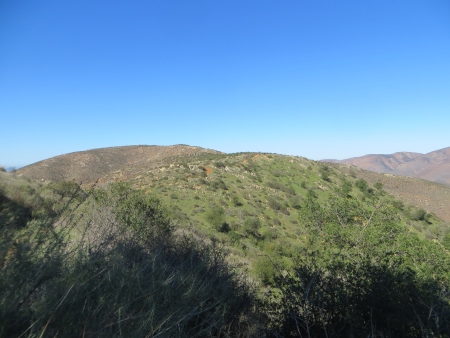
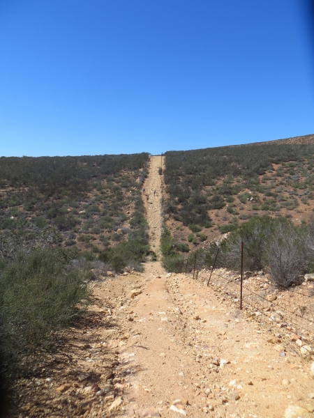
After that, we had a choice of a very flat trail with part of it on the road or a trail with, as the leader described it, “ups and downs.” We chose the latter, thinking that after coming down that hill, how bad could it be? Well, it was a challenge, because it was about 5 significant climbs, plus more crazy downhills (not THAT crazy, but still…poles would have helped), and by this time, it was warm…low 80s. And we were tired. It doesn’t look too bad in this photo…
Now we are on the western end of the range, and the plants have changed again…
That’s more of what the up and down looked like…neverending…
You’d get to the top of one thinking you were in the clear, that you were almost there, and then you’d see the next one..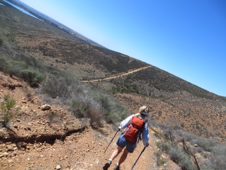
It doesn’t look too bad until you see the people climbing and realize how steep it is. Again.
Luckily, everyone was a good sport and realized that a trail is a trail…it can be easy, medium, or difficult, but it’s still being outside in the fresh air, and a challenge is never a bad thing out here…we all had plenty of water and were able to keep moving…
Ken’s shot of where we had come (I’m hiding behind the woman in pink) just to give you a better idea of the slope…
All in all, close to 9 miles, a hot day, lots of ups and downs, but there were flowers and wildlife…we saw mule deer and coyotes and California horned toads (I almost stepped on one…too fast for a photo), plus the caterpillars and the hawks and the parachuting folks…it was definitely worth the time and effort to hang out with a group with a remarkably good attitude about a difficult but not impossible trail. Will I do it again in two weeks to see more wildflowers (because it had just rained)? Um. Well. Probably not? But I’d consider it again next year around this time…we decided that some trails are like childbirth…you have to wait a while before it sounds like a sane thing to do again. It was good, though. Definitely worth the walk.
