Saturday I hiked San Miguel Mountain…this mountain was a bitch. It was incredibly difficult, so difficult that if I were a different person, I would have given up about 700 times. But I’m not that person. Once I started, I think I would have had to pass out to NOT make it up the mountain, so I stopped a lot to catch my breath, because OXYGEN. But I kept going and I made it. All the way to the fucking top. And no, I don’t ever EVER want to do it again, but I can’t promise that I won’t, because sometimes the crazy takes over, but I did it. It’s about 5 miles round trip from Butterfly Way in Chula Vista, and about 1725′ in elevation gain. There are no switchbacks and no shade, and there’s rocks everywhere.
Once I had signed up (committed myself) for this hike, I kept staring at it…here it is from the parking structure at my doctor’s office…

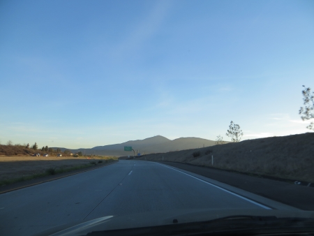
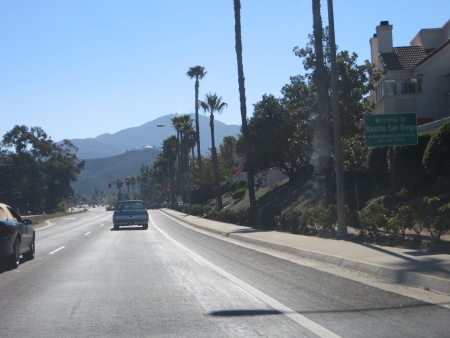
Although I can see this mountain from just about everywhere in the town where I live, I had to drive south quite a ways to get to this trailhead…you can see it in the distance here from the 125 toll road portion.
You go into a residential area to park at one of the trailheads…and there it is pointing up in the distance.

There’s a fairly easy hill up to the electrical tower…in this photo, San Miguel is right in the middle.

We stopped here for the obligatory group photo…

About half of us had never done this hike before (and one of them would drop out before we even got to the flag). Most of us carried poles. It was the first time I’ve used poles, and hell yes, I needed them, especially on the downhills.
I didn’t notice them going out, but coming back, the wires were humming.

This is the first section of the trail up to the flag, which is where most people seem to turn around and go back. Yes, it’s steep.

This is about halfway up the first slope, looking back at where we started, on the left in the middle, which is where that tract home community was.

From about the same place, looking up toward the flag (which I never actually went up to, but it’s up there somewhere).

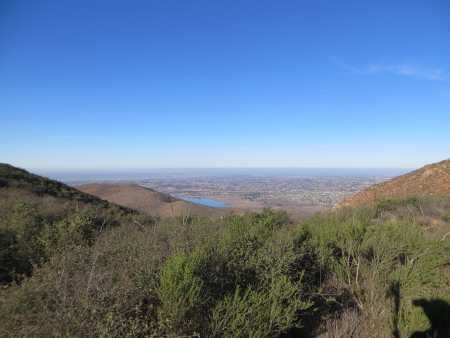
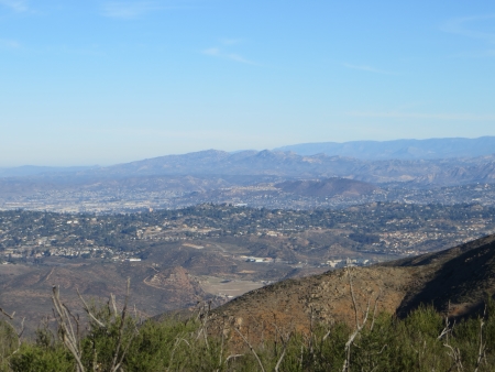
This is the view of Otay Lakes and Chula Vista, with Mexico in the distance. It was a gorgeous day, a little warm, but not bad.

We did start early-ish to beat the heat. From here, you can see the trail is leveling off (the flag on the rocks is to my left), and San Miguel is in the distance.

The saddle between the two mountains is mostly flat…well, sort of. There are some ups and downs, but not too bad.

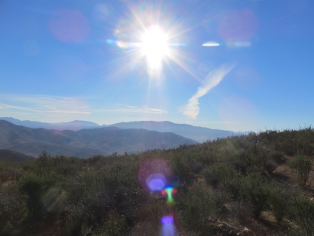
There are great views in all directions…this is east, with Lyons Peak pointing up in the middle.

This is looking north, toward El Cajon and Bonita.
And south again…
This is north, and that little pointy mountain on the left is Cowles Mountain.
This picture actually shows the gym where I work out…not that you can tell…but I see this mountain from the gym parking lot…ironically…
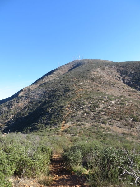
From the saddle, you can barely see the skinny brown trail snaking up the middle of the mountain to the antennas…I still have to go down into the valley and back up from here.

I’m still not all the way down. It’s a little daunting looking at it from here…
Honestly, I tried not to think too hard about it. I would hike until it hurt my quads too much or I felt dizzy, and then I would stop, turn around and look at the view, and breathe for a minute. Then I would turn around and keep going. This was at the very bottom of the saddle looking up at the antennas.

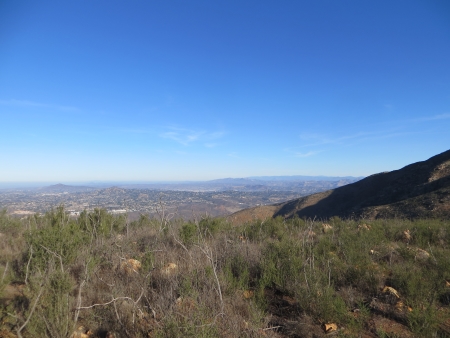
On the way up, looking west towards downtown San Diego, which is right in the middle of the far distance.
This is looking back at what I’ve already come up and over…

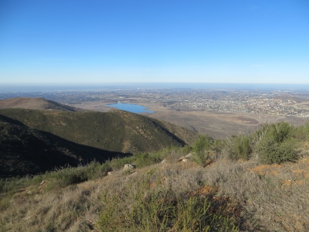
And looking back to the south toward Otay Lakes.

The antennas pull you upwards…they are a good landmark for judging distance.

This is Liar’s Rock…because you’re NOT almost there…I mean, I guess you are in terms of the whole trip, but you’ve still got some serious climbing to do.

This is looking back at where we parked, way the heck down there.

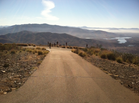
And finally, at the top…this is the view to the east, with Lyons Peak in the middle.

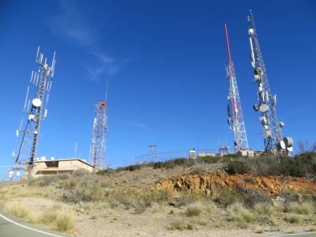
The antennas are fenced in at the very top…
And a photo of the group from the antennas…
Yes, that’s a road. There is a road. We didn’t walk on the road. Apparently you can also drive on the road.
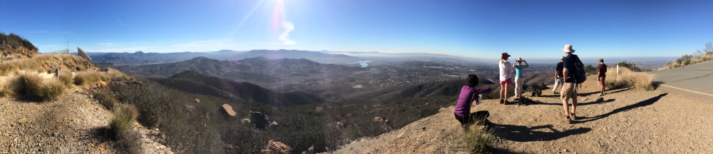
I took this panoramic shot, which is just the southern 180 degrees of the view…
It took about an hour and 15 minutes to get up to the top…and much less time to get down.

I used the poles a lot going down…I had surgery on one knee about 18 years ago and this kind of steep, slippy, rocky downhill is tough, but I did it. On the flat areas, I would jog to keep up with the group. I didn’t take many photos going down, but here’s one pretty close to the end of the golf course next to the last bit.

And as I’m driving home, there it is again…

And after I got home and showered and ate (burned a billion calories and felt it all day)…there it is again on the way to the library to pick up new books…
This mountain was a challenge…I’m glad I did it, because now every time I look at it, I think, yeah, you climbed that…and I see that sucker every single day. It was hard…no, it was REALLY REALLY hard, but I climbed it. Kind of a metaphor for my whole life at the moment. It’s hard. Every day I get up and it’s hard and every day I try to climb that damn mountain. I hope someday it’s less of a daily hardship, but I guess once I get past all this, I’ll be able to say I survived it. I’m kind of a persistent, stubborn bitch that way.
And before you freak out about two posts in one night, I wrote most of this in the morning…I was just waiting for the organizer to post the official group photos so I could slot those in…

Wow! Beautiful day and what an experience… 🙂
LikeLike